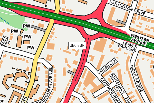
UB6 8SR is located in the Central Greenford electoral ward, within the London borough of Ealing and the English Parliamentary constituency of Ealing North. The Sub Integrated Care Board (ICB) Location is NHS North West London ICB - W2U3Z and the police force is Metropolitan Police. This postcode has been in use since November 2003.


GetTheData
Source: OS OpenMap – Local (Ordnance Survey)
Source: OS VectorMap District (Ordnance Survey)
Licence: Open Government Licence (requires attribution)
| Easting | 514718 |
| Northing | 183117 |
| Latitude | 51.535311 |
| Longitude | -0.347418 |
GetTheData
Source: Open Postcode Geo
Licence: Open Government Licence
| Country | England |
| Postcode District | UB6 |
➜ See where UB6 is on a map ➜ Where is Greenford? | |
GetTheData
Source: Land Registry Price Paid Data
Licence: Open Government Licence
Elevation or altitude of UB6 8SR as distance above sea level:
| Metres | Feet | |
|---|---|---|
| Elevation | 20m | 66ft |
Elevation is measured from the approximate centre of the postcode, to the nearest point on an OS contour line from OS Terrain 50, which has contour spacing of ten vertical metres.
➜ How high above sea level am I? Find the elevation of your current position using your device's GPS.
GetTheData
Source: Open Postcode Elevation
Licence: Open Government Licence
| Ward | Central Greenford |
| Constituency | Ealing North |
GetTheData
Source: ONS Postcode Database
Licence: Open Government Licence
| Cowgate Road | Greenford | 21m |
| Cowgate Road | Greenford | 89m |
| Greenford Road Roundabout | Greenford | 149m |
| Middleton Avenue (Ub6) (Western Avenue) | Greenford | 193m |
| East Close (Ferrymead Gardens) | Greenford | 269m |
| Greenford Underground Station | Greenford | 797m |
| South Greenford Station | 0.8km |
| Greenford Station | 0.8km |
| Castle Bar Park Station | 1.8km |
GetTheData
Source: NaPTAN
Licence: Open Government Licence
GetTheData
Source: ONS Postcode Database
Licence: Open Government Licence


➜ Get more ratings from the Food Standards Agency
GetTheData
Source: Food Standards Agency
Licence: FSA terms & conditions
| Last Collection | |||
|---|---|---|---|
| Location | Mon-Fri | Sat | Distance |
| Cowgate Road | 16:30 | 11:30 | 80m |
| 73 Oldfields Lane South | 17:30 | 11:45 | 182m |
| Costons Lane | 17:45 | 12:00 | 255m |
GetTheData
Source: Dracos
Licence: Creative Commons Attribution-ShareAlike
| Risk of UB6 8SR flooding from rivers and sea | Medium |
| ➜ UB6 8SR flood map | |
GetTheData
Source: Open Flood Risk by Postcode
Licence: Open Government Licence
The below table lists the International Territorial Level (ITL) codes (formerly Nomenclature of Territorial Units for Statistics (NUTS) codes) and Local Administrative Units (LAU) codes for UB6 8SR:
| ITL 1 Code | Name |
|---|---|
| TLI | London |
| ITL 2 Code | Name |
| TLI7 | Outer London - West and North West |
| ITL 3 Code | Name |
| TLI73 | Ealing |
| LAU 1 Code | Name |
| E09000009 | Ealing |
GetTheData
Source: ONS Postcode Directory
Licence: Open Government Licence
The below table lists the Census Output Area (OA), Lower Layer Super Output Area (LSOA), and Middle Layer Super Output Area (MSOA) for UB6 8SR:
| Code | Name | |
|---|---|---|
| OA | E00006335 | |
| LSOA | E01001267 | Ealing 006C |
| MSOA | E02000243 | Ealing 006 |
GetTheData
Source: ONS Postcode Directory
Licence: Open Government Licence
| UB6 8QR | Greenford Road | 98m |
| UB6 9JS | Oldfield Lane South | 114m |
| UB6 8ET | Blenheim Close | 136m |
| UB6 8HQ | Cowgate Road | 148m |
| UB6 8XB | Wessex Lane | 152m |
| UB6 9AB | Wordsworth Avenue | 156m |
| UB6 8RQ | Greenford Road | 158m |
| UB6 9JP | Karoline Gardens | 162m |
| UB6 9AA | Wordsworth Avenue | 174m |
| UB6 9JR | Oldfield Lane South | 180m |
GetTheData
Source: Open Postcode Geo; Land Registry Price Paid Data
Licence: Open Government Licence