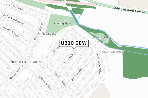
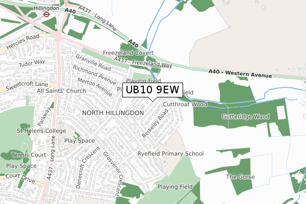
UB10 9EW is located in the Hillingdon East electoral ward, within the London borough of Hillingdon and the English Parliamentary constituency of Uxbridge and South Ruislip. The Sub Integrated Care Board (ICB) Location is NHS North West London ICB - W2U3Z and the police force is Metropolitan Police. This postcode has been in use since February 2020.


GetTheData
Source: OS Open Zoomstack (Ordnance Survey)
Licence: Open Government Licence (requires attribution)
Attribution: Contains OS data © Crown copyright and database right 2024
Source: Open Postcode Geo
Licence: Open Government Licence (requires attribution)
Attribution: Contains OS data © Crown copyright and database right 2024; Contains Royal Mail data © Royal Mail copyright and database right 2024; Source: Office for National Statistics licensed under the Open Government Licence v.3.0
| Easting | 507553 |
| Northing | 184705 |
| Latitude | 51.550995 |
| Longitude | -0.450174 |
GetTheData
Source: Open Postcode Geo
Licence: Open Government Licence
| Country | England |
| Postcode District | UB10 |
➜ See where UB10 is on a map ➜ Where is Hillingdon? | |
GetTheData
Source: Land Registry Price Paid Data
Licence: Open Government Licence
| Ward | Hillingdon East |
| Constituency | Uxbridge And South Ruislip |
GetTheData
Source: ONS Postcode Database
Licence: Open Government Licence
| Hillingdon Circus | North Hillingdon | 90m |
| Hillingdon Circus | North Hillingdon | 92m |
| Auriol Drive (Ub10) | North Hillingdon | 140m |
| Auriol Drive (Ub10) | North Hillingdon | 169m |
| Hillingdon Circus (.) | North Hillingdon | 198m |
| Hillingdon Underground Station | North Hillingdon | 304m |
| Ickenham Underground Station | Ickenham | 1,349m |
| West Ruislip Station | 2.3km |
| South Ruislip Station | 3.6km |
| Denham Station | 4.5km |
GetTheData
Source: NaPTAN
Licence: Open Government Licence
GetTheData
Source: ONS Postcode Database
Licence: Open Government Licence


➜ Get more ratings from the Food Standards Agency
GetTheData
Source: Food Standards Agency
Licence: FSA terms & conditions
| Last Collection | |||
|---|---|---|---|
| Location | Mon-Fri | Sat | Distance |
| North Hillingdon Post Office | 19:00 | 12:00 | 116m |
| Richmond Avenue | 18:45 | 12:00 | 403m |
| Copthall Road East | 18:00 | 12:45 | 460m |
GetTheData
Source: Dracos
Licence: Creative Commons Attribution-ShareAlike
The below table lists the International Territorial Level (ITL) codes (formerly Nomenclature of Territorial Units for Statistics (NUTS) codes) and Local Administrative Units (LAU) codes for UB10 9EW:
| ITL 1 Code | Name |
|---|---|
| TLI | London |
| ITL 2 Code | Name |
| TLI7 | Outer London - West and North West |
| ITL 3 Code | Name |
| TLI74 | Harrow and Hillingdon |
| LAU 1 Code | Name |
| E09000017 | Hillingdon |
GetTheData
Source: ONS Postcode Directory
Licence: Open Government Licence
The below table lists the Census Output Area (OA), Lower Layer Super Output Area (LSOA), and Middle Layer Super Output Area (MSOA) for UB10 9EW:
| Code | Name | |
|---|---|---|
| OA | E00012513 | |
| LSOA | E01002513 | Hillingdon 013D |
| MSOA | E02000506 | Hillingdon 013 |
GetTheData
Source: ONS Postcode Directory
Licence: Open Government Licence
| UB10 9JY | Long Lane | 48m |
| UB10 9PP | Magnolia Court | 64m |
| UB10 9JU | Long Lane | 94m |
| UB10 9PG | Long Lane | 111m |
| UB10 9PU | Pastures Mead | 114m |
| UB10 9LS | Hercies Road | 138m |
| UB10 9PQ | Western Parade | 151m |
| UB10 9PX | Pastures Mead | 162m |
| UB10 9JS | Long Lane | 184m |
| UB10 9AD | Granville Road | 191m |
GetTheData
Source: Open Postcode Geo; Land Registry Price Paid Data
Licence: Open Government Licence