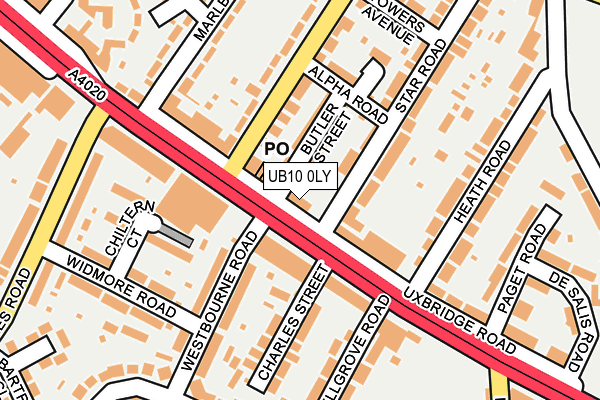
UB10 0LY lies on Uxbridge Road in Uxbridge. UB10 0LY is located in the Hillingdon East electoral ward, within the London borough of Hillingdon and the English Parliamentary constituency of Uxbridge and South Ruislip. The Sub Integrated Care Board (ICB) Location is NHS North West London ICB - W2U3Z and the police force is Metropolitan Police. This postcode has been in use since June 2011.


GetTheData
Source: OS OpenMap – Local (Ordnance Survey)
Source: OS VectorMap District (Ordnance Survey)
Licence: Open Government Licence (requires attribution)
| Easting | 507947 |
| Northing | 182313 |
| Latitude | 51.529418 |
| Longitude | -0.445247 |
GetTheData
Source: Open Postcode Geo
Licence: Open Government Licence
| Street | Uxbridge Road |
| Town/City | Uxbridge |
| Country | England |
| Postcode District | UB10 |
➜ See where UB10 is on a map ➜ Where is Hillingdon? | |
GetTheData
Source: Land Registry Price Paid Data
Licence: Open Government Licence
Elevation or altitude of UB10 0LY as distance above sea level:
| Metres | Feet | |
|---|---|---|
| Elevation | 50m | 164ft |
Elevation is measured from the approximate centre of the postcode, to the nearest point on an OS contour line from OS Terrain 50, which has contour spacing of ten vertical metres.
➜ How high above sea level am I? Find the elevation of your current position using your device's GPS.
GetTheData
Source: Open Postcode Elevation
Licence: Open Government Licence
| Ward | Hillingdon East |
| Constituency | Uxbridge And South Ruislip |
GetTheData
Source: ONS Postcode Database
Licence: Open Government Licence
THE STAR, UXBRIDGE ROAD, UXBRIDGE, UB10 0LY 2011 18 JUN £490,000 |
GetTheData
Source: HM Land Registry Price Paid Data
Licence: Contains HM Land Registry data © Crown copyright and database right 2025. This data is licensed under the Open Government Licence v3.0.
| Lees Road (Ub10) | Hillingdon Heath | 119m |
| Lees Road (Ub10) (Uxbridge Road) | Hillingdon Heath | 170m |
| New Road (Ub10) (Uxbridge Road) | Hillingdon Heath | 179m |
| Heath Road (Ub10) | Hillingdon Heath | 200m |
| Widmore Road (Lees Road) | Hillingdon Heath | 223m |
| West Drayton Station | 2.9km |
| Hayes & Harlington Station | 3.4km |
| South Ruislip Station | 4.4km |
GetTheData
Source: NaPTAN
Licence: Open Government Licence
GetTheData
Source: ONS Postcode Database
Licence: Open Government Licence


➜ Get more ratings from the Food Standards Agency
GetTheData
Source: Food Standards Agency
Licence: FSA terms & conditions
| Last Collection | |||
|---|---|---|---|
| Location | Mon-Fri | Sat | Distance |
| Lees Road | 16:45 | 12:30 | 323m |
| St Margarets Avenue | 16:30 | 12:15 | 582m |
| Nicholls Avenue | 19:00 | 12:00 | 631m |
GetTheData
Source: Dracos
Licence: Creative Commons Attribution-ShareAlike
The below table lists the International Territorial Level (ITL) codes (formerly Nomenclature of Territorial Units for Statistics (NUTS) codes) and Local Administrative Units (LAU) codes for UB10 0LY:
| ITL 1 Code | Name |
|---|---|
| TLI | London |
| ITL 2 Code | Name |
| TLI7 | Outer London - West and North West |
| ITL 3 Code | Name |
| TLI74 | Harrow and Hillingdon |
| LAU 1 Code | Name |
| E09000017 | Hillingdon |
GetTheData
Source: ONS Postcode Directory
Licence: Open Government Licence
The below table lists the Census Output Area (OA), Lower Layer Super Output Area (LSOA), and Middle Layer Super Output Area (MSOA) for UB10 0LY:
| Code | Name | |
|---|---|---|
| OA | E00012232 | |
| LSOA | E01002455 | Hillingdon 019D |
| MSOA | E02000512 | Hillingdon 019 |
GetTheData
Source: ONS Postcode Directory
Licence: Open Government Licence
| UB10 0NY | Westbourne Parade | 54m |
| UB10 0LZ | Byron Parade | 60m |
| UB10 0QR | Butler Street | 63m |
| UB10 0NX | Agincourt Villas | 64m |
| UB10 0NU | Norham Villas | 87m |
| UB10 0PZ | Pole Hill Road | 94m |
| UB10 0QH | Star Road | 108m |
| UB10 0QW | Star Road | 127m |
| UB10 0LR | Marlborough Parade | 128m |
| UB10 0QP | Alpha Road | 131m |
GetTheData
Source: Open Postcode Geo; Land Registry Price Paid Data
Licence: Open Government Licence