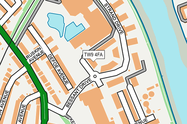
TW9 4FA is located in the Kew electoral ward, within the London borough of Richmond upon Thames and the English Parliamentary constituency of Richmond Park. The Sub Integrated Care Board (ICB) Location is NHS South West London ICB - 36L and the police force is Metropolitan Police. This postcode has been in use since June 2017.


GetTheData
Source: OS OpenMap – Local (Ordnance Survey)
Source: OS VectorMap District (Ordnance Survey)
Licence: Open Government Licence (requires attribution)
| Easting | 519594 |
| Northing | 177046 |
| Latitude | 51.479738 |
| Longitude | -0.279185 |
GetTheData
Source: Open Postcode Geo
Licence: Open Government Licence
| Country | England |
| Postcode District | TW9 |
➜ See where TW9 is on a map ➜ Where is London? | |
GetTheData
Source: Land Registry Price Paid Data
Licence: Open Government Licence
| Ward | Kew |
| Constituency | Richmond Park |
GetTheData
Source: ONS Postcode Database
Licence: Open Government Licence
| Kew Retail Park (Bessant Drive) | Kew Gardens | 132m |
| West Park Road (Mortlake Road) | Kew | 418m |
| West Park Road (Mortlake Road) | Kew | 425m |
| Taylor Avenue | Kew | 549m |
| Kew Gdns Stn Parade | Kew | 551m |
| Kew Gardens Underground Station | Kew Gardens | 514m |
| Gunnersbury Underground Station | Gunnersbury | 1,370m |
| Kew Gardens Station | 0.5km |
| Chiswick Station | 0.8km |
| Kew Bridge Station | 1.2km |
GetTheData
Source: NaPTAN
Licence: Open Government Licence
| Percentage of properties with Next Generation Access | 100.0% |
| Percentage of properties with Superfast Broadband | 100.0% |
| Percentage of properties with Ultrafast Broadband | 0.0% |
| Percentage of properties with Full Fibre Broadband | 0.0% |
Superfast Broadband is between 30Mbps and 300Mbps
Ultrafast Broadband is > 300Mbps
| Percentage of properties unable to receive 2Mbps | 0.0% |
| Percentage of properties unable to receive 5Mbps | 0.0% |
| Percentage of properties unable to receive 10Mbps | 0.0% |
| Percentage of properties unable to receive 30Mbps | 0.0% |
GetTheData
Source: Ofcom
Licence: Ofcom Terms of Use (requires attribution)
GetTheData
Source: ONS Postcode Database
Licence: Open Government Licence


➜ Get more ratings from the Food Standards Agency
GetTheData
Source: Food Standards Agency
Licence: FSA terms & conditions
| Last Collection | |||
|---|---|---|---|
| Location | Mon-Fri | Sat | Distance |
| Mortlake Road | 17:15 | 11:30 | 178m |
| Leybourne Park, Kew | 17:15 | 11:30 | 379m |
| Beechwood Avenue | 17:30 | 11:15 | 439m |
GetTheData
Source: Dracos
Licence: Creative Commons Attribution-ShareAlike
| Risk of TW9 4FA flooding from rivers and sea | Very Low |
| ➜ TW9 4FA flood map | |
GetTheData
Source: Open Flood Risk by Postcode
Licence: Open Government Licence
The below table lists the International Territorial Level (ITL) codes (formerly Nomenclature of Territorial Units for Statistics (NUTS) codes) and Local Administrative Units (LAU) codes for TW9 4FA:
| ITL 1 Code | Name |
|---|---|
| TLI | London |
| ITL 2 Code | Name |
| TLI7 | Outer London - West and North West |
| ITL 3 Code | Name |
| TLI75 | Hounslow and Richmond upon Thames |
| LAU 1 Code | Name |
| E09000027 | Richmond upon Thames |
GetTheData
Source: ONS Postcode Directory
Licence: Open Government Licence
The below table lists the Census Output Area (OA), Lower Layer Super Output Area (LSOA), and Middle Layer Super Output Area (MSOA) for TW9 4FA:
| Code | Name | |
|---|---|---|
| OA | E00174882 | |
| LSOA | E01033570 | Richmond upon Thames 004G |
| MSOA | E02000787 | Richmond upon Thames 004 |
GetTheData
Source: ONS Postcode Directory
Licence: Open Government Licence
| TW9 4BX | Melliss Avenue | 91m |
| TW9 4DT | Defoe Avenue | 100m |
| TW9 4DS | Defoe Avenue | 129m |
| TW9 4EZ | Strand Drive | 137m |
| TW9 4BY | Melliss Avenue | 137m |
| TW9 4DR | Ruskin Avenue | 143m |
| TW9 4BZ | Melliss Avenue | 144m |
| TW9 4DN | Strand Drive | 146m |
| TW9 4AA | Mortlake Road | 174m |
| TW9 4DJ | Ruskin Avenue | 174m |
GetTheData
Source: Open Postcode Geo; Land Registry Price Paid Data
Licence: Open Government Licence