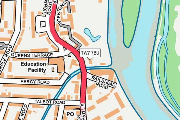
TW7 7BU is located in the Isleworth electoral ward, within the London borough of Hounslow and the English Parliamentary constituency of Brentford and Isleworth. The Sub Integrated Care Board (ICB) Location is NHS North West London ICB - W2U3Z and the police force is Metropolitan Police. This postcode has been in use since January 1980.


GetTheData
Source: OS OpenMap – Local (Ordnance Survey)
Source: OS VectorMap District (Ordnance Survey)
Licence: Open Government Licence (requires attribution)
| Easting | 516599 |
| Northing | 175407 |
| Latitude | 51.465632 |
| Longitude | -0.322856 |
GetTheData
Source: Open Postcode Geo
Licence: Open Government Licence
| Country | England |
| Postcode District | TW7 |
➜ See where TW7 is on a map ➜ Where is Isleworth? | |
GetTheData
Source: Land Registry Price Paid Data
Licence: Open Government Licence
Elevation or altitude of TW7 7BU as distance above sea level:
| Metres | Feet | |
|---|---|---|
| Elevation | 10m | 33ft |
Elevation is measured from the approximate centre of the postcode, to the nearest point on an OS contour line from OS Terrain 50, which has contour spacing of ten vertical metres.
➜ How high above sea level am I? Find the elevation of your current position using your device's GPS.
GetTheData
Source: Open Postcode Elevation
Licence: Open Government Licence
| Ward | Isleworth |
| Constituency | Brentford And Isleworth |
GetTheData
Source: ONS Postcode Database
Licence: Open Government Licence
| Talbot Road St Margarets Rd (St Margarets Road) | St Margarets | 65m |
| Talbot Road St Margarets Rd (St Margarets Road) | St Margarets | 97m |
| Richmond Road Queens Terrace | Isleworth | 105m |
| Richmond Road Queens Terrace | Isleworth | 214m |
| South Street (Tw7) (South Street) | Isleworth | 356m |
| St Margarets (London) Station | 1.2km |
| Isleworth Station | 1.4km |
| Richmond (London) Station | 1.5km |
GetTheData
Source: NaPTAN
Licence: Open Government Licence
GetTheData
Source: ONS Postcode Database
Licence: Open Government Licence


➜ Get more ratings from the Food Standards Agency
GetTheData
Source: Food Standards Agency
Licence: FSA terms & conditions
| Last Collection | |||
|---|---|---|---|
| Location | Mon-Fri | Sat | Distance |
| 385 St Margaret's Road | 17:00 | 11:00 | 164m |
| Old Isleworth | 17:30 | 12:00 | 373m |
| Steele Road | 17:45 | 12:00 | 391m |
GetTheData
Source: Dracos
Licence: Creative Commons Attribution-ShareAlike
| Risk of TW7 7BU flooding from rivers and sea | High |
| ➜ TW7 7BU flood map | |
GetTheData
Source: Open Flood Risk by Postcode
Licence: Open Government Licence
The below table lists the International Territorial Level (ITL) codes (formerly Nomenclature of Territorial Units for Statistics (NUTS) codes) and Local Administrative Units (LAU) codes for TW7 7BU:
| ITL 1 Code | Name |
|---|---|
| TLI | London |
| ITL 2 Code | Name |
| TLI7 | Outer London - West and North West |
| ITL 3 Code | Name |
| TLI75 | Hounslow and Richmond upon Thames |
| LAU 1 Code | Name |
| E09000018 | Hounslow |
GetTheData
Source: ONS Postcode Directory
Licence: Open Government Licence
The below table lists the Census Output Area (OA), Lower Layer Super Output Area (LSOA), and Middle Layer Super Output Area (MSOA) for TW7 7BU:
| Code | Name | |
|---|---|---|
| OA | E00013275 | |
| LSOA | E01002667 | Hounslow 020A |
| MSOA | E02000545 | Hounslow 020 |
GetTheData
Source: ONS Postcode Directory
Licence: Open Government Licence
| TW1 1RJ | Railshead Road | 77m |
| TW7 7BW | Charleville Mews | 80m |
| TW7 7BY | Railshead Road | 88m |
| TW7 7BZ | St Margarets Road | 102m |
| TW1 1PP | St Margarets Road | 176m |
| TW7 7HB | Percy Road | 188m |
| TW1 1QT | Corsellis Square | 192m |
| TW7 7DB | Queens Terrace | 193m |
| TW7 7HD | Percy Road | 221m |
| TW7 7BS | Richmond Road | 222m |
GetTheData
Source: Open Postcode Geo; Land Registry Price Paid Data
Licence: Open Government Licence