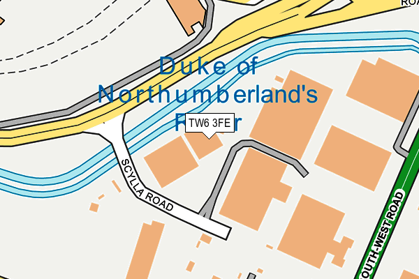
TW6 3FE is located in the Heathrow Villages electoral ward, within the London borough of Hillingdon and the English Parliamentary constituency of Hayes and Harlington. The Sub Integrated Care Board (ICB) Location is NHS North West London ICB - W2U3Z and the police force is Metropolitan Police. This postcode has been in use since August 2012.


GetTheData
Source: OS OpenMap – Local (Ordnance Survey)
Source: OS VectorMap District (Ordnance Survey)
Licence: Open Government Licence (requires attribution)
| Easting | 508017 |
| Northing | 174137 |
| Latitude | 51.455918 |
| Longitude | -0.446738 |
GetTheData
Source: Open Postcode Geo
Licence: Open Government Licence
| Country | England |
| Postcode District | TW6 |
➜ See where TW6 is on a map ➜ Where is London? | |
GetTheData
Source: Land Registry Price Paid Data
Licence: Open Government Licence
Elevation or altitude of TW6 3FE as distance above sea level:
| Metres | Feet | |
|---|---|---|
| Elevation | 30m | 98ft |
Elevation is measured from the approximate centre of the postcode, to the nearest point on an OS contour line from OS Terrain 50, which has contour spacing of ten vertical metres.
➜ How high above sea level am I? Find the elevation of your current position using your device's GPS.
GetTheData
Source: Open Postcode Elevation
Licence: Open Government Licence
| Ward | Heathrow Villages |
| Constituency | Hayes And Harlington |
GetTheData
Source: ONS Postcode Database
Licence: Open Government Licence
| Scylla Road (Southern Perimeter Road) | Heathrow Airport | 92m |
| Scylla Road (Southern Perimeter Road) | Heathrow Airport | 181m |
| Great South West Road East Bedfont (Stanwell Road) | East Bedfont | 284m |
| Heathrow Terminal 4 | Heathrow Airport Terminal 4 | 285m |
| Heathrow Terminal 4 | Heathrow Airport Terminal 4 | 289m |
| Heathrow Terminal 4 Underground Station | Heathrow Airport Terminal 4 | 297m |
| Heathrow Terminal 4 Station | 0.3km |
| Heathrow Terminal 4 (Rail-Air) | 0.4km |
| Heathrow Airport Central Bus Stn (Rail-Air) | 1.7km |
GetTheData
Source: NaPTAN
Licence: Open Government Licence
GetTheData
Source: ONS Postcode Database
Licence: Open Government Licence

➜ Get more ratings from the Food Standards Agency
GetTheData
Source: Food Standards Agency
Licence: FSA terms & conditions
| Last Collection | |||
|---|---|---|---|
| Location | Mon-Fri | Sat | Distance |
| The Green Man, Green Man Lane | 18:30 | 11:45 | 991m |
| Orchard Avenue | 17:00 | 11:45 | 1,019m |
| Hounslow / Staines Roads | 18:30 | 11:30 | 1,298m |
GetTheData
Source: Dracos
Licence: Creative Commons Attribution-ShareAlike
The below table lists the International Territorial Level (ITL) codes (formerly Nomenclature of Territorial Units for Statistics (NUTS) codes) and Local Administrative Units (LAU) codes for TW6 3FE:
| ITL 1 Code | Name |
|---|---|
| TLI | London |
| ITL 2 Code | Name |
| TLI7 | Outer London - West and North West |
| ITL 3 Code | Name |
| TLI74 | Harrow and Hillingdon |
| LAU 1 Code | Name |
| E09000017 | Hillingdon |
GetTheData
Source: ONS Postcode Directory
Licence: Open Government Licence
The below table lists the Census Output Area (OA), Lower Layer Super Output Area (LSOA), and Middle Layer Super Output Area (MSOA) for TW6 3FE:
| Code | Name | |
|---|---|---|
| OA | E00012179 | |
| LSOA | E01002444 | Hillingdon 031A |
| MSOA | E02000524 | Hillingdon 031 |
GetTheData
Source: ONS Postcode Directory
Licence: Open Government Licence
| TW14 8LH | Bedfont Close | 354m |
| TW14 8LF | Bedfont Close | 374m |
| TW14 8NW | Stanwell Road | 433m |
| TW14 8PR | West View | 438m |
| TW14 8LG | Bedfont Close | 453m |
| TW14 8LE | Bedfont Close | 457m |
| TW14 8LJ | Bedfont Close | 476m |
| TW14 8LW | Horsham Road | 479m |
| TW14 8LQ | Bedfont Close | 498m |
| TW14 8LN | Horsham Road | 500m |
GetTheData
Source: Open Postcode Geo; Land Registry Price Paid Data
Licence: Open Government Licence