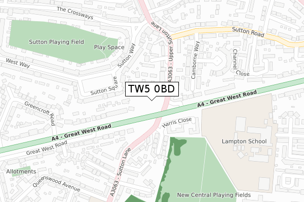
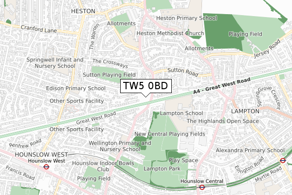
TW5 0BD is located in the Heston Central electoral ward, within the London borough of Hounslow and the English Parliamentary constituency of Feltham and Heston. The Sub Integrated Care Board (ICB) Location is NHS North West London ICB - W2U3Z and the police force is Metropolitan Police. This postcode has been in use since September 2019.


GetTheData
Source: OS Open Zoomstack (Ordnance Survey)
Licence: Open Government Licence (requires attribution)
Attribution: Contains OS data © Crown copyright and database right 2025
Source: Open Postcode Geo
Licence: Open Government Licence (requires attribution)
Attribution: Contains OS data © Crown copyright and database right 2025; Contains Royal Mail data © Royal Mail copyright and database right 2025; Source: Office for National Statistics licensed under the Open Government Licence v.3.0
| Easting | 513067 |
| Northing | 176734 |
| Latitude | 51.478275 |
| Longitude | -0.373235 |
GetTheData
Source: Open Postcode Geo
Licence: Open Government Licence
| Country | England |
| Postcode District | TW5 |
➜ See where TW5 is on a map ➜ Where is London? | |
GetTheData
Source: Land Registry Price Paid Data
Licence: Open Government Licence
| Ward | Heston Central |
| Constituency | Feltham And Heston |
GetTheData
Source: ONS Postcode Database
Licence: Open Government Licence
| Willow Gardensgreat West Road (Sutton Lane) | Lampton | 42m |
| Sutton Lane Great West Road (Great West Road) | Heston | 80m |
| Sutton Lane Great West Road (Great West Road) | Heston | 112m |
| Upper Sutton Lane | Heston | 143m |
| Upper Sutton Lane | Heston | 203m |
| Hounslow Central Underground Station | Hounslow Central | 904m |
| Hounslow West Underground Station | Hounslow West | 1,067m |
| Hounslow East Underground Station | Hounslow East | 1,295m |
| Osterley Underground Station | Osterley | 1,498m |
| Hounslow Station | 2km |
| Isleworth Station | 2.6km |
| Southall Station | 3.1km |
GetTheData
Source: NaPTAN
Licence: Open Government Licence
GetTheData
Source: ONS Postcode Database
Licence: Open Government Licence


➜ Get more ratings from the Food Standards Agency
GetTheData
Source: Food Standards Agency
Licence: FSA terms & conditions
| Last Collection | |||
|---|---|---|---|
| Location | Mon-Fri | Sat | Distance |
| Crossways | 17:30 | 11:45 | 246m |
| Queenswood Avenue | 17:45 | 12:00 | 341m |
| Alexandra Gardens | 17:15 | 11:45 | 394m |
GetTheData
Source: Dracos
Licence: Creative Commons Attribution-ShareAlike
The below table lists the International Territorial Level (ITL) codes (formerly Nomenclature of Territorial Units for Statistics (NUTS) codes) and Local Administrative Units (LAU) codes for TW5 0BD:
| ITL 1 Code | Name |
|---|---|
| TLI | London |
| ITL 2 Code | Name |
| TLI7 | Outer London - West and North West |
| ITL 3 Code | Name |
| TLI75 | Hounslow and Richmond upon Thames |
| LAU 1 Code | Name |
| E09000018 | Hounslow |
GetTheData
Source: ONS Postcode Directory
Licence: Open Government Licence
The below table lists the Census Output Area (OA), Lower Layer Super Output Area (LSOA), and Middle Layer Super Output Area (MSOA) for TW5 0BD:
| Code | Name | |
|---|---|---|
| OA | E00013045 | |
| LSOA | E01002621 | Hounslow 011B |
| MSOA | E02000536 | Hounslow 011 |
GetTheData
Source: ONS Postcode Directory
Licence: Open Government Licence
| TW5 0PA | Noble Corner | 80m |
| TW5 0PR | Upper Sutton Lane | 101m |
| TW3 3DU | Sutton Lane | 121m |
| TW3 4JJ | Harris Close | 130m |
| TW3 4JU | Harris Close | 130m |
| TW3 4JS | Willow Gardens | 144m |
| TW5 0PU | Palmer Close | 153m |
| TW5 0JB | Sutton Square | 159m |
| TW3 4JW | Sutton Lane | 172m |
| TW5 0BA | Great West Road | 181m |
GetTheData
Source: Open Postcode Geo; Land Registry Price Paid Data
Licence: Open Government Licence