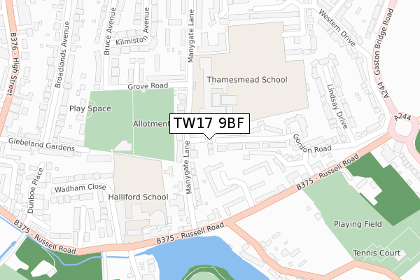
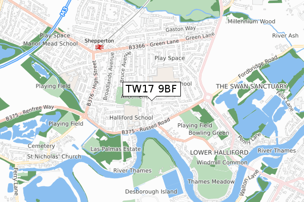
TW17 9BF is located in the Shepperton Town electoral ward, within the local authority district of Spelthorne and the English Parliamentary constituency of Spelthorne. The Sub Integrated Care Board (ICB) Location is NHS Surrey Heartlands ICB - 92A and the police force is Surrey. This postcode has been in use since June 2019.


GetTheData
Source: OS Open Zoomstack (Ordnance Survey)
Licence: Open Government Licence (requires attribution)
Attribution: Contains OS data © Crown copyright and database right 2025
Source: Open Postcode Geo
Licence: Open Government Licence (requires attribution)
Attribution: Contains OS data © Crown copyright and database right 2025; Contains Royal Mail data © Royal Mail copyright and database right 2025; Source: Office for National Statistics licensed under the Open Government Licence v.3.0
| Easting | 508498 |
| Northing | 167053 |
| Latitude | 51.392152 |
| Longitude | -0.441964 |
GetTheData
Source: Open Postcode Geo
Licence: Open Government Licence
| Country | England |
| Postcode District | TW17 |
➜ See where TW17 is on a map ➜ Where is Shepperton? | |
GetTheData
Source: Land Registry Price Paid Data
Licence: Open Government Licence
| Ward | Shepperton Town |
| Constituency | Spelthorne |
GetTheData
Source: ONS Postcode Database
Licence: Open Government Licence
1, OLD HALLIFORD PLACE, SHEPPERTON, TW17 9BF 2019 20 DEC £610,000 |
GetTheData
Source: HM Land Registry Price Paid Data
Licence: Contains HM Land Registry data © Crown copyright and database right 2025. This data is licensed under the Open Government Licence v3.0.
| Thamesmead School (Manygate Lane) | Shepperton | 116m |
| Gordon Drive (Russell Road) | Lower Halliford | 202m |
| Gordon Drive (Russell Road) | Lower Halliford | 245m |
| Old Ship Hotel (Russell Road) | Shepperton | 323m |
| Old Ship Hotel (Russell Road) | Shepperton | 340m |
| Shepperton Station | 0.6km |
| Upper Halliford Station | 2.5km |
| Walton-on-Thames Station | 2.9km |
GetTheData
Source: NaPTAN
Licence: Open Government Licence
| Percentage of properties with Next Generation Access | 100.0% |
| Percentage of properties with Superfast Broadband | 100.0% |
| Percentage of properties with Ultrafast Broadband | 0.0% |
| Percentage of properties with Full Fibre Broadband | 0.0% |
Superfast Broadband is between 30Mbps and 300Mbps
Ultrafast Broadband is > 300Mbps
| Percentage of properties unable to receive 2Mbps | 0.0% |
| Percentage of properties unable to receive 5Mbps | 0.0% |
| Percentage of properties unable to receive 10Mbps | 0.0% |
| Percentage of properties unable to receive 30Mbps | 0.0% |
GetTheData
Source: Ofcom
Licence: Ofcom Terms of Use (requires attribution)
GetTheData
Source: ONS Postcode Database
Licence: Open Government Licence


➜ Get more ratings from the Food Standards Agency
GetTheData
Source: Food Standards Agency
Licence: FSA terms & conditions
| Last Collection | |||
|---|---|---|---|
| Location | Mon-Fri | Sat | Distance |
| Russell Road | 16:30 | 11:15 | 178m |
| Gaston Bridge Road | 16:30 | 11:15 | 408m |
| Manygate Lane | 16:30 | 11:15 | 467m |
GetTheData
Source: Dracos
Licence: Creative Commons Attribution-ShareAlike
| Risk of TW17 9BF flooding from rivers and sea | Low |
| ➜ TW17 9BF flood map | |
GetTheData
Source: Open Flood Risk by Postcode
Licence: Open Government Licence
The below table lists the International Territorial Level (ITL) codes (formerly Nomenclature of Territorial Units for Statistics (NUTS) codes) and Local Administrative Units (LAU) codes for TW17 9BF:
| ITL 1 Code | Name |
|---|---|
| TLJ | South East (England) |
| ITL 2 Code | Name |
| TLJ2 | Surrey, East and West Sussex |
| ITL 3 Code | Name |
| TLJ25 | West Surrey |
| LAU 1 Code | Name |
| E07000213 | Spelthorne |
GetTheData
Source: ONS Postcode Directory
Licence: Open Government Licence
The below table lists the Census Output Area (OA), Lower Layer Super Output Area (LSOA), and Middle Layer Super Output Area (MSOA) for TW17 9BF:
| Code | Name | |
|---|---|---|
| OA | E00156718 | |
| LSOA | E01030732 | Spelthorne 013C |
| MSOA | E02006415 | Spelthorne 013 |
GetTheData
Source: ONS Postcode Directory
Licence: Open Government Licence
| TW17 9EJ | Manygate Lane | 84m |
| TW17 9ED | Manygate Lane | 111m |
| TW17 8JY | Gordon Road | 114m |
| TW17 8JL | Mulberry Trees | 124m |
| TW17 9EQ | Manygate Lane | 138m |
| TW17 8JN | Mulberry Trees | 160m |
| TW17 8JX | Gordon Road | 163m |
| TW17 8JF | Mitre Close | 182m |
| TW17 8JJ | Russell Road | 183m |
| TW17 9EZ | River Court | 184m |
GetTheData
Source: Open Postcode Geo; Land Registry Price Paid Data
Licence: Open Government Licence