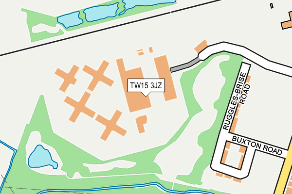
TW15 3JZ is located in the Ashford Town electoral ward, within the local authority district of Spelthorne and the English Parliamentary constituency of Spelthorne. The Sub Integrated Care Board (ICB) Location is NHS Surrey Heartlands ICB - 92A and the police force is Surrey. This postcode has been in use since May 2004.


GetTheData
Source: OS OpenMap – Local (Ordnance Survey)
Source: OS VectorMap District (Ordnance Survey)
Licence: Open Government Licence (requires attribution)
| Easting | 505561 |
| Northing | 171527 |
| Latitude | 51.432921 |
| Longitude | -0.482850 |
GetTheData
Source: Open Postcode Geo
Licence: Open Government Licence
| Country | England |
| Postcode District | TW15 |
➜ See where TW15 is on a map ➜ Where is Ashford? | |
GetTheData
Source: Land Registry Price Paid Data
Licence: Open Government Licence
Elevation or altitude of TW15 3JZ as distance above sea level:
| Metres | Feet | |
|---|---|---|
| Elevation | 20m | 66ft |
Elevation is measured from the approximate centre of the postcode, to the nearest point on an OS contour line from OS Terrain 50, which has contour spacing of ten vertical metres.
➜ How high above sea level am I? Find the elevation of your current position using your device's GPS.
GetTheData
Source: Open Postcode Elevation
Licence: Open Government Licence
| Ward | Ashford Town |
| Constituency | Spelthorne |
GetTheData
Source: ONS Postcode Database
Licence: Open Government Licence
| Brookside Avenue | Ashford | 328m |
| Chesterfield Road (Woodthorpe Road) | Ashford | 329m |
| Brookside Avenue | Ashford | 341m |
| Ferndale Road (Woodthorpe Road) | Ashford | 356m |
| St Martin's Court (Boundary Road) | Ashford | 362m |
| Ashford (Surrey) Station | 1.1km |
| Staines Station | 1.4km |
| Heathrow Terminal 4 Station | 3.8km |
GetTheData
Source: NaPTAN
Licence: Open Government Licence
GetTheData
Source: ONS Postcode Database
Licence: Open Government Licence


➜ Get more ratings from the Food Standards Agency
GetTheData
Source: Food Standards Agency
Licence: FSA terms & conditions
| Last Collection | |||
|---|---|---|---|
| Location | Mon-Fri | Sat | Distance |
| Outside P.o. 110 Woodthorpe Road | 16:45 | 11:30 | 379m |
| Ferndale Road | 16:45 | 11:45 | 443m |
| Kingston Crescent | 16:45 | 11:45 | 446m |
GetTheData
Source: Dracos
Licence: Creative Commons Attribution-ShareAlike
| Risk of TW15 3JZ flooding from rivers and sea | Low |
| ➜ TW15 3JZ flood map | |
GetTheData
Source: Open Flood Risk by Postcode
Licence: Open Government Licence
The below table lists the International Territorial Level (ITL) codes (formerly Nomenclature of Territorial Units for Statistics (NUTS) codes) and Local Administrative Units (LAU) codes for TW15 3JZ:
| ITL 1 Code | Name |
|---|---|
| TLJ | South East (England) |
| ITL 2 Code | Name |
| TLJ2 | Surrey, East and West Sussex |
| ITL 3 Code | Name |
| TLJ25 | West Surrey |
| LAU 1 Code | Name |
| E07000213 | Spelthorne |
GetTheData
Source: ONS Postcode Directory
Licence: Open Government Licence
The below table lists the Census Output Area (OA), Lower Layer Super Output Area (LSOA), and Middle Layer Super Output Area (MSOA) for TW15 3JZ:
| Code | Name | |
|---|---|---|
| OA | E00156619 | |
| LSOA | E01030714 | Spelthorne 003E |
| MSOA | E02006405 | Spelthorne 003 |
GetTheData
Source: ONS Postcode Directory
Licence: Open Government Licence
| TW15 3LD | Ruggles Brise Road | 188m |
| TW15 3LF | Ruggles Brise Road | 237m |
| TW15 3JL | Rowan Close | 251m |
| TW15 3LY | Brookside Avenue | 299m |
| TW15 3JB | Queens Walk | 336m |
| TW15 3LQ | Woodthorpe Road | 343m |
| TW15 3LX | Brookside Avenue | 348m |
| TW15 3LZ | Brookside Avenue | 354m |
| TW15 3LH | Woodthorpe Road | 360m |
| TW15 3JF | Queens Walk | 368m |
GetTheData
Source: Open Postcode Geo; Land Registry Price Paid Data
Licence: Open Government Licence