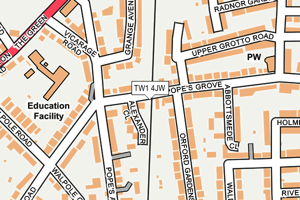
TW1 4JW is located in the South Twickenham electoral ward, within the London borough of Richmond upon Thames and the English Parliamentary constituency of Twickenham. The Sub Integrated Care Board (ICB) Location is NHS South West London ICB - 36L and the police force is Metropolitan Police. This postcode has been in use since July 2004.


GetTheData
Source: OS OpenMap – Local (Ordnance Survey)
Source: OS VectorMap District (Ordnance Survey)
Licence: Open Government Licence (requires attribution)
| Easting | 515529 |
| Northing | 172708 |
| Latitude | 51.441593 |
| Longitude | -0.339133 |
GetTheData
Source: Open Postcode Geo
Licence: Open Government Licence
| Country | England |
| Postcode District | TW1 |
➜ See where TW1 is on a map ➜ Where is Twickenham? | |
GetTheData
Source: Land Registry Price Paid Data
Licence: Open Government Licence
Elevation or altitude of TW1 4JW as distance above sea level:
| Metres | Feet | |
|---|---|---|
| Elevation | 10m | 33ft |
Elevation is measured from the approximate centre of the postcode, to the nearest point on an OS contour line from OS Terrain 50, which has contour spacing of ten vertical metres.
➜ How high above sea level am I? Find the elevation of your current position using your device's GPS.
GetTheData
Source: Open Postcode Elevation
Licence: Open Government Licence
| Ward | South Twickenham |
| Constituency | Twickenham |
GetTheData
Source: ONS Postcode Database
Licence: Open Government Licence
| Twickenham Green (The Green) | Strawberry Hill | 284m |
| Twickenham Green (The Green) | Strawberry Hill | 288m |
| The Prince Albert Twickenham (Hampton Road) | Strawberry Hill | 301m |
| The Prince Albert Twickenham (Hampton Road) | Strawberry Hill | 357m |
| Twickenham Green | Strawberry Hill | 365m |
| Strawberry Hill Station | 0.3km |
| Fulwell Station | 1.1km |
| Twickenham Station | 1.1km |
GetTheData
Source: NaPTAN
Licence: Open Government Licence
GetTheData
Source: ONS Postcode Database
Licence: Open Government Licence


➜ Get more ratings from the Food Standards Agency
GetTheData
Source: Food Standards Agency
Licence: FSA terms & conditions
| Last Collection | |||
|---|---|---|---|
| Location | Mon-Fri | Sat | Distance |
| Popes Grove | 17:30 | 11:15 | 93m |
| Radnor Road | 18:30 | 11:15 | 258m |
| Strawberry Vale | 18:30 | 11:15 | 295m |
GetTheData
Source: Dracos
Licence: Creative Commons Attribution-ShareAlike
The below table lists the International Territorial Level (ITL) codes (formerly Nomenclature of Territorial Units for Statistics (NUTS) codes) and Local Administrative Units (LAU) codes for TW1 4JW:
| ITL 1 Code | Name |
|---|---|
| TLI | London |
| ITL 2 Code | Name |
| TLI7 | Outer London - West and North West |
| ITL 3 Code | Name |
| TLI75 | Hounslow and Richmond upon Thames |
| LAU 1 Code | Name |
| E09000027 | Richmond upon Thames |
GetTheData
Source: ONS Postcode Directory
Licence: Open Government Licence
The below table lists the Census Output Area (OA), Lower Layer Super Output Area (LSOA), and Middle Layer Super Output Area (MSOA) for TW1 4JW:
| Code | Name | |
|---|---|---|
| OA | E00019539 | |
| LSOA | E01003884 | Richmond upon Thames 016C |
| MSOA | E02000799 | Richmond upon Thames 016 |
GetTheData
Source: ONS Postcode Directory
Licence: Open Government Licence
| TW2 5TB | Alexander Close | 56m |
| TW2 5TA | Popes Grove | 57m |
| TW2 5TN | Popes Avenue | 105m |
| TW2 5TD | Popes Avenue | 114m |
| TW2 5TJ | Popes Avenue | 127m |
| TW1 4JZ | Popes Grove | 138m |
| TW1 4NL | Hollies Close | 139m |
| TW1 4JY | Popes Grove | 141m |
| TW2 5TE | Popes Avenue | 145m |
| TW1 4PL | Orford Gardens | 146m |
GetTheData
Source: Open Postcode Geo; Land Registry Price Paid Data
Licence: Open Government Licence