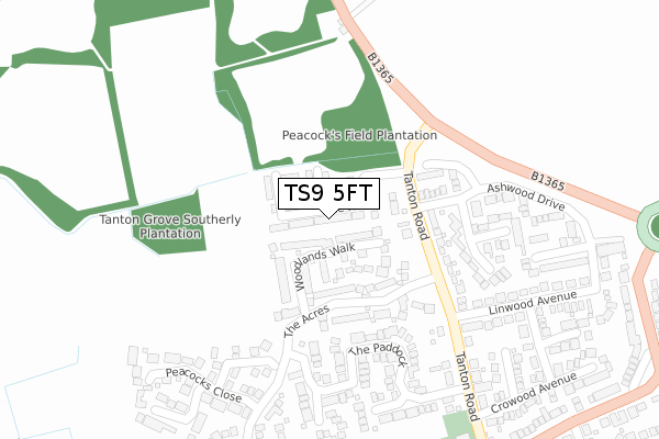
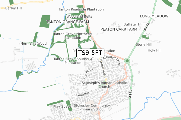
TS9 5FT is located in the Stokesley electoral ward, within the unitary authority of North Yorkshire and the English Parliamentary constituency of Richmond (Yorks). The Sub Integrated Care Board (ICB) Location is NHS Humber and North Yorkshire ICB - 42D and the police force is North Yorkshire. This postcode has been in use since July 2018.


GetTheData
Source: OS Open Zoomstack (Ordnance Survey)
Licence: Open Government Licence (requires attribution)
Attribution: Contains OS data © Crown copyright and database right 2025
Source: Open Postcode Geo
Licence: Open Government Licence (requires attribution)
Attribution: Contains OS data © Crown copyright and database right 2025; Contains Royal Mail data © Royal Mail copyright and database right 2025; Source: Office for National Statistics licensed under the Open Government Licence v.3.0
| Easting | 452505 |
| Northing | 509497 |
| Latitude | 54.478133 |
| Longitude | -1.191227 |
GetTheData
Source: Open Postcode Geo
Licence: Open Government Licence
| Country | England |
| Postcode District | TS9 |
➜ See where TS9 is on a map ➜ Where is Stokesley? | |
GetTheData
Source: Land Registry Price Paid Data
Licence: Open Government Licence
| Ward | Stokesley |
| Constituency | Richmond (Yorks) |
GetTheData
Source: ONS Postcode Database
Licence: Open Government Licence
71, THE FIRS, STOKESLEY, MIDDLESBROUGH, TS9 5FT 2025 24 JAN £305,000 |
117, THE FIRS, STOKESLEY, MIDDLESBROUGH, TS9 5FT 2022 30 NOV £364,995 |
111, THE FIRS, STOKESLEY, MIDDLESBROUGH, TS9 5FT 2022 30 SEP £234,995 |
101, THE FIRS, STOKESLEY, MIDDLESBROUGH, TS9 5FT 2022 26 MAY £299,995 |
103, THE FIRS, STOKESLEY, MIDDLESBROUGH, TS9 5FT 2022 20 MAY £299,995 |
95, THE FIRS, STOKESLEY, MIDDLESBROUGH, TS9 5FT 2022 25 FEB £289,995 |
3, THE FIRS, STOKESLEY, MIDDLESBROUGH, TS9 5FT 2021 30 SEP £329,995 |
75, THE FIRS, STOKESLEY, MIDDLESBROUGH, TS9 5FT 2021 25 JUN £229,995 |
77, THE FIRS, STOKESLEY, MIDDLESBROUGH, TS9 5FT 2021 25 JUN £289,995 |
73, THE FIRS, STOKESLEY, MIDDLESBROUGH, TS9 5FT 2021 25 JUN £289,995 |
GetTheData
Source: HM Land Registry Price Paid Data
Licence: Contains HM Land Registry data © Crown copyright and database right 2025. This data is licensed under the Open Government Licence v3.0.
| Ashwood Drive (Tanton Road) | Stokesley | 193m |
| Tanton Grove (Tanton Road) | Stokesley | 200m |
| St Josephs Church (Crowood Avenue) | Stokesley | 415m |
| St Josephs Church (Tanton Road) | Stokesley | 423m |
| Meadowfield | Stokesley | 598m |
| Great Ayton Station | 5.1km |
GetTheData
Source: NaPTAN
Licence: Open Government Licence
| Percentage of properties with Next Generation Access | 100.0% |
| Percentage of properties with Superfast Broadband | 100.0% |
| Percentage of properties with Ultrafast Broadband | 100.0% |
| Percentage of properties with Full Fibre Broadband | 100.0% |
Superfast Broadband is between 30Mbps and 300Mbps
Ultrafast Broadband is > 300Mbps
| Percentage of properties unable to receive 2Mbps | 0.0% |
| Percentage of properties unable to receive 5Mbps | 0.0% |
| Percentage of properties unable to receive 10Mbps | 0.0% |
| Percentage of properties unable to receive 30Mbps | 0.0% |
GetTheData
Source: Ofcom
Licence: Ofcom Terms of Use (requires attribution)
GetTheData
Source: ONS Postcode Database
Licence: Open Government Licence


➜ Get more ratings from the Food Standards Agency
GetTheData
Source: Food Standards Agency
Licence: FSA terms & conditions
| Last Collection | |||
|---|---|---|---|
| Location | Mon-Fri | Sat | Distance |
| Queens Drive | 17:30 | 09:15 | 727m |
| Stokesley Post Office | 17:30 | 12:30 | 860m |
| Stokesley Post Office | 17:30 | 12:30 | 928m |
GetTheData
Source: Dracos
Licence: Creative Commons Attribution-ShareAlike
The below table lists the International Territorial Level (ITL) codes (formerly Nomenclature of Territorial Units for Statistics (NUTS) codes) and Local Administrative Units (LAU) codes for TS9 5FT:
| ITL 1 Code | Name |
|---|---|
| TLE | Yorkshire and The Humber |
| ITL 2 Code | Name |
| TLE2 | North Yorkshire |
| ITL 3 Code | Name |
| TLE22 | North Yorkshire CC |
| LAU 1 Code | Name |
| E07000164 | Hambleton |
GetTheData
Source: ONS Postcode Directory
Licence: Open Government Licence
The below table lists the Census Output Area (OA), Lower Layer Super Output Area (LSOA), and Middle Layer Super Output Area (MSOA) for TS9 5FT:
| Code | Name | |
|---|---|---|
| OA | E00140669 | |
| LSOA | E01027624 | Hambleton 002C |
| MSOA | E02005751 | Hambleton 002 |
GetTheData
Source: ONS Postcode Directory
Licence: Open Government Licence
| TS9 5QG | Woodlands Walk | 80m |
| TS9 5QA | The Acres | 162m |
| TS9 5PW | The Paddock | 205m |
| TS9 5QF | Jackson Drive | 231m |
| TS9 5JU | Cedarwood Avenue | 247m |
| TS9 5HR | Tanton Road | 249m |
| TS9 5QD | Peacocks Close | 287m |
| TS9 5PN | The Paddock | 297m |
| TS9 5JA | Beechwood Avenue | 302m |
| TS9 5QE | Hildyard Close | 323m |
GetTheData
Source: Open Postcode Geo; Land Registry Price Paid Data
Licence: Open Government Licence