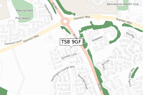
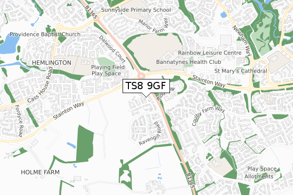
TS8 9GF is located in the Stainton & Thornton electoral ward, within the unitary authority of Middlesbrough and the English Parliamentary constituency of Middlesbrough South and East Cleveland. The Sub Integrated Care Board (ICB) Location is NHS North East and North Cumbria ICB - 16C and the police force is Cleveland. This postcode has been in use since July 2018.


GetTheData
Source: OS Open Zoomstack (Ordnance Survey)
Licence: Open Government Licence (requires attribution)
Attribution: Contains OS data © Crown copyright and database right 2025
Source: Open Postcode Geo
Licence: Open Government Licence (requires attribution)
Attribution: Contains OS data © Crown copyright and database right 2025; Contains Royal Mail data © Royal Mail copyright and database right 2025; Source: Office for National Statistics licensed under the Open Government Licence v.3.0
| Easting | 450193 |
| Northing | 514227 |
| Latitude | 54.520870 |
| Longitude | -1.226102 |
GetTheData
Source: Open Postcode Geo
Licence: Open Government Licence
| Country | England |
| Postcode District | TS8 |
➜ See where TS8 is on a map ➜ Where is Middlesbrough? | |
GetTheData
Source: Land Registry Price Paid Data
Licence: Open Government Licence
| Ward | Stainton & Thornton |
| Constituency | Middlesbrough South And East Cleveland |
GetTheData
Source: ONS Postcode Database
Licence: Open Government Licence
2024 28 MAR £200,000 |
7, APPLE NOOK, HEMLINGTON, MIDDLESBROUGH, TS8 9GF 2019 30 APR £169,950 |
2, APPLE NOOK, HEMLINGTON, MIDDLESBROUGH, TS8 9GF 2018 24 AUG £227,950 |
2018 29 JUN £179,950 |
GetTheData
Source: HM Land Registry Price Paid Data
Licence: Contains HM Land Registry data © Crown copyright and database right 2025. This data is licensed under the Open Government Licence v3.0.
| The Gables (Stokesley Road) | Hemlington | 78m |
| The Gables (Stokesley Road) | Hemlington | 91m |
| The Gables (Stainton Way) | Hemlington | 215m |
| The Gables (Stainton Way) | Hemlington | 217m |
| The King's Academy (Stainton Way) | Coulby Newham | 293m |
| Marton Station | 3.2km |
| Gypsy Lane Station | 3.3km |
| James Cook University Hospital Station | 3.6km |
GetTheData
Source: NaPTAN
Licence: Open Government Licence
| Percentage of properties with Next Generation Access | 100.0% |
| Percentage of properties with Superfast Broadband | 100.0% |
| Percentage of properties with Ultrafast Broadband | 100.0% |
| Percentage of properties with Full Fibre Broadband | 100.0% |
Superfast Broadband is between 30Mbps and 300Mbps
Ultrafast Broadband is > 300Mbps
| Percentage of properties unable to receive 2Mbps | 0.0% |
| Percentage of properties unable to receive 5Mbps | 0.0% |
| Percentage of properties unable to receive 10Mbps | 0.0% |
| Percentage of properties unable to receive 30Mbps | 0.0% |
GetTheData
Source: Ofcom
Licence: Ofcom Terms of Use (requires attribution)
GetTheData
Source: ONS Postcode Database
Licence: Open Government Licence


➜ Get more ratings from the Food Standards Agency
GetTheData
Source: Food Standards Agency
Licence: FSA terms & conditions
| Last Collection | |||
|---|---|---|---|
| Location | Mon-Fri | Sat | Distance |
| Coulby Farm Way | 17:00 | 09:45 | 979m |
| Low Lane | 17:15 | 12:30 | 1,768m |
| Brookfield Post Office | 17:00 | 12:00 | 2,068m |
GetTheData
Source: Dracos
Licence: Creative Commons Attribution-ShareAlike
The below table lists the International Territorial Level (ITL) codes (formerly Nomenclature of Territorial Units for Statistics (NUTS) codes) and Local Administrative Units (LAU) codes for TS8 9GF:
| ITL 1 Code | Name |
|---|---|
| TLC | North East (England) |
| ITL 2 Code | Name |
| TLC1 | Tees Valley and Durham |
| ITL 3 Code | Name |
| TLC12 | South Teesside |
| LAU 1 Code | Name |
| E06000002 | Middlesbrough |
GetTheData
Source: ONS Postcode Directory
Licence: Open Government Licence
The below table lists the Census Output Area (OA), Lower Layer Super Output Area (LSOA), and Middle Layer Super Output Area (MSOA) for TS8 9GF:
| Code | Name | |
|---|---|---|
| OA | E00060963 | |
| LSOA | E01032553 | Middlesbrough 018H |
| MSOA | E02002513 | Middlesbrough 018 |
GetTheData
Source: ONS Postcode Directory
Licence: Open Government Licence
| TS8 9DE | Hemlington Village Road | 87m |
| TS8 9DR | Hemlington Village Road | 163m |
| TS8 9JR | Brabourn Gardens | 291m |
| TS8 9JT | Beckenham Gardens | 304m |
| TS8 0UB | The Birches | 309m |
| TS8 0UA | The Birches | 321m |
| TS8 9JS | Brabourn Gardens | 349m |
| TS8 9JU | Beckenham Gardens | 375m |
| TS8 0UH | Swallowfields | 385m |
| TS8 9JX | Bridport Grove | 444m |
GetTheData
Source: Open Postcode Geo; Land Registry Price Paid Data
Licence: Open Government Licence