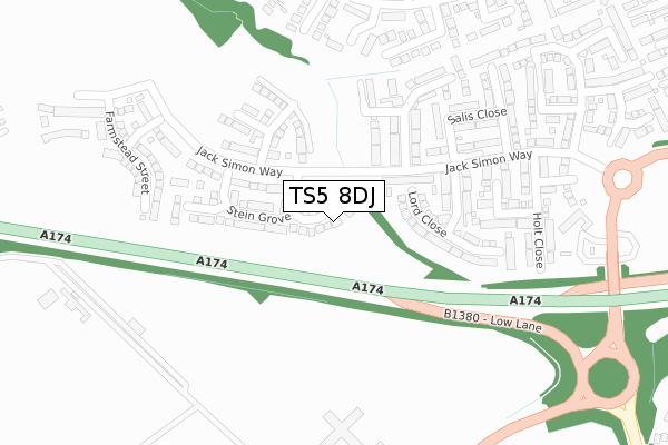
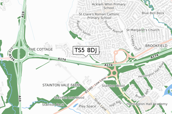
TS5 8DJ is located in the Trimdon electoral ward, within the unitary authority of Middlesbrough and the English Parliamentary constituency of Middlesbrough. The Sub Integrated Care Board (ICB) Location is NHS North East and North Cumbria ICB - 16C and the police force is Cleveland. This postcode has been in use since September 2018.


GetTheData
Source: OS Open Zoomstack (Ordnance Survey)
Licence: Open Government Licence (requires attribution)
Attribution: Contains OS data © Crown copyright and database right 2024
Source: Open Postcode Geo
Licence: Open Government Licence (requires attribution)
Attribution: Contains OS data © Crown copyright and database right 2024; Contains Royal Mail data © Royal Mail copyright and database right 2024; Source: Office for National Statistics licensed under the Open Government Licence v.3.0
| Easting | 447514 |
| Northing | 515062 |
| Latitude | 54.528631 |
| Longitude | -1.267352 |
GetTheData
Source: Open Postcode Geo
Licence: Open Government Licence
| Country | England |
| Postcode District | TS5 |
➜ See where TS5 is on a map ➜ Where is Middlesbrough? | |
GetTheData
Source: Land Registry Price Paid Data
Licence: Open Government Licence
| Ward | Trimdon |
| Constituency | Middlesbrough |
GetTheData
Source: ONS Postcode Database
Licence: Open Government Licence
2024 18 JUL £265,000 |
2023 18 DEC £345,000 |
2022 15 JUN £315,000 |
1, STEIN GROVE, MIDDLESBROUGH, TS5 8DJ 2021 26 MAR £277,995 |
13, STEIN GROVE, MIDDLESBROUGH, TS5 8DJ 2020 6 JUL £329,995 |
15, STEIN GROVE, MIDDLESBROUGH, TS5 8DJ 2020 24 APR £298,995 |
35, STEIN GROVE, MIDDLESBROUGH, TS5 8DJ 2020 27 MAR £299,995 |
65, STEIN GROVE, MIDDLESBROUGH, TS5 8DJ 2020 24 JAN £254,995 |
63, STEIN GROVE, MIDDLESBROUGH, TS5 8DJ 2019 13 DEC £279,995 |
61, STEIN GROVE, MIDDLESBROUGH, TS5 8DJ 2019 13 DEC £269,995 |
GetTheData
Source: HM Land Registry Price Paid Data
Licence: Contains HM Land Registry data © Crown copyright and database right 2024. This data is licensed under the Open Government Licence v3.0.
| Gore Sands (Baldoon Sands) | Brookfield | 430m |
| Cunningham House Farm (Low Lane) | Brookfield | 544m |
| Sporting Lodge Hotel (Strait Lane) | Stainton | 552m |
| Sporting Lodge Hotel (Strait Lane) | Stainton | 556m |
| Cunningham House Farm (Low Lane) | Brookfield | 561m |
| Thornaby Station | 4.1km |
| James Cook University Hospital Station | 4.6km |
| Marton Station | 4.8km |
GetTheData
Source: NaPTAN
Licence: Open Government Licence
| Percentage of properties with Next Generation Access | 100.0% |
| Percentage of properties with Superfast Broadband | 100.0% |
| Percentage of properties with Ultrafast Broadband | 100.0% |
| Percentage of properties with Full Fibre Broadband | 100.0% |
Superfast Broadband is between 30Mbps and 300Mbps
Ultrafast Broadband is > 300Mbps
| Percentage of properties unable to receive 2Mbps | 0.0% |
| Percentage of properties unable to receive 5Mbps | 0.0% |
| Percentage of properties unable to receive 10Mbps | 0.0% |
| Percentage of properties unable to receive 30Mbps | 0.0% |
GetTheData
Source: Ofcom
Licence: Ofcom Terms of Use (requires attribution)
GetTheData
Source: ONS Postcode Database
Licence: Open Government Licence


➜ Get more ratings from the Food Standards Agency
GetTheData
Source: Food Standards Agency
Licence: FSA terms & conditions
| Last Collection | |||
|---|---|---|---|
| Location | Mon-Fri | Sat | Distance |
| High Rifts, Stainton | 17:00 | 11:45 | 779m |
| Stockwell Ave, | 819m | ||
| Brookfield Post Office | 17:00 | 12:00 | 1,019m |
GetTheData
Source: Dracos
Licence: Creative Commons Attribution-ShareAlike
The below table lists the International Territorial Level (ITL) codes (formerly Nomenclature of Territorial Units for Statistics (NUTS) codes) and Local Administrative Units (LAU) codes for TS5 8DJ:
| ITL 1 Code | Name |
|---|---|
| TLC | North East (England) |
| ITL 2 Code | Name |
| TLC1 | Tees Valley and Durham |
| ITL 3 Code | Name |
| TLC12 | South Teesside |
| LAU 1 Code | Name |
| E06000002 | Middlesbrough |
GetTheData
Source: ONS Postcode Directory
Licence: Open Government Licence
The below table lists the Census Output Area (OA), Lower Layer Super Output Area (LSOA), and Middle Layer Super Output Area (MSOA) for TS5 8DJ:
| Code | Name | |
|---|---|---|
| OA | E00060642 | |
| LSOA | E01012022 | Middlesbrough 015A |
| MSOA | E02002510 | Middlesbrough 015 |
GetTheData
Source: ONS Postcode Directory
Licence: Open Government Licence
| TS5 8EJ | Jack Simon Way | 288m |
| TS5 8UR | Galloway Sands | 301m |
| TS5 8UW | Dornoch Sands | 334m |
| TS17 9LW | Low Lane | 341m |
| TS5 8UL | Luce Sands | 373m |
| TS5 8TS | Gayton Sands | 383m |
| TS5 8FB | Salis Close | 390m |
| TS17 9LG | 403m | |
| TS5 8UP | Blackhall Sands | 426m |
| TS5 8UJ | Gore Sands | 435m |
GetTheData
Source: Open Postcode Geo; Land Registry Price Paid Data
Licence: Open Government Licence