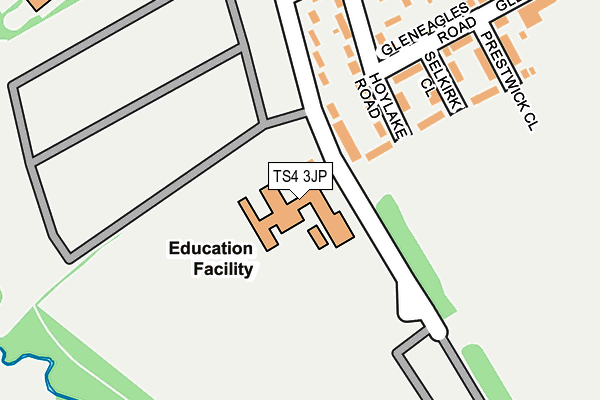
TS4 3JP is located in the Longlands & Beechwood electoral ward, within the unitary authority of Middlesbrough and the English Parliamentary constituency of Middlesbrough. The Sub Integrated Care Board (ICB) Location is NHS North East and North Cumbria ICB - 16C and the police force is Cleveland. This postcode has been in use since January 1980.


GetTheData
Source: OS OpenMap – Local (Ordnance Survey)
Source: OS VectorMap District (Ordnance Survey)
Licence: Open Government Licence (requires attribution)
| Easting | 449823 |
| Northing | 516977 |
| Latitude | 54.545619 |
| Longitude | -1.231354 |
GetTheData
Source: Open Postcode Geo
Licence: Open Government Licence
| Country | England |
| Postcode District | TS4 |
➜ See where TS4 is on a map ➜ Where is Middlesbrough? | |
GetTheData
Source: Land Registry Price Paid Data
Licence: Open Government Licence
Elevation or altitude of TS4 3JP as distance above sea level:
| Metres | Feet | |
|---|---|---|
| Elevation | 20m | 66ft |
Elevation is measured from the approximate centre of the postcode, to the nearest point on an OS contour line from OS Terrain 50, which has contour spacing of ten vertical metres.
➜ How high above sea level am I? Find the elevation of your current position using your device's GPS.
GetTheData
Source: Open Postcode Elevation
Licence: Open Government Licence
| Ward | Longlands & Beechwood |
| Constituency | Middlesbrough |
GetTheData
Source: ONS Postcode Database
Licence: Open Government Licence
| Trinity Catholic College (Saltersgill Avenue) | Saltersgill | 39m |
| Sunningdale Road | Saltersgill | 217m |
| Sunningdale Road (Saltersgill Avenue) | Saltersgill | 239m |
| The Saltersgill (Saltersgill Avenue) | Saltersgill | 439m |
| Fremantle Crescent (Sunningdale Road) | Beechwood | 442m |
| James Cook University Hospital Station | 1.6km |
| Marton Station | 2.1km |
| Gypsy Lane Station | 3.6km |
GetTheData
Source: NaPTAN
Licence: Open Government Licence
GetTheData
Source: ONS Postcode Database
Licence: Open Government Licence


➜ Get more ratings from the Food Standards Agency
GetTheData
Source: Food Standards Agency
Licence: FSA terms & conditions
| Last Collection | |||
|---|---|---|---|
| Location | Mon-Fri | Sat | Distance |
| Tollesby Post Office | 17:15 | 11:30 | 582m |
| St Marys Walk | 17:45 | 12:45 | 1,226m |
| Eastbourne Road Post Office | 17:15 | 11:15 | 1,313m |
GetTheData
Source: Dracos
Licence: Creative Commons Attribution-ShareAlike
The below table lists the International Territorial Level (ITL) codes (formerly Nomenclature of Territorial Units for Statistics (NUTS) codes) and Local Administrative Units (LAU) codes for TS4 3JP:
| ITL 1 Code | Name |
|---|---|
| TLC | North East (England) |
| ITL 2 Code | Name |
| TLC1 | Tees Valley and Durham |
| ITL 3 Code | Name |
| TLC12 | South Teesside |
| LAU 1 Code | Name |
| E06000002 | Middlesbrough |
GetTheData
Source: ONS Postcode Directory
Licence: Open Government Licence
The below table lists the Census Output Area (OA), Lower Layer Super Output Area (LSOA), and Middle Layer Super Output Area (MSOA) for TS4 3JP:
| Code | Name | |
|---|---|---|
| OA | E00060624 | |
| LSOA | E01012021 | Middlesbrough 011D |
| MSOA | E02002506 | Middlesbrough 011 |
GetTheData
Source: ONS Postcode Directory
Licence: Open Government Licence
| TS4 3JN | Saltersgill Avenue | 99m |
| TS4 3JL | Hoylake Road | 108m |
| TS4 3JG | Gleneagles Road | 177m |
| TS4 3JJ | Hoylake Road | 183m |
| TS4 3JH | Selkirk Close | 203m |
| TS4 3JA | Sunningdale Road | 236m |
| TS4 3JF | Gleneagles Road | 243m |
| TS4 3JQ | Prestwick Close | 257m |
| TS4 3HZ | Sunningdale Road | 263m |
| TS4 3HY | Portrush Close | 292m |
GetTheData
Source: Open Postcode Geo; Land Registry Price Paid Data
Licence: Open Government Licence