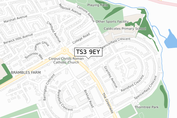
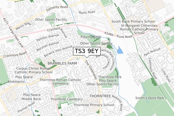
TS3 9EY is located in the Brambles & Thorntree electoral ward, within the unitary authority of Middlesbrough and the English Parliamentary constituency of Middlesbrough. The Sub Integrated Care Board (ICB) Location is NHS North East and North Cumbria ICB - 16C and the police force is Cleveland. This postcode has been in use since October 2019.


GetTheData
Source: OS Open Zoomstack (Ordnance Survey)
Licence: Open Government Licence (requires attribution)
Attribution: Contains OS data © Crown copyright and database right 2025
Source: Open Postcode Geo
Licence: Open Government Licence (requires attribution)
Attribution: Contains OS data © Crown copyright and database right 2025; Contains Royal Mail data © Royal Mail copyright and database right 2025; Source: Office for National Statistics licensed under the Open Government Licence v.3.0
| Easting | 452513 |
| Northing | 519061 |
| Latitude | 54.564075 |
| Longitude | -1.189405 |
GetTheData
Source: Open Postcode Geo
Licence: Open Government Licence
| Country | England |
| Postcode District | TS3 |
➜ See where TS3 is on a map ➜ Where is Middlesbrough? | |
GetTheData
Source: Land Registry Price Paid Data
Licence: Open Government Licence
| Ward | Brambles & Thorntree |
| Constituency | Middlesbrough |
GetTheData
Source: ONS Postcode Database
Licence: Open Government Licence
20, KELD HOUSE GARDENS, MIDDLESBROUGH, TS3 9EY 2023 6 NOV £156,995 |
14, KELD HOUSE GARDENS, MIDDLESBROUGH, TS3 9EY 2023 30 JUN £155,995 |
50, KELD HOUSE GARDENS, MIDDLESBROUGH, TS3 9EY 2022 28 APR £150,995 |
56, KELD HOUSE GARDENS, MIDDLESBROUGH, TS3 9EY 2021 25 JUN £181,995 |
66, KELD HOUSE GARDENS, MIDDLESBROUGH, TS3 9EY 2021 21 MAY £136,995 |
68, KELD HOUSE GARDENS, MIDDLESBROUGH, TS3 9EY 2021 19 APR £146,995 |
82, KELD HOUSE GARDENS, MIDDLESBROUGH, TS3 9EY 2020 11 DEC £139,995 |
88, KELD HOUSE GARDENS, MIDDLESBROUGH, TS3 9EY 2020 20 NOV £132,995 |
GetTheData
Source: HM Land Registry Price Paid Data
Licence: Contains HM Land Registry data © Crown copyright and database right 2025. This data is licensed under the Open Government Licence v3.0.
| College Road | Thorntree | 124m |
| College Road | Thorntree | 187m |
| Corpus Christi Primary School (Cargo Fleet Lane) | Pallister | 199m |
| Corpus Christi Primary School (Cargo Fleet Lane) | Pallister | 212m |
| Edridge Green (Homerton Road) | Pallister | 230m |
| James Cook University Hospital Station | 1.8km |
| Marton Station | 2.3km |
| South Bank Station | 2.3km |
GetTheData
Source: NaPTAN
Licence: Open Government Licence
GetTheData
Source: ONS Postcode Database
Licence: Open Government Licence


➜ Get more ratings from the Food Standards Agency
GetTheData
Source: Food Standards Agency
Licence: FSA terms & conditions
| Last Collection | |||
|---|---|---|---|
| Location | Mon-Fri | Sat | Distance |
| Birchington Avenue P.o. | 17:00 | 12:15 | 1,062m |
| Westerdale Road | 17:45 | 11:45 | 1,076m |
| Norfolk Place Post Office | 17:00 | 11:45 | 1,082m |
GetTheData
Source: Dracos
Licence: Creative Commons Attribution-ShareAlike
The below table lists the International Territorial Level (ITL) codes (formerly Nomenclature of Territorial Units for Statistics (NUTS) codes) and Local Administrative Units (LAU) codes for TS3 9EY:
| ITL 1 Code | Name |
|---|---|
| TLC | North East (England) |
| ITL 2 Code | Name |
| TLC1 | Tees Valley and Durham |
| ITL 3 Code | Name |
| TLC12 | South Teesside |
| LAU 1 Code | Name |
| E06000002 | Middlesbrough |
GetTheData
Source: ONS Postcode Directory
Licence: Open Government Licence
The below table lists the Census Output Area (OA), Lower Layer Super Output Area (LSOA), and Middle Layer Super Output Area (MSOA) for TS3 9EY:
| Code | Name | |
|---|---|---|
| OA | E00060971 | |
| LSOA | E01012090 | Middlesbrough 007E |
| MSOA | E02002502 | Middlesbrough 007 |
GetTheData
Source: ONS Postcode Directory
Licence: Open Government Licence
| TS3 9EW | College Road | 75m |
| TS3 9JD | Barrington Crescent | 157m |
| TS3 9JU | Hatherley Court | 183m |
| TS3 8NQ | Eastland View | 188m |
| TS3 8NA | Edridge Green | 210m |
| TS3 9JZ | Hopkins Avenue | 210m |
| TS3 8LY | Homerton Road | 216m |
| TS3 9RW | Cobblewood | 231m |
| TS3 8LZ | Homerton Road | 234m |
| TS3 9BW | Lilac Grove | 235m |
GetTheData
Source: Open Postcode Geo; Land Registry Price Paid Data
Licence: Open Government Licence