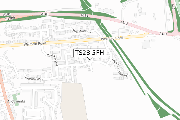
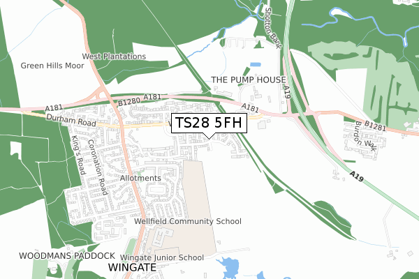
TS28 5FH is located in the Wingate electoral ward, within the unitary authority of County Durham and the English Parliamentary constituency of Sedgefield. The Sub Integrated Care Board (ICB) Location is NHS North East and North Cumbria ICB - 84H and the police force is Durham. This postcode has been in use since October 2018.


GetTheData
Source: OS Open Zoomstack (Ordnance Survey)
Licence: Open Government Licence (requires attribution)
Attribution: Contains OS data © Crown copyright and database right 2025
Source: Open Postcode Geo
Licence: Open Government Licence (requires attribution)
Attribution: Contains OS data © Crown copyright and database right 2025; Contains Royal Mail data © Royal Mail copyright and database right 2025; Source: Office for National Statistics licensed under the Open Government Licence v.3.0
| Easting | 440492 |
| Northing | 538135 |
| Latitude | 54.736575 |
| Longitude | -1.372664 |
GetTheData
Source: Open Postcode Geo
Licence: Open Government Licence
| Country | England |
| Postcode District | TS28 |
➜ See where TS28 is on a map ➜ Where is Wingate? | |
GetTheData
Source: Land Registry Price Paid Data
Licence: Open Government Licence
| Ward | Wingate |
| Constituency | Sedgefield |
GetTheData
Source: ONS Postcode Database
Licence: Open Government Licence
4, EDDERACRES WALK, WINGATE, TS28 5FH 2019 22 FEB £289,995 |
2, EDDERACRES WALK, WINGATE, TS28 5FH 2018 30 NOV £269,995 |
GetTheData
Source: HM Land Registry Price Paid Data
Licence: Contains HM Land Registry data © Crown copyright and database right 2025. This data is licensed under the Open Government Licence v3.0.
| Old Railway Bridge (Wellfield Road) | Wellfield | 141m |
| Old Railway Bridge (Wellfield Road) | Wellfield | 213m |
| Dairy (Wellfield Road) | Wellfield | 262m |
| Dairy (Wellfield Road) | Wellfield | 318m |
| Fir Tree Inn (North Road) | Wingate | 509m |
GetTheData
Source: NaPTAN
Licence: Open Government Licence
| Percentage of properties with Next Generation Access | 94.1% |
| Percentage of properties with Superfast Broadband | 94.1% |
| Percentage of properties with Ultrafast Broadband | 70.6% |
| Percentage of properties with Full Fibre Broadband | 70.6% |
Superfast Broadband is between 30Mbps and 300Mbps
Ultrafast Broadband is > 300Mbps
| Percentage of properties unable to receive 2Mbps | 0.0% |
| Percentage of properties unable to receive 5Mbps | 0.0% |
| Percentage of properties unable to receive 10Mbps | 0.0% |
| Percentage of properties unable to receive 30Mbps | 0.0% |
GetTheData
Source: Ofcom
Licence: Ofcom Terms of Use (requires attribution)
GetTheData
Source: ONS Postcode Database
Licence: Open Government Licence


➜ Get more ratings from the Food Standards Agency
GetTheData
Source: Food Standards Agency
Licence: FSA terms & conditions
| Last Collection | |||
|---|---|---|---|
| Location | Mon-Fri | Sat | Distance |
| Wellfield | 16:30 | 09:00 | 136m |
| O'neill Drive | 17:15 | 13:15 | 3,033m |
| Hutton Henry | 16:45 | 12:00 | 3,332m |
GetTheData
Source: Dracos
Licence: Creative Commons Attribution-ShareAlike
The below table lists the International Territorial Level (ITL) codes (formerly Nomenclature of Territorial Units for Statistics (NUTS) codes) and Local Administrative Units (LAU) codes for TS28 5FH:
| ITL 1 Code | Name |
|---|---|
| TLC | North East (England) |
| ITL 2 Code | Name |
| TLC1 | Tees Valley and Durham |
| ITL 3 Code | Name |
| TLC14 | Durham |
| LAU 1 Code | Name |
| E06000047 | County Durham |
GetTheData
Source: ONS Postcode Directory
Licence: Open Government Licence
The below table lists the Census Output Area (OA), Lower Layer Super Output Area (LSOA), and Middle Layer Super Output Area (MSOA) for TS28 5FH:
| Code | Name | |
|---|---|---|
| OA | E00105519 | |
| LSOA | E01020794 | County Durham 043C |
| MSOA | E02004332 | County Durham 043 |
GetTheData
Source: ONS Postcode Directory
Licence: Open Government Licence
| TS28 5JX | Wellfield Road South | 121m |
| TS28 5PR | Goldsborough Court | 123m |
| TS28 5PS | Stewart Drive | 139m |
| TS28 5PP | Martindale Walk | 142m |
| TS28 5LA | Wellfield Road North | 168m |
| TS28 5PN | Roxby Wynd | 206m |
| TS27 4TD | 209m | |
| TS28 5PH | The Maltings | 226m |
| TS27 4TB | Wellfield Terrace | 246m |
| TS28 5LJ | Arundel Walk | 277m |
GetTheData
Source: Open Postcode Geo; Land Registry Price Paid Data
Licence: Open Government Licence