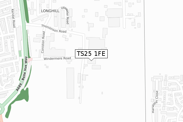
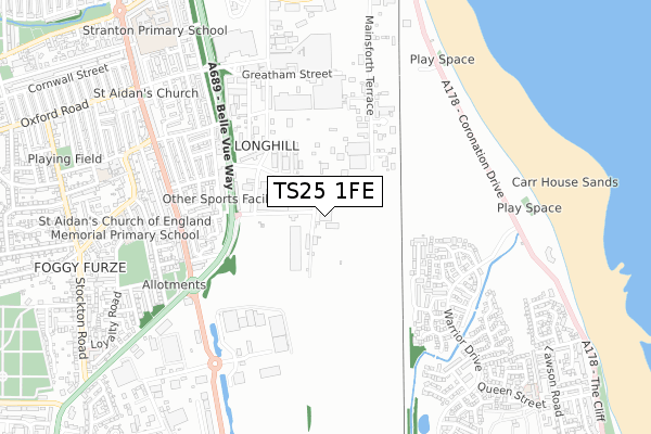
TS25 1FE is located in the Burn Valley electoral ward, within the unitary authority of Hartlepool and the English Parliamentary constituency of Hartlepool. The Sub Integrated Care Board (ICB) Location is NHS North East and North Cumbria ICB - 16C and the police force is Cleveland. This postcode has been in use since June 2019.


GetTheData
Source: OS Open Zoomstack (Ordnance Survey)
Licence: Open Government Licence (requires attribution)
Attribution: Contains OS data © Crown copyright and database right 2025
Source: Open Postcode Geo
Licence: Open Government Licence (requires attribution)
Attribution: Contains OS data © Crown copyright and database right 2025; Contains Royal Mail data © Royal Mail copyright and database right 2025; Source: Office for National Statistics licensed under the Open Government Licence v.3.0
| Easting | 451418 |
| Northing | 530941 |
| Latitude | 54.670936 |
| Longitude | -1.204258 |
GetTheData
Source: Open Postcode Geo
Licence: Open Government Licence
| Country | England |
| Postcode District | TS25 |
➜ See where TS25 is on a map ➜ Where is Hartlepool? | |
GetTheData
Source: Land Registry Price Paid Data
Licence: Open Government Licence
| Ward | Burn Valley |
| Constituency | Hartlepool |
GetTheData
Source: ONS Postcode Database
Licence: Open Government Licence
| Windermere Road (Brenda Road) | Foggy Furze | 552m |
| Windermere Road (Brenda Road) | Foggy Furze | 562m |
| Usworth Road (Brenda Road) | Foggy Furze | 624m |
| Sandgate Crossing (Coronation Drive) | Hartlepool | 644m |
| Sandgate Crossing (Coronation Drive) | Hartlepool | 669m |
| Seaton Carew Station | 1.4km |
| Hartlepool Station | 1.8km |
GetTheData
Source: NaPTAN
Licence: Open Government Licence
GetTheData
Source: ONS Postcode Database
Licence: Open Government Licence


➜ Get more ratings from the Food Standards Agency
GetTheData
Source: Food Standards Agency
Licence: FSA terms & conditions
| Last Collection | |||
|---|---|---|---|
| Location | Mon-Fri | Sat | Distance |
| Clark Street Delivery Office | 18:30 | 13:15 | 1,265m |
| Church Street | 18:30 | 12:00 | 1,756m |
| Clifton Avenue | 18:00 | 12:30 | 1,770m |
GetTheData
Source: Dracos
Licence: Creative Commons Attribution-ShareAlike
The below table lists the International Territorial Level (ITL) codes (formerly Nomenclature of Territorial Units for Statistics (NUTS) codes) and Local Administrative Units (LAU) codes for TS25 1FE:
| ITL 1 Code | Name |
|---|---|
| TLC | North East (England) |
| ITL 2 Code | Name |
| TLC1 | Tees Valley and Durham |
| ITL 3 Code | Name |
| TLC11 | Hartlepool and Stockton-on-Tees |
| LAU 1 Code | Name |
| E06000001 | Hartlepool |
GetTheData
Source: ONS Postcode Directory
Licence: Open Government Licence
The below table lists the Census Output Area (OA), Lower Layer Super Output Area (LSOA), and Middle Layer Super Output Area (MSOA) for TS25 1FE:
| Code | Name | |
|---|---|---|
| OA | E00165754 | |
| LSOA | E01012001 | Hartlepool 008D |
| MSOA | E02002490 | Hartlepool 008 |
GetTheData
Source: ONS Postcode Directory
Licence: Open Government Licence
| TS25 1NJ | Coniston Road | 325m |
| TS25 1NS | Thomlinson Road | 375m |
| TS25 1QU | Kendal Road | 430m |
| TS25 1GD | Harvester Close | 452m |
| TS25 1QT | Windermere Road | 457m |
| TS25 1QY | Kendal Road | 478m |
| TS25 1NZ | Sarah Street | 478m |
| TS25 1GE | Intrepid Close | 478m |
| TS25 1RZ | Lakeland Walk | 495m |
| TS25 1RD | Worcester Gardens | 510m |
GetTheData
Source: Open Postcode Geo; Land Registry Price Paid Data
Licence: Open Government Licence