Property/Postcode Data Search:
TS24 9NN maps, stats, and open data
TS24 9NN is located in the De Bruce electoral ward, within the unitary authority of Hartlepool and the English Parliamentary constituency of Hartlepool. The Sub Integrated Care Board (ICB) Location is NHS North East and North Cumbria ICB - 16C and the police force is Cleveland. This postcode has been in use since December 2019.
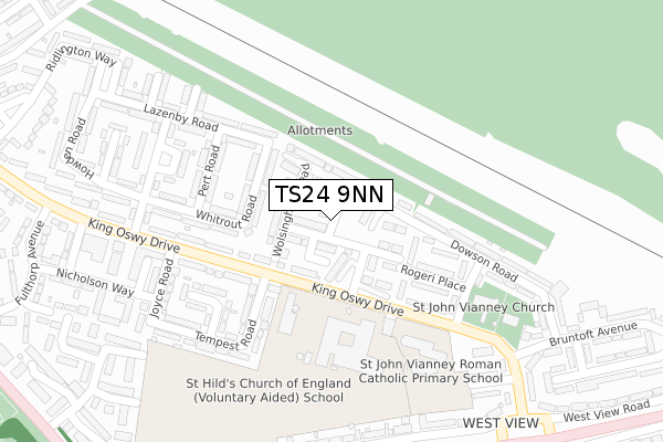
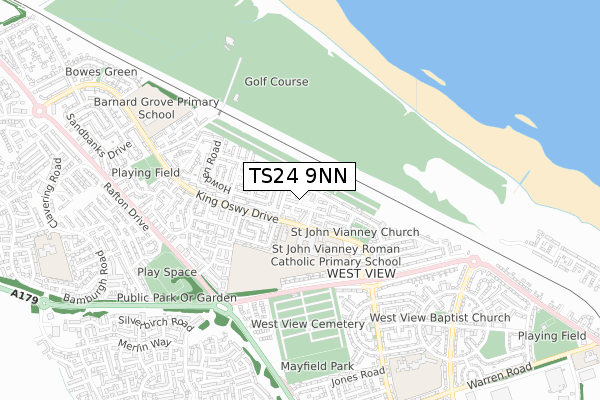
TS24 9NN maps


Source: OS Open Zoomstack (Ordnance Survey)
Licence: Open Government Licence (requires attribution)
Attribution: Contains OS data © Crown copyright and database right 2025
Source: Open Postcode Geo
Licence: Open Government Licence (requires attribution)
Attribution: Contains OS data © Crown copyright and database right 2025; Contains Royal Mail data © Royal Mail copyright and database right 2025; Source: Office for National Statistics licensed under the Open Government Licence v.3.0
Licence: Open Government Licence (requires attribution)
Attribution: Contains OS data © Crown copyright and database right 2025
Source: Open Postcode Geo
Licence: Open Government Licence (requires attribution)
Attribution: Contains OS data © Crown copyright and database right 2025; Contains Royal Mail data © Royal Mail copyright and database right 2025; Source: Office for National Statistics licensed under the Open Government Licence v.3.0
TS24 9NN geodata
| Easting | 449515 |
| Northing | 535503 |
| Latitude | 54.712120 |
| Longitude | -1.232991 |
Where is TS24 9NN?
| Country | England |
| Postcode District | TS24 |
Politics
| Ward | De Bruce |
|---|---|
| Constituency | Hartlepool |
House Prices
Sales of detached houses in TS24 9NN
2025 18 JUL £255,000 |
14, LANCHESTER CLOSE, HARTLEPOOL, TS24 9NN 2021 19 MAR £218,950 |
15, LANCHESTER CLOSE, HARTLEPOOL, TS24 9NN 2021 11 MAR £184,950 |
12, LANCHESTER CLOSE, HARTLEPOOL, TS24 9NN 2021 4 FEB £182,950 |
11, LANCHESTER CLOSE, HARTLEPOOL, TS24 9NN 2020 18 DEC £182,950 |
13, LANCHESTER CLOSE, HARTLEPOOL, TS24 9NN 2020 25 SEP £184,950 |
2020 11 SEP £213,702 |
1, LANCHESTER CLOSE, HARTLEPOOL, TS24 9NN 2020 31 JUL £182,950 |
2, LANCHESTER CLOSE, HARTLEPOOL, TS24 9NN 2020 30 MAR £182,950 |
3, LANCASTER PLACE, HARTLEPOOL, TS24 9NN 2019 22 NOV £199,998 |
Source: HM Land Registry Price Paid Data
Licence: Contains HM Land Registry data © Crown copyright and database right 2025. This data is licensed under the Open Government Licence v3.0.
Licence: Contains HM Land Registry data © Crown copyright and database right 2025. This data is licensed under the Open Government Licence v3.0.
Transport
Nearest bus stops to TS24 9NN
| St Hild's School (King Oswy Drive) | West View | 178m |
| King Oswy Hotel (King Oswy Drive) | West View | 224m |
| Goldsmith Avenue (King Oswy Drive) | Hart Station | 256m |
| King Oswy Hotel (King Oswy Drive) | West View | 292m |
| Goldsmith Avenue (King Oswy Drive) | Hart Station | 319m |
Nearest railway stations to TS24 9NN
| Hartlepool Station | 3.3km |
Deprivation
83% of English postcodes are less deprived than TS24 9NN:Food Standards Agency
Three nearest food hygiene ratings to TS24 9NN (metres)
St Hilds C of E Voluntary Aided School

King Oswy Drive
227m
St John Vianney Primary School

King Oswy Drive
278m
Starfish Daycare

St John Vianney Rc Primary Sch
278m
➜ Get more ratings from the Food Standards Agency
Nearest post box to TS24 9NN
| Last Collection | |||
|---|---|---|---|
| Location | Mon-Fri | Sat | Distance |
| Ocean Road, Hart Station | 17:30 | 12:00 | 1,476m |
| Elmwood Road | 17:30 | 12:30 | 2,059m |
| Brougham Terrace | 18:00 | 12:15 | 2,307m |
TS24 9NN ITL and TS24 9NN LAU
The below table lists the International Territorial Level (ITL) codes (formerly Nomenclature of Territorial Units for Statistics (NUTS) codes) and Local Administrative Units (LAU) codes for TS24 9NN:
| ITL 1 Code | Name |
|---|---|
| TLC | North East (England) |
| ITL 2 Code | Name |
| TLC1 | Tees Valley and Durham |
| ITL 3 Code | Name |
| TLC11 | Hartlepool and Stockton-on-Tees |
| LAU 1 Code | Name |
| E06000001 | Hartlepool |
TS24 9NN census areas
The below table lists the Census Output Area (OA), Lower Layer Super Output Area (LSOA), and Middle Layer Super Output Area (MSOA) for TS24 9NN:
| Code | Name | |
|---|---|---|
| OA | E00060275 | |
| LSOA | E01011954 | Hartlepool 001A |
| MSOA | E02002483 | Hartlepool 001 |
Nearest postcodes to TS24 9NN
| TS24 9NJ | Wolsingham Road | 47m |
| TS24 9NL | Witton Drive | 52m |
| TS24 9NH | Willington Drive | 127m |
| TS24 9LZ | Brancepath Walk | 159m |
| TS24 9PR | Lazenby Road | 163m |
| TS24 9PW | Whitrout Road | 168m |
| TS24 9PE | King Oswy Drive | 174m |
| TS24 9PP | Pert Road | 201m |
| TS24 9NA | Rogeri Place | 202m |
| TS24 9PD | King Oswy Drive | 208m |