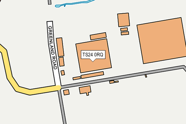
TS24 0RQ is located in the Headland & Harbour electoral ward, within the unitary authority of Hartlepool and the English Parliamentary constituency of Hartlepool. The Sub Integrated Care Board (ICB) Location is NHS North East and North Cumbria ICB - 16C and the police force is Cleveland. This postcode has been in use since September 1991.


GetTheData
Source: OS OpenMap – Local (Ordnance Survey)
Source: OS VectorMap District (Ordnance Survey)
Licence: Open Government Licence (requires attribution)
| Easting | 451347 |
| Northing | 533939 |
| Latitude | 54.697872 |
| Longitude | -1.204819 |
GetTheData
Source: Open Postcode Geo
Licence: Open Government Licence
| Country | England |
| Postcode District | TS24 |
➜ See where TS24 is on a map ➜ Where is Hartlepool? | |
GetTheData
Source: Land Registry Price Paid Data
Licence: Open Government Licence
Elevation or altitude of TS24 0RQ as distance above sea level:
| Metres | Feet | |
|---|---|---|
| Elevation | 0m | 0ft |
Elevation is measured from the approximate centre of the postcode, to the nearest point on an OS contour line from OS Terrain 50, which has contour spacing of ten vertical metres.
➜ How high above sea level am I? Find the elevation of your current position using your device's GPS.
GetTheData
Source: Open Postcode Elevation
Licence: Open Government Licence
| Ward | Headland & Harbour |
| Constituency | Hartlepool |
GetTheData
Source: ONS Postcode Database
Licence: Open Government Licence
| Greenland Road (Cleveland Road) | West View | 343m |
| Greenland Road (Cleveland Road) | West View | 372m |
| Cleveland Roundabout (Marina Way) | Dyke House | 377m |
| Arch Court (Cleveland Road) | West View | 382m |
| Cleveland Roundabout (Marina Way) | Dyke House | 402m |
| Hartlepool Station | 1.2km |
| Seaton Carew Station | 4.4km |
GetTheData
Source: NaPTAN
Licence: Open Government Licence
GetTheData
Source: ONS Postcode Database
Licence: Open Government Licence


➜ Get more ratings from the Food Standards Agency
GetTheData
Source: Food Standards Agency
Licence: FSA terms & conditions
| Last Collection | |||
|---|---|---|---|
| Location | Mon-Fri | Sat | Distance |
| Navigation Point | 17:45 | 12:30 | 651m |
| Brougham Terrace | 18:00 | 12:15 | 941m |
| Church Street | 18:30 | 12:00 | 1,248m |
GetTheData
Source: Dracos
Licence: Creative Commons Attribution-ShareAlike
The below table lists the International Territorial Level (ITL) codes (formerly Nomenclature of Territorial Units for Statistics (NUTS) codes) and Local Administrative Units (LAU) codes for TS24 0RQ:
| ITL 1 Code | Name |
|---|---|
| TLC | North East (England) |
| ITL 2 Code | Name |
| TLC1 | Tees Valley and Durham |
| ITL 3 Code | Name |
| TLC11 | Hartlepool and Stockton-on-Tees |
| LAU 1 Code | Name |
| E06000001 | Hartlepool |
GetTheData
Source: ONS Postcode Directory
Licence: Open Government Licence
The below table lists the Census Output Area (OA), Lower Layer Super Output Area (LSOA), and Middle Layer Super Output Area (MSOA) for TS24 0RQ:
| Code | Name | |
|---|---|---|
| OA | E00060471 | |
| LSOA | E01011994 | Hartlepool 002F |
| MSOA | E02002484 | Hartlepool 002 |
GetTheData
Source: ONS Postcode Directory
Licence: Open Government Licence
| TS24 0TY | Arch Court | 433m |
| TS24 0UE | Telford Close | 450m |
| TS24 0TD | Deerpool Close | 460m |
| TS24 0TQ | Firby Close | 473m |
| TS24 0TE | Mountbatten Close | 487m |
| TS24 8LS | Lancaster Road | 509m |
| TS24 0UN | Viscount Close | 521m |
| TS24 0UF | Brunel Close | 528m |
| TS24 0TB | Hindpool Close | 544m |
| TS24 0UX | Harbour Walk | 547m |
GetTheData
Source: Open Postcode Geo; Land Registry Price Paid Data
Licence: Open Government Licence