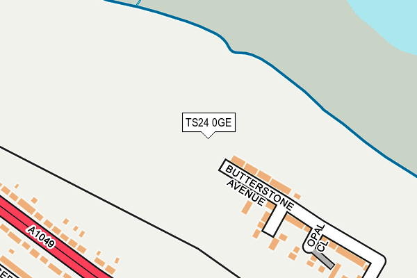
TS24 0GE is located in the Headland & Harbour electoral ward, within the unitary authority of Hartlepool and the English Parliamentary constituency of Hartlepool. The Sub Integrated Care Board (ICB) Location is NHS North East and North Cumbria ICB - 16C and the police force is Cleveland. This postcode has been in use since April 2017.


GetTheData
Source: OS OpenMap – Local (Ordnance Survey)
Source: OS VectorMap District (Ordnance Survey)
Licence: Open Government Licence (requires attribution)
| Easting | 450731 |
| Northing | 535119 |
| Latitude | 54.708549 |
| Longitude | -1.214185 |
GetTheData
Source: Open Postcode Geo
Licence: Open Government Licence
| Country | England |
| Postcode District | TS24 |
➜ See where TS24 is on a map ➜ Where is Hartlepool? | |
GetTheData
Source: Land Registry Price Paid Data
Licence: Open Government Licence
| Ward | Headland & Harbour |
| Constituency | Hartlepool |
GetTheData
Source: ONS Postcode Database
Licence: Open Government Licence
8, GARNET CLOSE, HARTLEPOOL, TS24 0GE 2017 27 OCT £184,950 |
4, GARNET CLOSE, HARTLEPOOL, TS24 0GE 2017 23 JUN £199,950 |
3, GARNET CLOSE, HARTLEPOOL, TS24 0GE 2017 31 MAR £149,950 |
GetTheData
Source: HM Land Registry Price Paid Data
Licence: Contains HM Land Registry data © Crown copyright and database right 2025. This data is licensed under the Open Government Licence v3.0.
| The Touchdown (West View Road) | West View | 195m |
| The Touchdown (West View Road) | West View | 222m |
| Arkley Crescent (West View Road) | West View | 225m |
| Arkley Crescent (West View Road) | West View | 227m |
| Brus Shops (West View Road) | West View | 447m |
| Hartlepool Station | 2.5km |
GetTheData
Source: NaPTAN
Licence: Open Government Licence
| Percentage of properties with Next Generation Access | 43.5% |
| Percentage of properties with Superfast Broadband | 43.5% |
| Percentage of properties with Ultrafast Broadband | 43.5% |
| Percentage of properties with Full Fibre Broadband | 0.0% |
Superfast Broadband is between 30Mbps and 300Mbps
Ultrafast Broadband is > 300Mbps
| Median download speed | 100.0Mbps |
| Average download speed | 95.3Mbps |
| Maximum download speed | 200.00Mbps |
| Median upload speed | 0.6Mbps |
| Average upload speed | 0.6Mbps |
| Maximum upload speed | 0.59Mbps |
| Percentage of properties unable to receive 2Mbps | 0.0% |
| Percentage of properties unable to receive 5Mbps | 56.5% |
| Percentage of properties unable to receive 10Mbps | 56.5% |
| Percentage of properties unable to receive 30Mbps | 56.5% |
GetTheData
Source: Ofcom
Licence: Ofcom Terms of Use (requires attribution)
GetTheData
Source: ONS Postcode Database
Licence: Open Government Licence


➜ Get more ratings from the Food Standards Agency
GetTheData
Source: Food Standards Agency
Licence: FSA terms & conditions
| Last Collection | |||
|---|---|---|---|
| Location | Mon-Fri | Sat | Distance |
| Brougham Terrace | 18:00 | 12:15 | 1,688m |
| Navigation Point | 17:45 | 12:30 | 1,975m |
| Elmwood Road | 17:30 | 12:30 | 2,220m |
GetTheData
Source: Dracos
Licence: Creative Commons Attribution-ShareAlike
The below table lists the International Territorial Level (ITL) codes (formerly Nomenclature of Territorial Units for Statistics (NUTS) codes) and Local Administrative Units (LAU) codes for TS24 0GE:
| ITL 1 Code | Name |
|---|---|
| TLC | North East (England) |
| ITL 2 Code | Name |
| TLC1 | Tees Valley and Durham |
| ITL 3 Code | Name |
| TLC11 | Hartlepool and Stockton-on-Tees |
| LAU 1 Code | Name |
| E06000001 | Hartlepool |
GetTheData
Source: ONS Postcode Directory
Licence: Open Government Licence
The below table lists the Census Output Area (OA), Lower Layer Super Output Area (LSOA), and Middle Layer Super Output Area (MSOA) for TS24 0GE:
| Code | Name | |
|---|---|---|
| OA | E00060477 | |
| LSOA | E01011992 | Hartlepool 002D |
| MSOA | E02002484 | Hartlepool 002 |
GetTheData
Source: ONS Postcode Directory
Licence: Open Government Licence
| TS24 9LF | West View Road | 168m |
| TS24 9LD | West View Road | 251m |
| TS24 9HN | Arkley Crescent | 286m |
| TS24 9LG | West View Road | 316m |
| TS24 9LB | West View Road | 354m |
| TS24 9EU | Sedgewick Close | 369m |
| TS24 9HE | Arkley Crescent | 371m |
| TS24 9HR | Bruce Crescent | 475m |
| TS24 9HS | Bruce Crescent | 483m |
| TS24 9LA | Brus Corner | 484m |
GetTheData
Source: Open Postcode Geo; Land Registry Price Paid Data
Licence: Open Government Licence