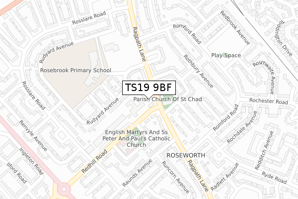
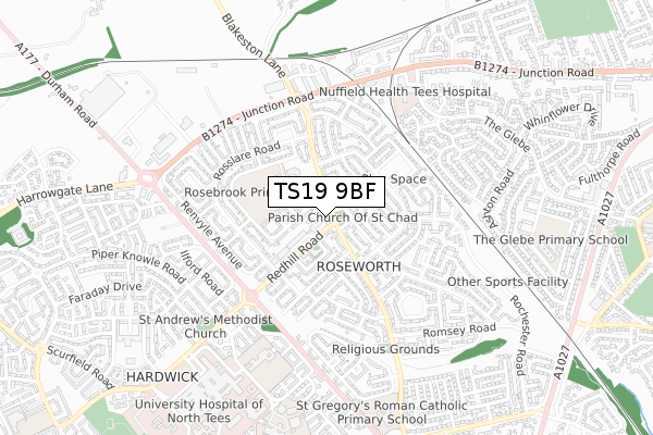
TS19 9BF is located in the Roseworth electoral ward, within the unitary authority of Stockton-on-Tees and the English Parliamentary constituency of Stockton North. The Sub Integrated Care Board (ICB) Location is NHS North East and North Cumbria ICB - 16C and the police force is Cleveland. This postcode has been in use since January 2020.


GetTheData
Source: OS Open Zoomstack (Ordnance Survey)
Licence: Open Government Licence (requires attribution)
Attribution: Contains OS data © Crown copyright and database right 2024
Source: Open Postcode Geo
Licence: Open Government Licence (requires attribution)
Attribution: Contains OS data © Crown copyright and database right 2024; Contains Royal Mail data © Royal Mail copyright and database right 2024; Source: Office for National Statistics licensed under the Open Government Licence v.3.0
| Easting | 442740 |
| Northing | 521727 |
| Latitude | 54.588948 |
| Longitude | -1.340146 |
GetTheData
Source: Open Postcode Geo
Licence: Open Government Licence
| Country | England |
| Postcode District | TS19 |
➜ See where TS19 is on a map ➜ Where is Stockton-on-Tees? | |
GetTheData
Source: Land Registry Price Paid Data
Licence: Open Government Licence
| Ward | Roseworth |
| Constituency | Stockton North |
GetTheData
Source: ONS Postcode Database
Licence: Open Government Licence
| St Chad's Church (Ragpath Lane) | Roseworth | 73m |
| St Chad's Church (Ragpath Lane) | Roseworth | 110m |
| Redhill Road Shops (Redhill Road) | Roseworth | 132m |
| Redhill Road Shops (Redhill Road) | Roseworth | 177m |
| Reynoldston Avenue (Romford Road) | Roseworth | 224m |
| Stockton Station | 2.6km |
| Thornaby Station | 4.1km |
| Billingham Station | 4.3km |
GetTheData
Source: NaPTAN
Licence: Open Government Licence
GetTheData
Source: ONS Postcode Database
Licence: Open Government Licence


➜ Get more ratings from the Food Standards Agency
GetTheData
Source: Food Standards Agency
Licence: FSA terms & conditions
| Last Collection | |||
|---|---|---|---|
| Location | Mon-Fri | Sat | Distance |
| Norton Green | 17:30 | 12:30 | 1,792m |
| Elm Tree Avenue | 16:45 | 11:45 | 2,030m |
| Crooksbarn Lane | 17:45 | 12:45 | 2,056m |
GetTheData
Source: Dracos
Licence: Creative Commons Attribution-ShareAlike
The below table lists the International Territorial Level (ITL) codes (formerly Nomenclature of Territorial Units for Statistics (NUTS) codes) and Local Administrative Units (LAU) codes for TS19 9BF:
| ITL 1 Code | Name |
|---|---|
| TLC | North East (England) |
| ITL 2 Code | Name |
| TLC1 | Tees Valley and Durham |
| ITL 3 Code | Name |
| TLC11 | Hartlepool and Stockton-on-Tees |
| LAU 1 Code | Name |
| E06000004 | Stockton-on-Tees |
GetTheData
Source: ONS Postcode Directory
Licence: Open Government Licence
The below table lists the Census Output Area (OA), Lower Layer Super Output Area (LSOA), and Middle Layer Super Output Area (MSOA) for TS19 9BF:
| Code | Name | |
|---|---|---|
| OA | E00061767 | |
| LSOA | E01012249 | Stockton-on-Tees 008B |
| MSOA | E02002542 | Stockton-on-Tees 008 |
GetTheData
Source: ONS Postcode Directory
Licence: Open Government Licence
| TS19 9JN | Ragpath Lane | 57m |
| TS19 9JW | Ragpath Lane | 74m |
| TS19 9JL | Rosedale Gardens | 94m |
| TS19 9LA | Rudyard Avenue | 95m |
| TS19 9JJ | Ramsbury Avenue | 98m |
| TS19 9AZ | Ragpath Lane | 106m |
| TS19 9JH | Ramsbury Avenue | 114m |
| TS19 9LB | Runnymede Close | 129m |
| TS19 9JQ | Ryhope Avenue | 152m |
| TS19 9AY | Ragpath Lane | 154m |
GetTheData
Source: Open Postcode Geo; Land Registry Price Paid Data
Licence: Open Government Licence