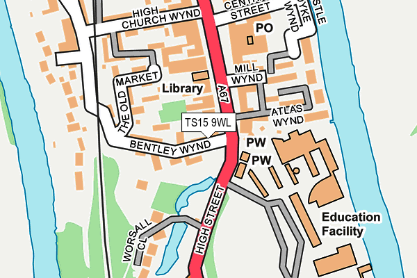
TS15 9WL is located in the Yarm electoral ward, within the unitary authority of Stockton-on-Tees and the English Parliamentary constituency of Stockton South. The Sub Integrated Care Board (ICB) Location is NHS North East and North Cumbria ICB - 16C and the police force is Cleveland. This postcode has been in use since July 2017.


GetTheData
Source: OS OpenMap – Local (Ordnance Survey)
Source: OS VectorMap District (Ordnance Survey)
Licence: Open Government Licence (requires attribution)
| Easting | 441899 |
| Northing | 512651 |
| Latitude | 54.507459 |
| Longitude | -1.354447 |
GetTheData
Source: Open Postcode Geo
Licence: Open Government Licence
| Country | England |
| Postcode District | TS15 |
➜ See where TS15 is on a map ➜ Where is Yarm? | |
GetTheData
Source: Land Registry Price Paid Data
Licence: Open Government Licence
| Ward | Yarm |
| Constituency | Stockton South |
GetTheData
Source: ONS Postcode Database
Licence: Open Government Licence
| Town Hall (High Street) | Yarm | 158m |
| Town Hall (High Street) | Yarm | 206m |
| Yarm School Main Entrance (The Spital) | Yarm | 258m |
| Medical Practice (Worsall Road) | Yarm | 293m |
| Medical Practice (Worsall Road) | Yarm | 300m |
| Yarm Station | 1.5km |
| Allens West Station | 2km |
| Eaglescliffe Station | 2.5km |
GetTheData
Source: NaPTAN
Licence: Open Government Licence
| Percentage of properties with Next Generation Access | 100.0% |
| Percentage of properties with Superfast Broadband | 100.0% |
| Percentage of properties with Ultrafast Broadband | 100.0% |
| Percentage of properties with Full Fibre Broadband | 0.0% |
Superfast Broadband is between 30Mbps and 300Mbps
Ultrafast Broadband is > 300Mbps
| Median download speed | 75.0Mbps |
| Average download speed | 133.3Mbps |
| Maximum download speed | 350.00Mbps |
Ofcom does not currently provide upload speed data for TS15 9WL. This is because there are less than four broadband connections in this postcode.
| Percentage of properties unable to receive 2Mbps | 0.0% |
| Percentage of properties unable to receive 5Mbps | 0.0% |
| Percentage of properties unable to receive 10Mbps | 0.0% |
| Percentage of properties unable to receive 30Mbps | 0.0% |
GetTheData
Source: Ofcom
Licence: Ofcom Terms of Use (requires attribution)
GetTheData
Source: ONS Postcode Database
Licence: Open Government Licence


➜ Get more ratings from the Food Standards Agency
GetTheData
Source: Food Standards Agency
Licence: FSA terms & conditions
| Last Collection | |||
|---|---|---|---|
| Location | Mon-Fri | Sat | Distance |
| Low Worsall | 16:45 | 10:15 | 200m |
| Fauconberg Way | 17:00 | 10:15 | 1,302m |
| Davenport Road | 16:45 | 10:30 | 1,384m |
GetTheData
Source: Dracos
Licence: Creative Commons Attribution-ShareAlike
| Risk of TS15 9WL flooding from rivers and sea | Medium |
| ➜ TS15 9WL flood map | |
GetTheData
Source: Open Flood Risk by Postcode
Licence: Open Government Licence
The below table lists the International Territorial Level (ITL) codes (formerly Nomenclature of Territorial Units for Statistics (NUTS) codes) and Local Administrative Units (LAU) codes for TS15 9WL:
| ITL 1 Code | Name |
|---|---|
| TLC | North East (England) |
| ITL 2 Code | Name |
| TLC1 | Tees Valley and Durham |
| ITL 3 Code | Name |
| TLC11 | Hartlepool and Stockton-on-Tees |
| LAU 1 Code | Name |
| E06000004 | Stockton-on-Tees |
GetTheData
Source: ONS Postcode Directory
Licence: Open Government Licence
The below table lists the Census Output Area (OA), Lower Layer Super Output Area (LSOA), and Middle Layer Super Output Area (MSOA) for TS15 9WL:
| Code | Name | |
|---|---|---|
| OA | E00062039 | |
| LSOA | E01012299 | Stockton-on-Tees 024C |
| MSOA | E02002558 | Stockton-on-Tees 024 |
GetTheData
Source: ONS Postcode Directory
Licence: Open Government Licence
| TS15 9BW | High Street | 40m |
| TS15 9BP | Lord Nelsons Yard | 51m |
| TS15 9AA | High Street | 60m |
| TS15 9BL | Hauxwells Yard | 67m |
| TS15 9BS | Bentley Wynd | 88m |
| TS15 9BX | The Old Market | 100m |
| TS15 9BH | High Street | 118m |
| TS15 9US | The Old Market | 120m |
| TS15 9AF | Mill Wynd | 124m |
| TS15 9AE | High Street | 129m |
GetTheData
Source: Open Postcode Geo; Land Registry Price Paid Data
Licence: Open Government Licence