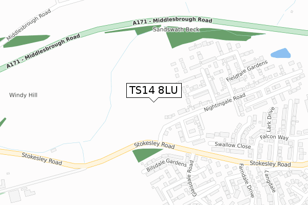
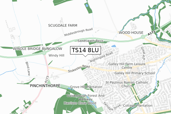
TS14 8LU is located in the Hutton electoral ward, within the unitary authority of Redcar and Cleveland and the English Parliamentary constituency of Middlesbrough South and East Cleveland. The Sub Integrated Care Board (ICB) Location is NHS North East and North Cumbria ICB - 16C and the police force is Cleveland. This postcode has been in use since June 2019.


GetTheData
Source: OS Open Zoomstack (Ordnance Survey)
Licence: Open Government Licence (requires attribution)
Attribution: Contains OS data © Crown copyright and database right 2024
Source: Open Postcode Geo
Licence: Open Government Licence (requires attribution)
Attribution: Contains OS data © Crown copyright and database right 2024; Contains Royal Mail data © Royal Mail copyright and database right 2024; Source: Office for National Statistics licensed under the Open Government Licence v.3.0
| Easting | 458980 |
| Northing | 515683 |
| Latitude | 54.533010 |
| Longitude | -1.090082 |
GetTheData
Source: Open Postcode Geo
Licence: Open Government Licence
| Country | England |
| Postcode District | TS14 |
➜ See where TS14 is on a map ➜ Where is Guisborough? | |
GetTheData
Source: Land Registry Price Paid Data
Licence: Open Government Licence
| Ward | Hutton |
| Constituency | Middlesbrough South And East Cleveland |
GetTheData
Source: ONS Postcode Database
Licence: Open Government Licence
2022 15 DEC £390,000 |
27, GOLDFINCH GARDENS, GUISBOROUGH, TS14 8LU 2022 1 JUL £339,995 |
37, GOLDFINCH GARDENS, GUISBOROUGH, TS14 8LU 2022 1 JUL £369,995 |
33, GOLDFINCH GARDENS, GUISBOROUGH, TS14 8LU 2022 30 JUN £329,995 |
31, GOLDFINCH GARDENS, GUISBOROUGH, TS14 8LU 2022 29 JUN £329,995 |
35, GOLDFINCH GARDENS, GUISBOROUGH, TS14 8LU 2022 24 JUN £354,995 |
29, GOLDFINCH GARDENS, GUISBOROUGH, TS14 8LU 2022 22 JUN £357,995 |
25, GOLDFINCH GARDENS, GUISBOROUGH, TS14 8LU 2022 17 JUN £359,995 |
26, GOLDFINCH GARDENS, GUISBOROUGH, TS14 8LU 2022 8 JUN £343,995 |
20, GOLDFINCH GARDENS, GUISBOROUGH, TS14 8LU 2022 27 MAY £325,995 |
GetTheData
Source: HM Land Registry Price Paid Data
Licence: Contains HM Land Registry data © Crown copyright and database right 2024. This data is licensed under the Open Government Licence v3.0.
| Galley Hill (A173 - Stokesley Road) | Guisborough | 371m |
| Galley Hill (A173 - Stokesley Road) | Guisborough | 424m |
| Deepdale (Farndale Drive) | Guisborough | 548m |
| Deepdale (Farndale Drive) | Guisborough | 548m |
| Blind Lane (A173) | Guisborough | 591m |
| Great Ayton Station | 5.1km |
GetTheData
Source: NaPTAN
Licence: Open Government Licence
GetTheData
Source: ONS Postcode Database
Licence: Open Government Licence


➜ Get more ratings from the Food Standards Agency
GetTheData
Source: Food Standards Agency
Licence: FSA terms & conditions
| Last Collection | |||
|---|---|---|---|
| Location | Mon-Fri | Sat | Distance |
| Falcon Way | 16:15 | 10:45 | 359m |
| Pinchinthorpe | 17:15 | 11:30 | 665m |
| Heron Gate | 16:15 | 10:45 | 713m |
GetTheData
Source: Dracos
Licence: Creative Commons Attribution-ShareAlike
The below table lists the International Territorial Level (ITL) codes (formerly Nomenclature of Territorial Units for Statistics (NUTS) codes) and Local Administrative Units (LAU) codes for TS14 8LU:
| ITL 1 Code | Name |
|---|---|
| TLC | North East (England) |
| ITL 2 Code | Name |
| TLC1 | Tees Valley and Durham |
| ITL 3 Code | Name |
| TLC12 | South Teesside |
| LAU 1 Code | Name |
| E06000003 | Redcar and Cleveland |
GetTheData
Source: ONS Postcode Directory
Licence: Open Government Licence
The below table lists the Census Output Area (OA), Lower Layer Super Output Area (LSOA), and Middle Layer Super Output Area (MSOA) for TS14 8LU:
| Code | Name | |
|---|---|---|
| OA | E00061158 | |
| LSOA | E01032549 | Redcar and Cleveland 019F |
| MSOA | E02002533 | Redcar and Cleveland 019 |
GetTheData
Source: ONS Postcode Directory
Licence: Open Government Licence
| TS14 8HL | Swallow Close | 287m |
| TS14 8DQ | Danby Close | 293m |
| TS14 8FA | Cringle Gardens | 312m |
| TS14 8HN | Osprey Close | 313m |
| TS14 8HW | Falcon Way | 345m |
| TS14 8JR | Bransdale | 380m |
| TS14 8HJ | Falcon Way | 384m |
| TS14 8HP | Lark Drive | 387m |
| TS14 8HX | Mallard Close | 414m |
| TS14 8DF | Glaisdale Road | 417m |
GetTheData
Source: Open Postcode Geo; Land Registry Price Paid Data
Licence: Open Government Licence