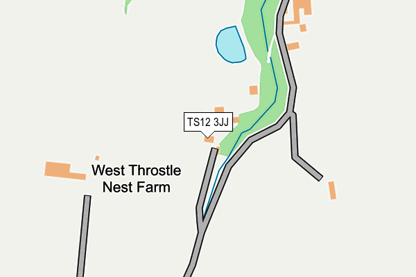
TS12 3JJ is in Moorsholm, Saltburn-by-the-sea. TS12 3JJ is located in the Lockwood electoral ward, within the unitary authority of Redcar and Cleveland and the English Parliamentary constituency of Middlesbrough South and East Cleveland. The Sub Integrated Care Board (ICB) Location is NHS North East and North Cumbria ICB - 16C and the police force is Cleveland. This postcode has been in use since January 1980.


GetTheData
Source: OS OpenMap – Local (Ordnance Survey)
Source: OS VectorMap District (Ordnance Survey)
Licence: Open Government Licence (requires attribution)
| Easting | 469553 |
| Northing | 515425 |
| Latitude | 54.529340 |
| Longitude | -0.926767 |
GetTheData
Source: Open Postcode Geo
Licence: Open Government Licence
| Locality | Moorsholm |
| Town/City | Saltburn-by-the-sea |
| Country | England |
| Postcode District | TS12 |
➜ See where TS12 is on a map | |
GetTheData
Source: Land Registry Price Paid Data
Licence: Open Government Licence
Elevation or altitude of TS12 3JJ as distance above sea level:
| Metres | Feet | |
|---|---|---|
| Elevation | 140m | 459ft |
Elevation is measured from the approximate centre of the postcode, to the nearest point on an OS contour line from OS Terrain 50, which has contour spacing of ten vertical metres.
➜ How high above sea level am I? Find the elevation of your current position using your device's GPS.
GetTheData
Source: Open Postcode Elevation
Licence: Open Government Licence
| Ward | Lockwood |
| Constituency | Middlesbrough South And East Cleveland |
GetTheData
Source: ONS Postcode Database
Licence: Open Government Licence
| Village (Freeborough Road) | Moorsholm | 1,280m |
GetTheData
Source: NaPTAN
Licence: Open Government Licence
GetTheData
Source: ONS Postcode Database
Licence: Open Government Licence

➜ Get more ratings from the Food Standards Agency
GetTheData
Source: Food Standards Agency
Licence: FSA terms & conditions
| Last Collection | |||
|---|---|---|---|
| Location | Mon-Fri | Sat | Distance |
| High Street, Skelton | 16:30 | 10:30 | 5,036m |
| Cotswold Drive | 16:30 | 10:30 | 5,098m |
| Rifts Avenue | 17:15 | 11:30 | 5,194m |
GetTheData
Source: Dracos
Licence: Creative Commons Attribution-ShareAlike
The below table lists the International Territorial Level (ITL) codes (formerly Nomenclature of Territorial Units for Statistics (NUTS) codes) and Local Administrative Units (LAU) codes for TS12 3JJ:
| ITL 1 Code | Name |
|---|---|
| TLC | North East (England) |
| ITL 2 Code | Name |
| TLC1 | Tees Valley and Durham |
| ITL 3 Code | Name |
| TLC12 | South Teesside |
| LAU 1 Code | Name |
| E06000003 | Redcar and Cleveland |
GetTheData
Source: ONS Postcode Directory
Licence: Open Government Licence
The below table lists the Census Output Area (OA), Lower Layer Super Output Area (LSOA), and Middle Layer Super Output Area (MSOA) for TS12 3JJ:
| Code | Name | |
|---|---|---|
| OA | E00061185 | |
| LSOA | E01012132 | Redcar and Cleveland 016A |
| MSOA | E02002530 | Redcar and Cleveland 016 |
GetTheData
Source: ONS Postcode Directory
Licence: Open Government Licence
| TS12 3JW | 481m | |
| TS12 3JF | Johnsons Square | 1022m |
| TS12 3JH | High Street | 1135m |
| TS12 3JT | Hillocks Lane | 1306m |
| TS12 3JA | Guisborough Road | 1370m |
| TS12 3JG | Ashberry Close | 1371m |
| TS12 3HZ | Recreation View | 1388m |
| TS12 3JS | Moor Close | 1439m |
| TS12 3JD | Ward Street | 1445m |
| TS12 3JB | Freebrough Road | 1486m |
GetTheData
Source: Open Postcode Geo; Land Registry Price Paid Data
Licence: Open Government Licence