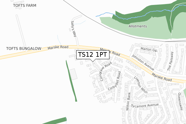
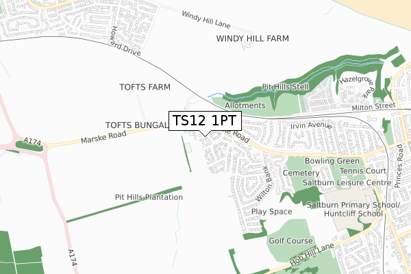
TS12 1PT is located in the Saltburn electoral ward, within the unitary authority of Redcar and Cleveland and the English Parliamentary constituency of Redcar. The Sub Integrated Care Board (ICB) Location is NHS North East and North Cumbria ICB - 16C and the police force is Cleveland. This postcode has been in use since October 2017.


GetTheData
Source: OS Open Zoomstack (Ordnance Survey)
Licence: Open Government Licence (requires attribution)
Attribution: Contains OS data © Crown copyright and database right 2025
Source: Open Postcode Geo
Licence: Open Government Licence (requires attribution)
Attribution: Contains OS data © Crown copyright and database right 2025; Contains Royal Mail data © Royal Mail copyright and database right 2025; Source: Office for National Statistics licensed under the Open Government Licence v.3.0
| Easting | 464954 |
| Northing | 521222 |
| Latitude | 54.582051 |
| Longitude | -0.996557 |
GetTheData
Source: Open Postcode Geo
Licence: Open Government Licence
| Country | England |
| Postcode District | TS12 |
➜ See where TS12 is on a map ➜ Where is Saltburn-by-the-Sea? | |
GetTheData
Source: Land Registry Price Paid Data
Licence: Open Government Licence
| Ward | Saltburn |
| Constituency | Redcar |
GetTheData
Source: ONS Postcode Database
Licence: Open Government Licence
10, PENNYMAN CLOSE, SALTBURN-BY-THE-SEA, TS12 1PT 2021 28 OCT £353,000 |
8, PENNYMAN CLOSE, SALTBURN-BY-THE-SEA, TS12 1PT 2018 6 NOV £259,950 |
7, PENNYMAN CLOSE, SALTBURN-BY-THE-SEA, TS12 1PT 2018 14 SEP £269,950 |
6, PENNYMAN CLOSE, SALTBURN-BY-THE-SEA, TS12 1PT 2018 24 AUG £294,950 |
10, PENNYMAN CLOSE, SALTBURN-BY-THE-SEA, TS12 1PT 2018 27 JUL £294,950 |
9, PENNYMAN CLOSE, SALTBURN-BY-THE-SEA, TS12 1PT 2018 27 JUL £299,950 |
11, PENNYMAN CLOSE, SALTBURN-BY-THE-SEA, TS12 1PT 2018 15 JUN £219,950 |
2, PENNYMAN CLOSE, SALTBURN-BY-THE-SEA, TS12 1PT 2018 30 MAY £294,950 |
12, PENNYMAN CLOSE, SALTBURN-BY-THE-SEA, TS12 1PT 2018 25 MAY £324,950 |
3, PENNYMAN CLOSE, SALTBURN-BY-THE-SEA, TS12 1PT 2018 11 MAY £299,950 |
➜ Saltburn-by-the-Sea house prices
GetTheData
Source: HM Land Registry Price Paid Data
Licence: Contains HM Land Registry data © Crown copyright and database right 2025. This data is licensed under the Open Government Licence v3.0.
| Riding School (Marske Road) | Saltburn | 77m |
| Riding School (Marske Road) | Saltburn | 114m |
| Ox Close (Marske Road) | Saltburn | 417m |
| Ox Close (Marske Road) | Saltburn | 484m |
| Cricket Field (Marske Road) | Saltburn | 680m |
| Saltburn Station | 1.5km |
| Marske Station | 1.6km |
| Longbeck Station | 2.3km |
GetTheData
Source: NaPTAN
Licence: Open Government Licence
| Percentage of properties with Next Generation Access | 100.0% |
| Percentage of properties with Superfast Broadband | 100.0% |
| Percentage of properties with Ultrafast Broadband | 100.0% |
| Percentage of properties with Full Fibre Broadband | 0.0% |
Superfast Broadband is between 30Mbps and 300Mbps
Ultrafast Broadband is > 300Mbps
| Percentage of properties unable to receive 2Mbps | 0.0% |
| Percentage of properties unable to receive 5Mbps | 0.0% |
| Percentage of properties unable to receive 10Mbps | 0.0% |
| Percentage of properties unable to receive 30Mbps | 0.0% |
GetTheData
Source: Ofcom
Licence: Ofcom Terms of Use (requires attribution)
GetTheData
Source: ONS Postcode Database
Licence: Open Government Licence


➜ Get more ratings from the Food Standards Agency
GetTheData
Source: Food Standards Agency
Licence: FSA terms & conditions
| Last Collection | |||
|---|---|---|---|
| Location | Mon-Fri | Sat | Distance |
| Upleatham Street | 17:15 | 11:30 | 1,377m |
| Station Street | 17:30 | 12:30 | 1,466m |
| Milton Street | 17:15 | 11:30 | 1,514m |
GetTheData
Source: Dracos
Licence: Creative Commons Attribution-ShareAlike
The below table lists the International Territorial Level (ITL) codes (formerly Nomenclature of Territorial Units for Statistics (NUTS) codes) and Local Administrative Units (LAU) codes for TS12 1PT:
| ITL 1 Code | Name |
|---|---|
| TLC | North East (England) |
| ITL 2 Code | Name |
| TLC1 | Tees Valley and Durham |
| ITL 3 Code | Name |
| TLC12 | South Teesside |
| LAU 1 Code | Name |
| E06000003 | Redcar and Cleveland |
GetTheData
Source: ONS Postcode Directory
Licence: Open Government Licence
The below table lists the Census Output Area (OA), Lower Layer Super Output Area (LSOA), and Middle Layer Super Output Area (MSOA) for TS12 1PT:
| Code | Name | |
|---|---|---|
| OA | E00061313 | |
| LSOA | E01012155 | Redcar and Cleveland 006F |
| MSOA | E02002520 | Redcar and Cleveland 006 |
GetTheData
Source: ONS Postcode Directory
Licence: Open Government Licence
| TS12 1PN | Marske Road | 225m |
| TS12 1PQ | Liverton Whin | 244m |
| TS12 1PG | Wilton Bank | 266m |
| TS12 1QX | Marske Road | 279m |
| TS12 1PJ | Elm Close | 291m |
| TS12 1QU | Marton Gill | 300m |
| TS12 1PL | Oxclose Cottages | 327m |
| TS12 1PH | Liverton Whin | 338m |
| TS12 1PF | Sycamore Avenue | 359m |
| TS12 1PD | Wilton Bank | 393m |
GetTheData
Source: Open Postcode Geo; Land Registry Price Paid Data
Licence: Open Government Licence