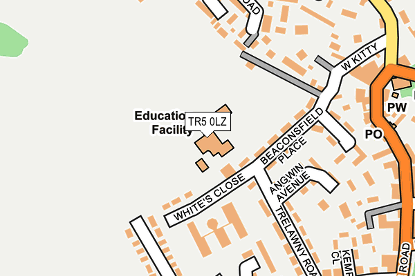
TR5 0LZ is located in the St Agnes electoral ward, within the unitary authority of Cornwall and the English Parliamentary constituency of Truro and Falmouth. The Sub Integrated Care Board (ICB) Location is NHS Cornwall and the Isles of Scilly ICB - 11N and the police force is Devon & Cornwall. This postcode has been in use since December 1998.


GetTheData
Source: OS OpenMap – Local (Ordnance Survey)
Source: OS VectorMap District (Ordnance Survey)
Licence: Open Government Licence (requires attribution)
| Easting | 171752 |
| Northing | 50655 |
| Latitude | 50.311550 |
| Longitude | -5.207165 |
GetTheData
Source: Open Postcode Geo
Licence: Open Government Licence
| Country | England |
| Postcode District | TR5 |
➜ See where TR5 is on a map ➜ Where is St Agnes? | |
GetTheData
Source: Land Registry Price Paid Data
Licence: Open Government Licence
Elevation or altitude of TR5 0LZ as distance above sea level:
| Metres | Feet | |
|---|---|---|
| Elevation | 110m | 361ft |
Elevation is measured from the approximate centre of the postcode, to the nearest point on an OS contour line from OS Terrain 50, which has contour spacing of ten vertical metres.
➜ How high above sea level am I? Find the elevation of your current position using your device's GPS.
GetTheData
Source: Open Postcode Elevation
Licence: Open Government Licence
| Ward | St Agnes |
| Constituency | Truro And Falmouth |
GetTheData
Source: ONS Postcode Database
Licence: Open Government Licence
| Church (Churchtown) | St Agnes | 268m |
| Institute (Vicarage Road) | St Agnes | 326m |
| Institute (Vicarage Road) | St Agnes | 335m |
| Penwinnick Parc | St Agnes | 515m |
| Penwinnick Parc | St Agnes | 517m |
GetTheData
Source: NaPTAN
Licence: Open Government Licence
GetTheData
Source: ONS Postcode Database
Licence: Open Government Licence


➜ Get more ratings from the Food Standards Agency
GetTheData
Source: Food Standards Agency
Licence: FSA terms & conditions
| Last Collection | |||
|---|---|---|---|
| Location | Mon-Fri | Sat | Distance |
| Quay | 16:15 | 10:30 | 827m |
GetTheData
Source: Dracos
Licence: Creative Commons Attribution-ShareAlike
The below table lists the International Territorial Level (ITL) codes (formerly Nomenclature of Territorial Units for Statistics (NUTS) codes) and Local Administrative Units (LAU) codes for TR5 0LZ:
| ITL 1 Code | Name |
|---|---|
| TLK | South West (England) |
| ITL 2 Code | Name |
| TLK3 | Cornwall and Isles of Scilly |
| ITL 3 Code | Name |
| TLK30 | Cornwall and Isles of Scilly |
| LAU 1 Code | Name |
| E06000052 | Cornwall |
GetTheData
Source: ONS Postcode Directory
Licence: Open Government Licence
The below table lists the Census Output Area (OA), Lower Layer Super Output Area (LSOA), and Middle Layer Super Output Area (MSOA) for TR5 0LZ:
| Code | Name | |
|---|---|---|
| OA | E00095179 | |
| LSOA | E01018851 | Cornwall 040C |
| MSOA | E02003907 | Cornwall 040 |
GetTheData
Source: ONS Postcode Directory
Licence: Open Government Licence
| TR5 0SZ | Beaconsfield Place | 128m |
| TR5 0TS | Angwin Avenue | 165m |
| TR5 0SL | Tregease Road | 200m |
| TR5 0SX | 206m | |
| TR5 0TP | Trelawney Road | 209m |
| TR5 0TR | Polbreen Avenue | 216m |
| TR5 0SU | 224m | |
| TR5 0SJ | Wheal Quoit Avenue | 250m |
| TR5 0XQ | Lawrence Road | 250m |
| TR5 0QW | Churchtown | 253m |
GetTheData
Source: Open Postcode Geo; Land Registry Price Paid Data
Licence: Open Government Licence