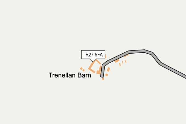
TR27 5FA is in Gwinear, Hayle. TR27 5FA is located in the Gwinear-Gwithian & Hayle East electoral ward, within the unitary authority of Cornwall and the English Parliamentary constituency of Camborne and Redruth. The Sub Integrated Care Board (ICB) Location is NHS Cornwall and the Isles of Scilly ICB - 11N and the police force is Devon & Cornwall. This postcode has been in use since March 2010.


GetTheData
Source: OS OpenMap – Local (Ordnance Survey)
Source: OS VectorMap District (Ordnance Survey)
Licence: Open Government Licence (requires attribution)
| Easting | 159733 |
| Northing | 36853 |
| Latitude | 50.182862 |
| Longitude | -5.366921 |
GetTheData
Source: Open Postcode Geo
Licence: Open Government Licence
| Locality | Gwinear |
| Town/City | Hayle |
| Country | England |
| Postcode District | TR27 |
➜ See where TR27 is on a map | |
GetTheData
Source: Land Registry Price Paid Data
Licence: Open Government Licence
Elevation or altitude of TR27 5FA as distance above sea level:
| Metres | Feet | |
|---|---|---|
| Elevation | 70m | 230ft |
Elevation is measured from the approximate centre of the postcode, to the nearest point on an OS contour line from OS Terrain 50, which has contour spacing of ten vertical metres.
➜ How high above sea level am I? Find the elevation of your current position using your device's GPS.
GetTheData
Source: Open Postcode Elevation
Licence: Open Government Licence
| Ward | Gwinear-gwithian & Hayle East |
| Constituency | Camborne And Redruth |
GetTheData
Source: ONS Postcode Database
Licence: Open Government Licence
| Stores (Reawla Lane) | Reawla | 856m |
| Lemin Parc | Reawla | 867m |
| Stores (Reawla Lane) | Reawla | 870m |
| Lemin Parc | Reawla | 877m |
| Cober Crescent | Wall | 943m |
| Hayle Station | 3.8km |
| Lelant Station | 5km |
GetTheData
Source: NaPTAN
Licence: Open Government Licence
GetTheData
Source: ONS Postcode Database
Licence: Open Government Licence


➜ Get more ratings from the Food Standards Agency
GetTheData
Source: Food Standards Agency
Licence: FSA terms & conditions
| Last Collection | |||
|---|---|---|---|
| Location | Mon-Fri | Sat | Distance |
| Gwinear Post Office | 16:05 | 10:30 | 518m |
| Carnhell Green Post Office | 16:15 | 09:00 | 2,022m |
| Connor Downs Post Office | 16:30 | 10:15 | 2,399m |
GetTheData
Source: Dracos
Licence: Creative Commons Attribution-ShareAlike
The below table lists the International Territorial Level (ITL) codes (formerly Nomenclature of Territorial Units for Statistics (NUTS) codes) and Local Administrative Units (LAU) codes for TR27 5FA:
| ITL 1 Code | Name |
|---|---|
| TLK | South West (England) |
| ITL 2 Code | Name |
| TLK3 | Cornwall and Isles of Scilly |
| ITL 3 Code | Name |
| TLK30 | Cornwall and Isles of Scilly |
| LAU 1 Code | Name |
| E06000052 | Cornwall |
GetTheData
Source: ONS Postcode Directory
Licence: Open Government Licence
The below table lists the Census Output Area (OA), Lower Layer Super Output Area (LSOA), and Middle Layer Super Output Area (MSOA) for TR27 5FA:
| Code | Name | |
|---|---|---|
| OA | E00095871 | |
| LSOA | E01018979 | Cornwall 061B |
| MSOA | E02003946 | Cornwall 061 |
GetTheData
Source: ONS Postcode Directory
Licence: Open Government Licence
| TR27 5JL | Churchtown | 519m |
| TR27 5HE | Relistian Lane | 540m |
| TR27 5JY | Herland Hill | 679m |
| TR27 5HL | Pen Tye | 825m |
| TR27 5HF | Relistian Park | 828m |
| TR27 5HQ | Reawla Lane | 886m |
| TR27 5HJ | Lemin Parc | 912m |
| TR27 5HD | Wall Vean | 925m |
| TR27 5HG | Henver Close | 928m |
| TR27 5LN | Henver Gardens | 956m |
GetTheData
Source: Open Postcode Geo; Land Registry Price Paid Data
Licence: Open Government Licence