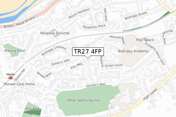
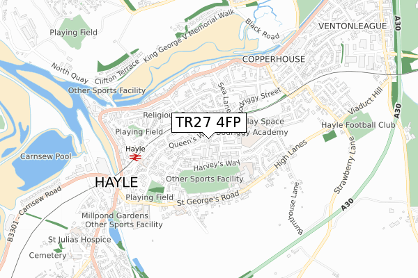
TR27 4FP is located in the Hayle West electoral ward, within the unitary authority of Cornwall and the English Parliamentary constituency of Camborne and Redruth. The Sub Integrated Care Board (ICB) Location is NHS Cornwall and the Isles of Scilly ICB - 11N and the police force is Devon & Cornwall. This postcode has been in use since December 2018.


GetTheData
Source: OS Open Zoomstack (Ordnance Survey)
Licence: Open Government Licence (requires attribution)
Attribution: Contains OS data © Crown copyright and database right 2025
Source: Open Postcode Geo
Licence: Open Government Licence (requires attribution)
Attribution: Contains OS data © Crown copyright and database right 2025; Contains Royal Mail data © Royal Mail copyright and database right 2025; Source: Office for National Statistics licensed under the Open Government Licence v.3.0
| Easting | 156405 |
| Northing | 37434 |
| Latitude | 50.186709 |
| Longitude | -5.413875 |
GetTheData
Source: Open Postcode Geo
Licence: Open Government Licence
| Country | England |
| Postcode District | TR27 |
➜ See where TR27 is on a map ➜ Where is Hayle? | |
GetTheData
Source: Land Registry Price Paid Data
Licence: Open Government Licence
| Ward | Hayle West |
| Constituency | Camborne And Redruth |
GetTheData
Source: ONS Postcode Database
Licence: Open Government Licence
3, QUEENSWAY GARDENS, HAYLE, TR27 4FP 2019 28 FEB £233,000 |
5, QUEENSWAY GARDENS, HAYLE, TR27 4FP 2019 13 FEB £235,000 |
1, QUEENSWAY GARDENS, HAYLE, TR27 4FP 2019 10 JAN £235,000 |
4, QUEENSWAY GARDENS, HAYLE, TR27 4FP 2018 14 DEC £230,000 |
GetTheData
Source: HM Land Registry Price Paid Data
Licence: Contains HM Land Registry data © Crown copyright and database right 2025. This data is licensed under the Open Government Licence v3.0.
| Bodgriggy Crescent Junction (Queen's Way) | Hayle | 66m |
| Bodriggy Crescent Junction (Queens Way) | Hayle | 76m |
| Opposite Bodriggy Health Centre (Queen's Way) | Foundry | 115m |
| Bodgriggy Health Centre (Queen's Way) | Foundry | 122m |
| Bodriggy Crescent | Foundry | 219m |
| Hayle Station | 0.4km |
| Lelant Station | 1.6km |
| Lelant Saltings Station | 2.1km |
GetTheData
Source: NaPTAN
Licence: Open Government Licence
| Percentage of properties with Next Generation Access | 100.0% |
| Percentage of properties with Superfast Broadband | 100.0% |
| Percentage of properties with Ultrafast Broadband | 0.0% |
| Percentage of properties with Full Fibre Broadband | 0.0% |
Superfast Broadband is between 30Mbps and 300Mbps
Ultrafast Broadband is > 300Mbps
| Percentage of properties unable to receive 2Mbps | 0.0% |
| Percentage of properties unable to receive 5Mbps | 0.0% |
| Percentage of properties unable to receive 10Mbps | 0.0% |
| Percentage of properties unable to receive 30Mbps | 0.0% |
GetTheData
Source: Ofcom
Licence: Ofcom Terms of Use (requires attribution)
GetTheData
Source: ONS Postcode Database
Licence: Open Government Licence


➜ Get more ratings from the Food Standards Agency
GetTheData
Source: Food Standards Agency
Licence: FSA terms & conditions
| Last Collection | |||
|---|---|---|---|
| Location | Mon-Fri | Sat | Distance |
| Belle Vue | 17:10 | 11:15 | 335m |
| Hayle Post Office | 18:00 | 11:00 | 542m |
| St Elwyns Church | 17:15 | 11:15 | 553m |
GetTheData
Source: Dracos
Licence: Creative Commons Attribution-ShareAlike
The below table lists the International Territorial Level (ITL) codes (formerly Nomenclature of Territorial Units for Statistics (NUTS) codes) and Local Administrative Units (LAU) codes for TR27 4FP:
| ITL 1 Code | Name |
|---|---|
| TLK | South West (England) |
| ITL 2 Code | Name |
| TLK3 | Cornwall and Isles of Scilly |
| ITL 3 Code | Name |
| TLK30 | Cornwall and Isles of Scilly |
| LAU 1 Code | Name |
| E06000052 | Cornwall |
GetTheData
Source: ONS Postcode Directory
Licence: Open Government Licence
The below table lists the Census Output Area (OA), Lower Layer Super Output Area (LSOA), and Middle Layer Super Output Area (MSOA) for TR27 4FP:
| Code | Name | |
|---|---|---|
| OA | E00095894 | |
| LSOA | E01018984 | Cornwall 057E |
| MSOA | E02003944 | Cornwall 057 |
GetTheData
Source: ONS Postcode Directory
Licence: Open Government Licence
| TR27 4NL | Queens Way | 76m |
| TR27 4NY | Ellis Way | 81m |
| TR27 4PE | Harveys Way | 87m |
| TR27 4QW | Queens Way Mews | 108m |
| TR27 4RL | Cornubia Close | 119m |
| TR27 4RP | Bowling Green Court | 141m |
| TR27 4PF | Harveys Way | 149m |
| TR27 4PG | Bodriggy Villas | 154m |
| TR27 4RR | Chy Kensa Close | 156m |
| TR27 4NN | Bodriggy Crescent | 179m |
GetTheData
Source: Open Postcode Geo; Land Registry Price Paid Data
Licence: Open Government Licence