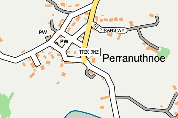
TR20 9NZ is located in the Long Rock, Marazion & St Erth electoral ward, within the unitary authority of Cornwall and the English Parliamentary constituency of St Ives. The Sub Integrated Care Board (ICB) Location is NHS Cornwall and the Isles of Scilly ICB - 11N and the police force is Devon & Cornwall. This postcode has been in use since February 2012.


GetTheData
Source: OS OpenMap – Local (Ordnance Survey)
Source: OS VectorMap District (Ordnance Survey)
Licence: Open Government Licence (requires attribution)
| Easting | 153882 |
| Northing | 29491 |
| Latitude | 50.114359 |
| Longitude | -5.444022 |
GetTheData
Source: Open Postcode Geo
Licence: Open Government Licence
| Country | England |
| Postcode District | TR20 |
➜ See where TR20 is on a map ➜ Where is Perranuthnoe? | |
GetTheData
Source: Land Registry Price Paid Data
Licence: Open Government Licence
Elevation or altitude of TR20 9NZ as distance above sea level:
| Metres | Feet | |
|---|---|---|
| Elevation | 20m | 66ft |
Elevation is measured from the approximate centre of the postcode, to the nearest point on an OS contour line from OS Terrain 50, which has contour spacing of ten vertical metres.
➜ How high above sea level am I? Find the elevation of your current position using your device's GPS.
GetTheData
Source: Open Postcode Elevation
Licence: Open Government Licence
| Ward | Long Rock, Marazion & St Erth |
| Constituency | St Ives |
GetTheData
Source: ONS Postcode Database
Licence: Open Government Licence
| St Pirans Way | Perranuthnoe | 105m |
| St Pirans Hall | Perranuthnoe | 136m |
| Perran Crossroads | Perranuthnoe | 769m |
| Perran Crossroads | Perranuthnoe | 776m |
| Perran Crossroads (A394) | Perranuthnoe | 817m |
GetTheData
Source: NaPTAN
Licence: Open Government Licence
GetTheData
Source: ONS Postcode Database
Licence: Open Government Licence


➜ Get more ratings from the Food Standards Agency
GetTheData
Source: Food Standards Agency
Licence: FSA terms & conditions
| Last Collection | |||
|---|---|---|---|
| Location | Mon-Fri | Sat | Distance |
| Henfor | 16:45 | 11:45 | 1,491m |
| Plantation | 09:00 | 09:00 | 1,862m |
| Plain An Gwarry | 09:45 | 09:45 | 2,064m |
GetTheData
Source: Dracos
Licence: Creative Commons Attribution-ShareAlike
The below table lists the International Territorial Level (ITL) codes (formerly Nomenclature of Territorial Units for Statistics (NUTS) codes) and Local Administrative Units (LAU) codes for TR20 9NZ:
| ITL 1 Code | Name |
|---|---|
| TLK | South West (England) |
| ITL 2 Code | Name |
| TLK3 | Cornwall and Isles of Scilly |
| ITL 3 Code | Name |
| TLK30 | Cornwall and Isles of Scilly |
| LAU 1 Code | Name |
| E06000052 | Cornwall |
GetTheData
Source: ONS Postcode Directory
Licence: Open Government Licence
The below table lists the Census Output Area (OA), Lower Layer Super Output Area (LSOA), and Middle Layer Super Output Area (MSOA) for TR20 9NZ:
| Code | Name | |
|---|---|---|
| OA | E00095938 | |
| LSOA | E01018990 | Cornwall 061D |
| MSOA | E02003946 | Cornwall 061 |
GetTheData
Source: ONS Postcode Directory
Licence: Open Government Licence
| TR20 9NB | 48m | |
| TR20 9NQ | 83m | |
| TR20 9NE | 96m | |
| TR20 9NP | 108m | |
| TR20 9NH | Boat Cove Lane | 114m |
| TR20 9ND | St Pirans Cottages | 134m |
| TR20 9NA | The Elms | 142m |
| TR20 9NN | Greeb Way | 156m |
| TR20 9NJ | St Pirans Way | 170m |
| TR20 9NR | 181m |
GetTheData
Source: Open Postcode Geo; Land Registry Price Paid Data
Licence: Open Government Licence