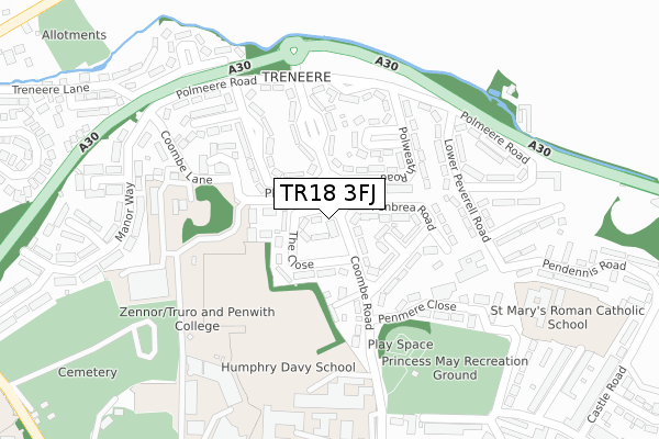
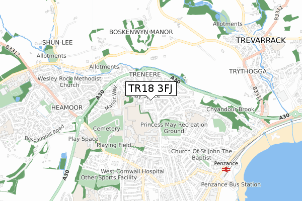
TR18 3FJ is located in the Penzance East electoral ward, within the unitary authority of Cornwall and the English Parliamentary constituency of St Ives. The Sub Integrated Care Board (ICB) Location is NHS Cornwall and the Isles of Scilly ICB - 11N and the police force is Devon & Cornwall. This postcode has been in use since May 2018.


GetTheData
Source: OS Open Zoomstack (Ordnance Survey)
Licence: Open Government Licence (requires attribution)
Attribution: Contains OS data © Crown copyright and database right 2025
Source: Open Postcode Geo
Licence: Open Government Licence (requires attribution)
Attribution: Contains OS data © Crown copyright and database right 2025; Contains Royal Mail data © Royal Mail copyright and database right 2025; Source: Office for National Statistics licensed under the Open Government Licence v.3.0
| Easting | 146995 |
| Northing | 31244 |
| Latitude | 50.127200 |
| Longitude | -5.541326 |
GetTheData
Source: Open Postcode Geo
Licence: Open Government Licence
| Country | England |
| Postcode District | TR18 |
➜ See where TR18 is on a map | |
GetTheData
Source: Land Registry Price Paid Data
Licence: Open Government Licence
| Ward | Penzance East |
| Constituency | St Ives |
GetTheData
Source: ONS Postcode Database
Licence: Open Government Licence
| The Close (Coombe Road) | Penzance | 38m |
| The Close | Penzance | 56m |
| Treneere Stores (Treweath Road) | Penzance | 152m |
| Treneere Stores (Treweath Road) | Penzance | 152m |
| Coombe Lane (Lower Peverell Road) | Trythogga | 205m |
| Penzance Station | 0.9km |
GetTheData
Source: NaPTAN
Licence: Open Government Licence
GetTheData
Source: ONS Postcode Database
Licence: Open Government Licence


➜ Get more ratings from the Food Standards Agency
GetTheData
Source: Food Standards Agency
Licence: FSA terms & conditions
| Last Collection | |||
|---|---|---|---|
| Location | Mon-Fri | Sat | Distance |
| Treneere Estate | 16:00 | 11:30 | 149m |
| Manor Way | 16:00 | 11:30 | 344m |
| Faugan Road | 16:10 | 08:30 | 413m |
GetTheData
Source: Dracos
Licence: Creative Commons Attribution-ShareAlike
The below table lists the International Territorial Level (ITL) codes (formerly Nomenclature of Territorial Units for Statistics (NUTS) codes) and Local Administrative Units (LAU) codes for TR18 3FJ:
| ITL 1 Code | Name |
|---|---|
| TLK | South West (England) |
| ITL 2 Code | Name |
| TLK3 | Cornwall and Isles of Scilly |
| ITL 3 Code | Name |
| TLK30 | Cornwall and Isles of Scilly |
| LAU 1 Code | Name |
| E06000052 | Cornwall |
GetTheData
Source: ONS Postcode Directory
Licence: Open Government Licence
The below table lists the Census Output Area (OA), Lower Layer Super Output Area (LSOA), and Middle Layer Super Output Area (MSOA) for TR18 3FJ:
| Code | Name | |
|---|---|---|
| OA | E00095972 | |
| LSOA | E01018997 | Cornwall 067E |
| MSOA | E02003948 | Cornwall 067 |
GetTheData
Source: ONS Postcode Directory
Licence: Open Government Licence
| TR18 3NU | The Close | 30m |
| TR18 3NR | Coombe Road | 74m |
| TR18 3PT | Penmere Place | 80m |
| TR18 3NY | Penbrea Road | 87m |
| TR18 3NT | The Close | 93m |
| TR18 3PW | Polweath Road | 109m |
| TR18 3PS | Penmere Road | 109m |
| TR18 3PZ | Treweath Road | 139m |
| TR18 3PR | Penmere Road | 142m |
| TR18 3PA | Colinsey Road | 146m |
GetTheData
Source: Open Postcode Geo; Land Registry Price Paid Data
Licence: Open Government Licence