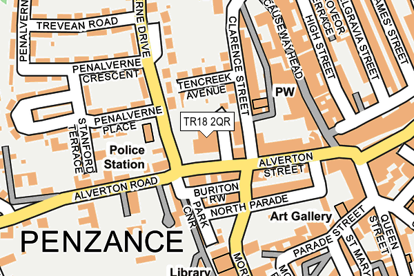
TR18 2QR is located in the Penzance East electoral ward, within the unitary authority of Cornwall and the English Parliamentary constituency of St Ives. The Sub Integrated Care Board (ICB) Location is NHS Cornwall and the Isles of Scilly ICB - 11N and the police force is Devon & Cornwall. This postcode has been in use since January 1980.


GetTheData
Source: OS OpenMap – Local (Ordnance Survey)
Source: OS VectorMap District (Ordnance Survey)
Licence: Open Government Licence (requires attribution)
| Easting | 147026 |
| Northing | 30300 |
| Latitude | 50.118749 |
| Longitude | -5.540213 |
GetTheData
Source: Open Postcode Geo
Licence: Open Government Licence
| Country | England |
| Postcode District | TR18 |
➜ See where TR18 is on a map ➜ Where is Penzance? | |
GetTheData
Source: Land Registry Price Paid Data
Licence: Open Government Licence
Elevation or altitude of TR18 2QR as distance above sea level:
| Metres | Feet | |
|---|---|---|
| Elevation | 30m | 98ft |
Elevation is measured from the approximate centre of the postcode, to the nearest point on an OS contour line from OS Terrain 50, which has contour spacing of ten vertical metres.
➜ How high above sea level am I? Find the elevation of your current position using your device's GPS.
GetTheData
Source: Open Postcode Elevation
Licence: Open Government Licence
| Ward | Penzance East |
| Constituency | St Ives |
GetTheData
Source: ONS Postcode Database
Licence: Open Government Licence
| Church | Penzance | 76m |
| First And Last (Alverton Road) | Penzance | 103m |
| Green Market (Alverton Street) | Penzance | 171m |
| St Claire's (Alverton Road) | Penzance | 213m |
| St Clare Street | Penzance | 296m |
| Penzance Station | 0.6km |
GetTheData
Source: NaPTAN
Licence: Open Government Licence
GetTheData
Source: ONS Postcode Database
Licence: Open Government Licence


➜ Get more ratings from the Food Standards Agency
GetTheData
Source: Food Standards Agency
Licence: FSA terms & conditions
| Last Collection | |||
|---|---|---|---|
| Location | Mon-Fri | Sat | Distance |
| Penzance Delivery Office | 18:05 | 12:15 | 57m |
| Penhalverne Drive | 17:30 | 11:30 | 204m |
| Causeway Head | 17:45 | 11:30 | 227m |
GetTheData
Source: Dracos
Licence: Creative Commons Attribution-ShareAlike
The below table lists the International Territorial Level (ITL) codes (formerly Nomenclature of Territorial Units for Statistics (NUTS) codes) and Local Administrative Units (LAU) codes for TR18 2QR:
| ITL 1 Code | Name |
|---|---|
| TLK | South West (England) |
| ITL 2 Code | Name |
| TLK3 | Cornwall and Isles of Scilly |
| ITL 3 Code | Name |
| TLK30 | Cornwall and Isles of Scilly |
| LAU 1 Code | Name |
| E06000052 | Cornwall |
GetTheData
Source: ONS Postcode Directory
Licence: Open Government Licence
The below table lists the Census Output Area (OA), Lower Layer Super Output Area (LSOA), and Middle Layer Super Output Area (MSOA) for TR18 2QR:
| Code | Name | |
|---|---|---|
| OA | E00095968 | |
| LSOA | E01018995 | Cornwall 068A |
| MSOA | E02003949 | Cornwall 068 |
GetTheData
Source: ONS Postcode Directory
Licence: Open Government Licence
| TR18 2QP | Alverton Street | 50m |
| TR18 2NX | Clarence Street | 56m |
| TR18 2QB | Tencreek Avenue | 66m |
| TR18 2QD | Trendeal Gardens | 84m |
| TR18 2QT | Morrab Road | 92m |
| TR18 4SN | North Parade | 95m |
| TR18 2QG | Buriton Row | 99m |
| TR18 4SR | Wellington Place | 101m |
| TR18 2RE | Penalverne Drive | 107m |
| TR18 2QW | Alverton Street | 107m |
GetTheData
Source: Open Postcode Geo; Land Registry Price Paid Data
Licence: Open Government Licence