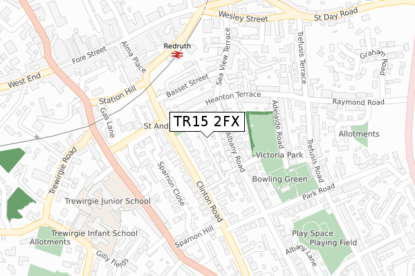
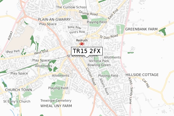
TR15 2FX is located in the Redruth South electoral ward, within the unitary authority of Cornwall and the English Parliamentary constituency of Camborne and Redruth. The Sub Integrated Care Board (ICB) Location is NHS Cornwall and the Isles of Scilly ICB - 11N and the police force is Devon & Cornwall. This postcode has been in use since December 2019.


GetTheData
Source: OS Open Zoomstack (Ordnance Survey)
Licence: Open Government Licence (requires attribution)
Attribution: Contains OS data © Crown copyright and database right 2025
Source: Open Postcode Geo
Licence: Open Government Licence (requires attribution)
Attribution: Contains OS data © Crown copyright and database right 2025; Contains Royal Mail data © Royal Mail copyright and database right 2025; Source: Office for National Statistics licensed under the Open Government Licence v.3.0
| Easting | 170133 |
| Northing | 41787 |
| Latitude | 50.231284 |
| Longitude | -5.224527 |
GetTheData
Source: Open Postcode Geo
Licence: Open Government Licence
| Country | England |
| Postcode District | TR15 |
➜ See where TR15 is on a map ➜ Where is Redruth? | |
GetTheData
Source: Land Registry Price Paid Data
Licence: Open Government Licence
| Ward | Redruth South |
| Constituency | Camborne And Redruth |
GetTheData
Source: ONS Postcode Database
Licence: Open Government Licence
7, ST ANDREWS MEWS, REDRUTH, TR15 2FX 2021 21 MAY £285,000 |
GetTheData
Source: HM Land Registry Price Paid Data
Licence: Contains HM Land Registry data © Crown copyright and database right 2025. This data is licensed under the Open Government Licence v3.0.
| Library | Redruth | 89m |
| Heanton Terrace | Redruth | 93m |
| Bond Street | Redruth | 153m |
| Falmouth Road | Redruth | 214m |
| Falmouth Road | Redruth | 226m |
| Redruth Station | 0.2km |
GetTheData
Source: NaPTAN
Licence: Open Government Licence
GetTheData
Source: ONS Postcode Database
Licence: Open Government Licence


➜ Get more ratings from the Food Standards Agency
GetTheData
Source: Food Standards Agency
Licence: FSA terms & conditions
| Last Collection | |||
|---|---|---|---|
| Location | Mon-Fri | Sat | Distance |
| Albany Road | 17:00 | 10:00 | 159m |
| Redruth Post Office | 18:30 | 12:15 | 301m |
| West Trewirgie | 17:45 | 09:00 | 639m |
GetTheData
Source: Dracos
Licence: Creative Commons Attribution-ShareAlike
The below table lists the International Territorial Level (ITL) codes (formerly Nomenclature of Territorial Units for Statistics (NUTS) codes) and Local Administrative Units (LAU) codes for TR15 2FX:
| ITL 1 Code | Name |
|---|---|
| TLK | South West (England) |
| ITL 2 Code | Name |
| TLK3 | Cornwall and Isles of Scilly |
| ITL 3 Code | Name |
| TLK30 | Cornwall and Isles of Scilly |
| LAU 1 Code | Name |
| E06000052 | Cornwall |
GetTheData
Source: ONS Postcode Directory
Licence: Open Government Licence
The below table lists the Census Output Area (OA), Lower Layer Super Output Area (LSOA), and Middle Layer Super Output Area (MSOA) for TR15 2FX:
| Code | Name | |
|---|---|---|
| OA | E00095502 | |
| LSOA | E01018913 | Cornwall 049B |
| MSOA | E02003920 | Cornwall 049 |
GetTheData
Source: ONS Postcode Directory
Licence: Open Government Licence
| TR15 2LL | Clinton Road | 50m |
| TR15 2HU | Albany Road | 64m |
| TR15 2HT | Heanton Villas | 86m |
| TR15 2QE | Clinton Road | 96m |
| TR15 2HS | Heanton Terrace | 110m |
| TR15 2QB | Bond Street | 144m |
| TR15 2LW | Clinton Road | 148m |
| TR15 2RJ | Sparnon Close | 149m |
| TR15 2HY | Albany Road | 150m |
| TR15 2QA | Bond Street | 161m |
GetTheData
Source: Open Postcode Geo; Land Registry Price Paid Data
Licence: Open Government Licence