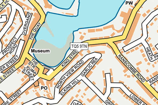
TQ5 9TN is located in the St Peter's with St Mary's electoral ward, within the unitary authority of Torbay and the English Parliamentary constituency of Totnes. The Sub Integrated Care Board (ICB) Location is NHS Devon ICB - 15N and the police force is Devon & Cornwall. This postcode has been in use since January 1980.


GetTheData
Source: OS OpenMap – Local (Ordnance Survey)
Source: OS VectorMap District (Ordnance Survey)
Licence: Open Government Licence (requires attribution)
| Easting | 292611 |
| Northing | 56159 |
| Latitude | 50.395457 |
| Longitude | -3.512229 |
GetTheData
Source: Open Postcode Geo
Licence: Open Government Licence
| Country | England |
| Postcode District | TQ5 |
➜ See where TQ5 is on a map ➜ Where is Brixham? | |
GetTheData
Source: Land Registry Price Paid Data
Licence: Open Government Licence
Elevation or altitude of TQ5 9TN as distance above sea level:
| Metres | Feet | |
|---|---|---|
| Elevation | 20m | 66ft |
Elevation is measured from the approximate centre of the postcode, to the nearest point on an OS contour line from OS Terrain 50, which has contour spacing of ten vertical metres.
➜ How high above sea level am I? Find the elevation of your current position using your device's GPS.
GetTheData
Source: Open Postcode Elevation
Licence: Open Government Licence
| Ward | St Peter's With St Mary's |
| Constituency | Totnes |
GetTheData
Source: ONS Postcode Database
Licence: Open Government Licence
| King Street | Brixham | 23m |
| Strand Statue (The Strand) | Brixham | 74m |
| Old Fish Market (The Quay) | Brixham Harbour | 195m |
| The Quay | Brixham Harbour | 207m |
| Town Square (Bank Lane) | Brixham | 226m |
| Paignton Station | 5.7km |
GetTheData
Source: NaPTAN
Licence: Open Government Licence
GetTheData
Source: ONS Postcode Database
Licence: Open Government Licence


➜ Get more ratings from the Food Standards Agency
GetTheData
Source: Food Standards Agency
Licence: FSA terms & conditions
| Last Collection | |||
|---|---|---|---|
| Location | Mon-Fri | Sat | Distance |
| Fore Street Post Office | 17:30 | 12:00 | 52m |
| Mount Pleasant Road | 16:45 | 12:00 | 94m |
| Broadacre Drive | 16:45 | 12:00 | 192m |
GetTheData
Source: Dracos
Licence: Creative Commons Attribution-ShareAlike
The below table lists the International Territorial Level (ITL) codes (formerly Nomenclature of Territorial Units for Statistics (NUTS) codes) and Local Administrative Units (LAU) codes for TQ5 9TN:
| ITL 1 Code | Name |
|---|---|
| TLK | South West (England) |
| ITL 2 Code | Name |
| TLK4 | Devon |
| ITL 3 Code | Name |
| TLK42 | Torbay |
| LAU 1 Code | Name |
| E06000027 | Torbay |
GetTheData
Source: ONS Postcode Directory
Licence: Open Government Licence
The below table lists the Census Output Area (OA), Lower Layer Super Output Area (LSOA), and Middle Layer Super Output Area (MSOA) for TQ5 9TN:
| Code | Name | |
|---|---|---|
| OA | E00076738 | |
| LSOA | E01015186 | Torbay 017D |
| MSOA | E02003170 | Torbay 017 |
GetTheData
Source: ONS Postcode Directory
Licence: Open Government Licence
| TQ5 9TP | Ostend Cottages | 13m |
| TQ5 8AJ | New Quay Lane | 42m |
| TQ5 9TR | Temperance Place | 42m |
| TQ5 9TF | King Street | 43m |
| TQ5 9TW | King Street | 43m |
| TQ5 9TE | St Peters Hill | 46m |
| TQ5 8EF | Fore Street | 50m |
| TQ5 8JL | Beach Approach | 68m |
| TQ5 9RZ | Rea Cottages | 69m |
| TQ5 8AG | Fore Street | 81m |
GetTheData
Source: Open Postcode Geo; Land Registry Price Paid Data
Licence: Open Government Licence