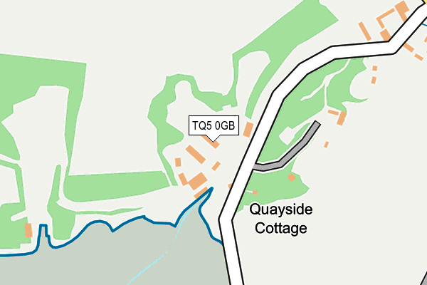
TQ5 0GB is located in the Dartmouth & East Dart electoral ward, within the local authority district of South Hams and the English Parliamentary constituency of Totnes. The Sub Integrated Care Board (ICB) Location is NHS Devon ICB - 15N and the police force is Devon & Cornwall. This postcode has been in use since June 2005.


GetTheData
Source: OS OpenMap – Local (Ordnance Survey)
Source: OS VectorMap District (Ordnance Survey)
Licence: Open Government Licence (requires attribution)
| Easting | 288129 |
| Northing | 56080 |
| Latitude | 50.393910 |
| Longitude | -3.575240 |
GetTheData
Source: Open Postcode Geo
Licence: Open Government Licence
| Country | England |
| Postcode District | TQ5 |
➜ See where TQ5 is on a map | |
GetTheData
Source: Land Registry Price Paid Data
Licence: Open Government Licence
Elevation or altitude of TQ5 0GB as distance above sea level:
| Metres | Feet | |
|---|---|---|
| Elevation | 10m | 33ft |
Elevation is measured from the approximate centre of the postcode, to the nearest point on an OS contour line from OS Terrain 50, which has contour spacing of ten vertical metres.
➜ How high above sea level am I? Find the elevation of your current position using your device's GPS.
GetTheData
Source: Open Postcode Elevation
Licence: Open Government Licence
| Ward | Dartmouth & East Dart |
| Constituency | Totnes |
GetTheData
Source: ONS Postcode Database
Licence: Open Government Licence
| Greenway Park (Greenway Road) | Galmpton | 662m |
| Triangle (Greenway Road) | Galmpton | 786m |
| Greenway Halt | Lower Dittisham | 894m |
| Manor Vale Road | Galmpton | 955m |
| Windy Corner (Dartmouth Road) | Broadsands | 1,147m |
| Greenway Halt (Paignton And Dartmouth Railway) (Greenway Road) | Galmpton | 845m |
| Churston (Paignton And Dartmouth Railway) (Dartmouth Road) | Churston | 1,323m |
| Paignton Station | 4.6km |
GetTheData
Source: NaPTAN
Licence: Open Government Licence
GetTheData
Source: ONS Postcode Database
Licence: Open Government Licence


➜ Get more ratings from the Food Standards Agency
GetTheData
Source: Food Standards Agency
Licence: FSA terms & conditions
| Last Collection | |||
|---|---|---|---|
| Location | Mon-Fri | Sat | Distance |
| Galmpton Post Office | 16:30 | 10:00 | 577m |
| Waddeton | 16:00 | 09:30 | 1,404m |
| Lower Fowden | 17:00 | 12:00 | 1,768m |
GetTheData
Source: Dracos
Licence: Creative Commons Attribution-ShareAlike
The below table lists the International Territorial Level (ITL) codes (formerly Nomenclature of Territorial Units for Statistics (NUTS) codes) and Local Administrative Units (LAU) codes for TQ5 0GB:
| ITL 1 Code | Name |
|---|---|
| TLK | South West (England) |
| ITL 2 Code | Name |
| TLK4 | Devon |
| ITL 3 Code | Name |
| TLK43 | Devon CC |
| LAU 1 Code | Name |
| E07000044 | South Hams |
GetTheData
Source: ONS Postcode Directory
Licence: Open Government Licence
The below table lists the Census Output Area (OA), Lower Layer Super Output Area (LSOA), and Middle Layer Super Output Area (MSOA) for TQ5 0GB:
| Code | Name | |
|---|---|---|
| OA | E00102060 | |
| LSOA | E01020153 | South Hams 004A |
| MSOA | E02004192 | South Hams 004 |
GetTheData
Source: ONS Postcode Directory
Licence: Open Government Licence
| TQ5 0EH | 269m | |
| TQ5 0EJ | Stoke Gabriel Road | 379m |
| TQ5 0NG | The Orchards | 445m |
| TQ5 0NE | Old Road | 495m |
| TQ5 0NF | The Coombe | 513m |
| TQ5 0NB | Galmpton Farm Close | 526m |
| TQ5 0EP | Greenway Road | 572m |
| TQ5 0NQ | Stoke Gabriel Road | 579m |
| TQ5 0NH | Scardons Gardens | 583m |
| TQ5 0NP | Galmpton Farm Close | 609m |
GetTheData
Source: Open Postcode Geo; Land Registry Price Paid Data
Licence: Open Government Licence