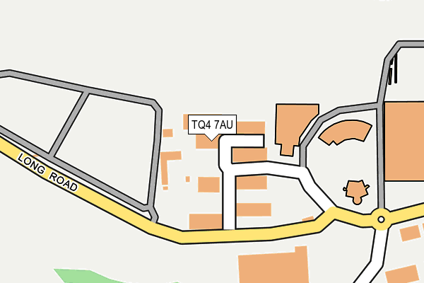
TQ4 7AU is located in the Collaton St Mary electoral ward, within the unitary authority of Torbay and the English Parliamentary constituency of Totnes. The Sub Integrated Care Board (ICB) Location is NHS Devon ICB - 15N and the police force is Devon & Cornwall. This postcode has been in use since October 2007.


GetTheData
Source: OS OpenMap – Local (Ordnance Survey)
Source: OS VectorMap District (Ordnance Survey)
Licence: Open Government Licence (requires attribution)
| Easting | 286986 |
| Northing | 58330 |
| Latitude | 50.413918 |
| Longitude | -3.591993 |
GetTheData
Source: Open Postcode Geo
Licence: Open Government Licence
| Country | England |
| Postcode District | TQ4 |
➜ See where TQ4 is on a map ➜ Where is Paignton? | |
GetTheData
Source: Land Registry Price Paid Data
Licence: Open Government Licence
Elevation or altitude of TQ4 7AU as distance above sea level:
| Metres | Feet | |
|---|---|---|
| Elevation | 60m | 197ft |
Elevation is measured from the approximate centre of the postcode, to the nearest point on an OS contour line from OS Terrain 50, which has contour spacing of ten vertical metres.
➜ How high above sea level am I? Find the elevation of your current position using your device's GPS.
GetTheData
Source: Open Postcode Elevation
Licence: Open Government Licence
| Ward | Collaton St Mary |
| Constituency | Totnes |
GetTheData
Source: ONS Postcode Database
Licence: Open Government Licence
| South Devon College (Long Road) | Paignton | 335m |
| South Devon College (Long Road) | Paignton | 355m |
| Long Road | Paignton | 668m |
| Long Road | Paignton | 687m |
| Brixham Road Sainsburys (Yalberton Road) | Yalberton | 780m |
| Paignton Station | 3km |
GetTheData
Source: NaPTAN
Licence: Open Government Licence
GetTheData
Source: ONS Postcode Database
Licence: Open Government Licence


➜ Get more ratings from the Food Standards Agency
GetTheData
Source: Food Standards Agency
Licence: FSA terms & conditions
| Last Collection | |||
|---|---|---|---|
| Location | Mon-Fri | Sat | Distance |
| Crabbs Park | 17:00 | 12:30 | 820m |
| Lulworth Close | 17:15 | 12:30 | 884m |
| Davies Avenue | 17:15 | 12:15 | 1,597m |
GetTheData
Source: Dracos
Licence: Creative Commons Attribution-ShareAlike
The below table lists the International Territorial Level (ITL) codes (formerly Nomenclature of Territorial Units for Statistics (NUTS) codes) and Local Administrative Units (LAU) codes for TQ4 7AU:
| ITL 1 Code | Name |
|---|---|
| TLK | South West (England) |
| ITL 2 Code | Name |
| TLK4 | Devon |
| ITL 3 Code | Name |
| TLK42 | Torbay |
| LAU 1 Code | Name |
| E06000027 | Torbay |
GetTheData
Source: ONS Postcode Directory
Licence: Open Government Licence
The below table lists the Census Output Area (OA), Lower Layer Super Output Area (LSOA), and Middle Layer Super Output Area (MSOA) for TQ4 7AU:
| Code | Name | |
|---|---|---|
| OA | E00076785 | |
| LSOA | E01015195 | Torbay 013F |
| MSOA | E02003166 | Torbay 013 |
GetTheData
Source: ONS Postcode Directory
Licence: Open Government Licence
| TQ4 7HP | Woodview Road | 302m |
| TQ4 7TW | Kemmings Close | 537m |
| TQ4 7FH | Wilkins Drive | 538m |
| TQ4 7FN | Hollyhock Way | 563m |
| TQ4 7FL | Meadowsweet Lane | 581m |
| TQ4 7FJ | Parkbay Avenue | 642m |
| TQ4 7BL | Long Road | 678m |
| TQ4 7PQ | Long Road | 684m |
| TQ4 7HU | Yannons Road | 693m |
| TQ4 7FE | Mimosa Way | 703m |
GetTheData
Source: Open Postcode Geo; Land Registry Price Paid Data
Licence: Open Government Licence