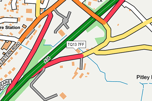
TQ13 7FF is located in the Ashburton & Buckfastleigh electoral ward, within the local authority district of Teignbridge and the English Parliamentary constituency of Central Devon. The Sub Integrated Care Board (ICB) Location is NHS Devon ICB - 15N and the police force is Devon & Cornwall. This postcode has been in use since July 2017.


GetTheData
Source: OS OpenMap – Local (Ordnance Survey)
Source: OS VectorMap District (Ordnance Survey)
Licence: Open Government Licence (requires attribution)
| Easting | 276419 |
| Northing | 70278 |
| Latitude | 50.519191 |
| Longitude | -3.744598 |
GetTheData
Source: Open Postcode Geo
Licence: Open Government Licence
| Country | England |
| Postcode District | TQ13 |
➜ See where TQ13 is on a map ➜ Where is Ashburton? | |
GetTheData
Source: Land Registry Price Paid Data
Licence: Open Government Licence
| Ward | Ashburton & Buckfastleigh |
| Constituency | Central Devon |
GetTheData
Source: ONS Postcode Database
Licence: Open Government Licence
| East End Terrace | Ashburton | 179m |
| Police Station (Eastern Road) | Ashburton | 223m |
| Hospital (Eastern Road) | Ashburton | 285m |
| East End Terrace (B3352) | Ashburton | 334m |
| Home Park (Cooks Close) | Ashburton | 455m |
GetTheData
Source: NaPTAN
Licence: Open Government Licence
GetTheData
Source: ONS Postcode Database
Licence: Open Government Licence


➜ Get more ratings from the Food Standards Agency
GetTheData
Source: Food Standards Agency
Licence: FSA terms & conditions
| Last Collection | |||
|---|---|---|---|
| Location | Mon-Fri | Sat | Distance |
| Mill Meadow | 12:00 | 11:00 | 986m |
| Tor Lane | 15:45 | 07:30 | 1,431m |
| Gurrington | 15:45 | 07:45 | 2,297m |
GetTheData
Source: Dracos
Licence: Creative Commons Attribution-ShareAlike
The below table lists the International Territorial Level (ITL) codes (formerly Nomenclature of Territorial Units for Statistics (NUTS) codes) and Local Administrative Units (LAU) codes for TQ13 7FF:
| ITL 1 Code | Name |
|---|---|
| TLK | South West (England) |
| ITL 2 Code | Name |
| TLK4 | Devon |
| ITL 3 Code | Name |
| TLK43 | Devon CC |
| LAU 1 Code | Name |
| E07000045 | Teignbridge |
GetTheData
Source: ONS Postcode Directory
Licence: Open Government Licence
The below table lists the Census Output Area (OA), Lower Layer Super Output Area (LSOA), and Middle Layer Super Output Area (MSOA) for TQ13 7FF:
| Code | Name | |
|---|---|---|
| OA | E00102297 | |
| LSOA | E01020195 | Teignbridge 017A |
| MSOA | E02004217 | Teignbridge 017 |
GetTheData
Source: ONS Postcode Directory
Licence: Open Government Licence
| TQ13 7LB | 72m | |
| TQ13 7FL | Dolbeare Business Park | 93m |
| TQ13 7BZ | Jordan Meadow | 184m |
| TQ13 7LD | East End Terrace | 268m |
| TQ13 7AP | Eastern Road | 285m |
| TQ13 7FB | Kellett Close | 285m |
| TQ13 7AR | Eastern Road | 304m |
| TQ13 7FE | Miners Close | 330m |
| TQ13 7DB | Emmetts Park | 341m |
| TQ13 7BW | Long Park | 345m |
GetTheData
Source: Open Postcode Geo; Land Registry Price Paid Data
Licence: Open Government Licence