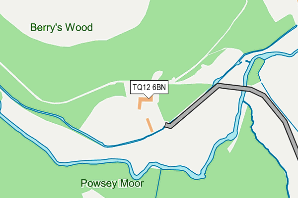
TQ12 6BN is located in the Bradley electoral ward, within the local authority district of Teignbridge and the English Parliamentary constituency of Newton Abbot. The Sub Integrated Care Board (ICB) Location is NHS Devon ICB - 15N and the police force is Devon & Cornwall. This postcode has been in use since January 1980.


GetTheData
Source: OS OpenMap – Local (Ordnance Survey)
Source: OS VectorMap District (Ordnance Survey)
Licence: Open Government Licence (requires attribution)
| Easting | 284855 |
| Northing | 70859 |
| Latitude | 50.526148 |
| Longitude | -3.625815 |
GetTheData
Source: Open Postcode Geo
Licence: Open Government Licence
| Country | England |
| Postcode District | TQ12 |
➜ See where TQ12 is on a map | |
GetTheData
Source: Land Registry Price Paid Data
Licence: Open Government Licence
Elevation or altitude of TQ12 6BN as distance above sea level:
| Metres | Feet | |
|---|---|---|
| Elevation | 20m | 66ft |
Elevation is measured from the approximate centre of the postcode, to the nearest point on an OS contour line from OS Terrain 50, which has contour spacing of ten vertical metres.
➜ How high above sea level am I? Find the elevation of your current position using your device's GPS.
GetTheData
Source: Open Postcode Elevation
Licence: Open Government Licence
| Ward | Bradley |
| Constituency | Newton Abbot |
GetTheData
Source: ONS Postcode Database
Licence: Open Government Licence
| Berrys Wood (Woodleigh Road) | Broadlands | 376m |
| Lower Budleigh Meadow (Woodleigh Road) | Broadlands | 382m |
| Berrys Wood (Woodleigh Road) | Broadlands | 407m |
| Meadow Halt (Larksmead Way) | East Ogwell | 409m |
| Meadow Halt (Larksmead Way) | East Ogwell | 411m |
| Newton Abbot Station | 1.9km |
GetTheData
Source: NaPTAN
Licence: Open Government Licence
GetTheData
Source: ONS Postcode Database
Licence: Open Government Licence


➜ Get more ratings from the Food Standards Agency
GetTheData
Source: Food Standards Agency
Licence: FSA terms & conditions
| Last Collection | |||
|---|---|---|---|
| Location | Mon-Fri | Sat | Distance |
| Canada Hill | 17:15 | 11:45 | 797m |
| Knowles Hill Road | 17:30 | 12:15 | 834m |
| Ogwell Green | 17:00 | 11:45 | 1,057m |
GetTheData
Source: Dracos
Licence: Creative Commons Attribution-ShareAlike
The below table lists the International Territorial Level (ITL) codes (formerly Nomenclature of Territorial Units for Statistics (NUTS) codes) and Local Administrative Units (LAU) codes for TQ12 6BN:
| ITL 1 Code | Name |
|---|---|
| TLK | South West (England) |
| ITL 2 Code | Name |
| TLK4 | Devon |
| ITL 3 Code | Name |
| TLK43 | Devon CC |
| LAU 1 Code | Name |
| E07000045 | Teignbridge |
GetTheData
Source: ONS Postcode Directory
Licence: Open Government Licence
The below table lists the Census Output Area (OA), Lower Layer Super Output Area (LSOA), and Middle Layer Super Output Area (MSOA) for TQ12 6BN:
| Code | Name | |
|---|---|---|
| OA | E00102364 | |
| LSOA | E01020209 | Teignbridge 012B |
| MSOA | E02004212 | Teignbridge 012 |
GetTheData
Source: ONS Postcode Directory
Licence: Open Government Licence
| TQ12 1UP | Berrys Wood | 325m |
| TQ12 1UW | Daggers Copse | 353m |
| TQ12 6LP | Merrywood | 354m |
| TQ12 6FB | Ogwellend Drive | 354m |
| TQ12 6FA | Meadow Halt | 386m |
| TQ12 1SF | Hunterswell Road | 387m |
| TQ12 1PP | The Warren | 390m |
| TQ12 1SG | Lea Vale Road | 393m |
| TQ12 6FE | Larksmead Way | 395m |
| TQ12 1UJ | Lower Budleigh Meadow | 396m |
GetTheData
Source: Open Postcode Geo; Land Registry Price Paid Data
Licence: Open Government Licence