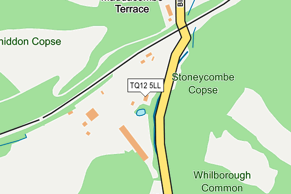
TQ12 5LL is located in the Ipplepen electoral ward, within the local authority district of Teignbridge and the English Parliamentary constituency of Newton Abbot. The Sub Integrated Care Board (ICB) Location is NHS Devon ICB - 15N and the police force is Devon & Cornwall. This postcode has been in use since January 1980.


GetTheData
Source: OS OpenMap – Local (Ordnance Survey)
Source: OS VectorMap District (Ordnance Survey)
Licence: Open Government Licence (requires attribution)
| Easting | 286368 |
| Northing | 67354 |
| Latitude | 50.494936 |
| Longitude | -3.603410 |
GetTheData
Source: Open Postcode Geo
Licence: Open Government Licence
| Country | England |
| Postcode District | TQ12 |
➜ See where TQ12 is on a map | |
GetTheData
Source: Land Registry Price Paid Data
Licence: Open Government Licence
Elevation or altitude of TQ12 5LL as distance above sea level:
| Metres | Feet | |
|---|---|---|
| Elevation | 40m | 131ft |
Elevation is measured from the approximate centre of the postcode, to the nearest point on an OS contour line from OS Terrain 50, which has contour spacing of ten vertical metres.
➜ How high above sea level am I? Find the elevation of your current position using your device's GPS.
GetTheData
Source: Open Postcode Elevation
Licence: Open Government Licence
| Ward | Ipplepen |
| Constituency | Newton Abbot |
GetTheData
Source: ONS Postcode Database
Licence: Open Government Licence
| Huxley Vale (Huxnor Road) | Kingskerswell | 1,272m |
| Wilton Close (Wilton Way) | Abbotskerswell | 1,405m |
| Grange Road (Wilton Way) | Abbotskerswell | 1,514m |
| Health Centre (School Road) | Kingskerswell | 1,559m |
| Health Centre (School Road) | Kingskerswell | 1,564m |
| Newton Abbot Station | 3.9km |
| Torre Station | 4.7km |
| Torquay Station | 5.7km |
GetTheData
Source: NaPTAN
Licence: Open Government Licence
GetTheData
Source: ONS Postcode Database
Licence: Open Government Licence


➜ Get more ratings from the Food Standards Agency
GetTheData
Source: Food Standards Agency
Licence: FSA terms & conditions
| Last Collection | |||
|---|---|---|---|
| Location | Mon-Fri | Sat | Distance |
| Bickleigh Mill | 16:00 | 07:45 | 197m |
| Saint Marys | 17:45 | 12:00 | 1,331m |
| Dainton | 15:45 | 08:15 | 1,397m |
GetTheData
Source: Dracos
Licence: Creative Commons Attribution-ShareAlike
| Risk of TQ12 5LL flooding from rivers and sea | High |
| ➜ TQ12 5LL flood map | |
GetTheData
Source: Open Flood Risk by Postcode
Licence: Open Government Licence
The below table lists the International Territorial Level (ITL) codes (formerly Nomenclature of Territorial Units for Statistics (NUTS) codes) and Local Administrative Units (LAU) codes for TQ12 5LL:
| ITL 1 Code | Name |
|---|---|
| TLK | South West (England) |
| ITL 2 Code | Name |
| TLK4 | Devon |
| ITL 3 Code | Name |
| TLK43 | Devon CC |
| LAU 1 Code | Name |
| E07000045 | Teignbridge |
GetTheData
Source: ONS Postcode Directory
Licence: Open Government Licence
The below table lists the Census Output Area (OA), Lower Layer Super Output Area (LSOA), and Middle Layer Super Output Area (MSOA) for TQ12 5LL:
| Code | Name | |
|---|---|---|
| OA | E00102510 | |
| LSOA | E01020239 | Teignbridge 019D |
| MSOA | E02004219 | Teignbridge 019 |
GetTheData
Source: ONS Postcode Directory
Licence: Open Government Licence
| TQ12 5LG | 480m | |
| TQ12 5LN | 513m | |
| TQ12 5LQ | 610m | |
| TQ12 5LF | Maddacombe Road | 739m |
| TQ12 5LH | Stoneyhill | 842m |
| TQ12 5LW | Mill Lane | 975m |
| TQ12 5LP | 1116m | |
| TQ12 5ED | Huxley Vale | 1174m |
| TQ12 5DY | Whilborough Road | 1213m |
| TQ12 5DT | Greenhill Road | 1255m |
GetTheData
Source: Open Postcode Geo; Land Registry Price Paid Data
Licence: Open Government Licence