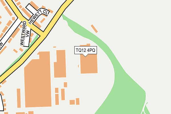
TQ12 4PQ is located in the Buckland & Milber electoral ward, within the local authority district of Teignbridge and the English Parliamentary constituency of Newton Abbot. The Sub Integrated Care Board (ICB) Location is NHS Devon ICB - 15N and the police force is Devon & Cornwall. This postcode has been in use since April 2013.


GetTheData
Source: OS OpenMap – Local (Ordnance Survey)
Source: OS VectorMap District (Ordnance Survey)
Licence: Open Government Licence (requires attribution)
| Easting | 288371 |
| Northing | 70898 |
| Latitude | 50.527167 |
| Longitude | -3.576258 |
GetTheData
Source: Open Postcode Geo
Licence: Open Government Licence
| Country | England |
| Postcode District | TQ12 |
➜ See where TQ12 is on a map ➜ Where is Newton Abbot? | |
GetTheData
Source: Land Registry Price Paid Data
Licence: Open Government Licence
Elevation or altitude of TQ12 4PQ as distance above sea level:
| Metres | Feet | |
|---|---|---|
| Elevation | 100m | 328ft |
Elevation is measured from the approximate centre of the postcode, to the nearest point on an OS contour line from OS Terrain 50, which has contour spacing of ten vertical metres.
➜ How high above sea level am I? Find the elevation of your current position using your device's GPS.
GetTheData
Source: Open Postcode Elevation
Licence: Open Government Licence
| Ward | Buckland & Milber |
| Constituency | Newton Abbot |
GetTheData
Source: ONS Postcode Database
Licence: Open Government Licence
| Haytor Drive Top (Moorland View) | Buckland | 261m |
| Haytor Drive | Buckland | 321m |
| Twickenham Road | Newtake | 355m |
| Flete Avenue (Moorland View) | Buckland | 361m |
| The Copse (Twickenham Road) | Newtake | 371m |
| Newton Abbot Station | 1.6km |
GetTheData
Source: NaPTAN
Licence: Open Government Licence
GetTheData
Source: ONS Postcode Database
Licence: Open Government Licence


➜ Get more ratings from the Food Standards Agency
GetTheData
Source: Food Standards Agency
Licence: FSA terms & conditions
| Last Collection | |||
|---|---|---|---|
| Location | Mon-Fri | Sat | Distance |
| Netherton | 17:30 | 08:00 | 881m |
| Courtenay Road | 17:30 | 13:10 | 1,019m |
| Railway Station | 17:30 | 11:45 | 1,663m |
GetTheData
Source: Dracos
Licence: Creative Commons Attribution-ShareAlike
The below table lists the International Territorial Level (ITL) codes (formerly Nomenclature of Territorial Units for Statistics (NUTS) codes) and Local Administrative Units (LAU) codes for TQ12 4PQ:
| ITL 1 Code | Name |
|---|---|
| TLK | South West (England) |
| ITL 2 Code | Name |
| TLK4 | Devon |
| ITL 3 Code | Name |
| TLK43 | Devon CC |
| LAU 1 Code | Name |
| E07000045 | Teignbridge |
GetTheData
Source: ONS Postcode Directory
Licence: Open Government Licence
The below table lists the Census Output Area (OA), Lower Layer Super Output Area (LSOA), and Middle Layer Super Output Area (MSOA) for TQ12 4PQ:
| Code | Name | |
|---|---|---|
| OA | E00102373 | |
| LSOA | E01020215 | Teignbridge 016D |
| MSOA | E02004216 | Teignbridge 016 |
GetTheData
Source: ONS Postcode Directory
Licence: Open Government Licence
| TQ12 4DY | Cheevor Place | 199m |
| TQ12 4DT | Westward View | 222m |
| TQ12 4EP | Moorland View | 266m |
| TQ12 4JJ | The Copse | 324m |
| TQ12 4AN | Foxhollows | 360m |
| TQ12 4DS | Haytor Grove | 381m |
| TQ12 4JF | Twickenham Road | 397m |
| TQ12 4EW | Moorland View | 401m |
| TQ12 4DU | Haytor Drive | 404m |
| TQ12 4JB | Haccombe Path | 406m |
GetTheData
Source: Open Postcode Geo; Land Registry Price Paid Data
Licence: Open Government Licence