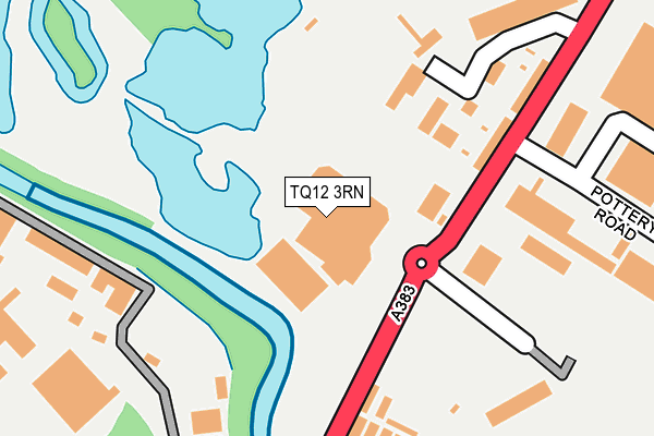
TQ12 3RN is located in the Kingsteignton West electoral ward, within the local authority district of Teignbridge and the English Parliamentary constituency of Newton Abbot. The Sub Integrated Care Board (ICB) Location is NHS Devon ICB - 15N and the police force is Devon & Cornwall. This postcode has been in use since March 1983.


GetTheData
Source: OS OpenMap – Local (Ordnance Survey)
Source: OS VectorMap District (Ordnance Survey)
Licence: Open Government Licence (requires attribution)
| Easting | 286569 |
| Northing | 72468 |
| Latitude | 50.540947 |
| Longitude | -3.602134 |
GetTheData
Source: Open Postcode Geo
Licence: Open Government Licence
| Country | England |
| Postcode District | TQ12 |
➜ See where TQ12 is on a map ➜ Where is Kingsteignton? | |
GetTheData
Source: Land Registry Price Paid Data
Licence: Open Government Licence
Elevation or altitude of TQ12 3RN as distance above sea level:
| Metres | Feet | |
|---|---|---|
| Elevation | 10m | 33ft |
Elevation is measured from the approximate centre of the postcode, to the nearest point on an OS contour line from OS Terrain 50, which has contour spacing of ten vertical metres.
➜ How high above sea level am I? Find the elevation of your current position using your device's GPS.
GetTheData
Source: Open Postcode Elevation
Licence: Open Government Licence
| Ward | Kingsteignton West |
| Constituency | Newton Abbot |
GetTheData
Source: ONS Postcode Database
Licence: Open Government Licence
| Racecourse (Newton Road) | Newton Abbot | 142m |
| Pottery Road (Newton Road) | Kingsteignton | 143m |
| Racecourse (Newton Road) | Newton Abbot | 160m |
| Pottery Road (Newton Road) | Kingsteignton | 175m |
| Homebase (Greenhill Way) | Kingsteignton | 466m |
| Newton Abbot Station | 1.3km |
GetTheData
Source: NaPTAN
Licence: Open Government Licence
GetTheData
Source: ONS Postcode Database
Licence: Open Government Licence


➜ Get more ratings from the Food Standards Agency
GetTheData
Source: Food Standards Agency
Licence: FSA terms & conditions
| Last Collection | |||
|---|---|---|---|
| Location | Mon-Fri | Sat | Distance |
| Pottery Cottages | 17:45 | 11:45 | 170m |
| Newton Road Post Office | 17:30 | 12:00 | 737m |
| Salisbury Road | 17:30 | 11:45 | 821m |
GetTheData
Source: Dracos
Licence: Creative Commons Attribution-ShareAlike
| Risk of TQ12 3RN flooding from rivers and sea | Medium |
| ➜ TQ12 3RN flood map | |
GetTheData
Source: Open Flood Risk by Postcode
Licence: Open Government Licence
The below table lists the International Territorial Level (ITL) codes (formerly Nomenclature of Territorial Units for Statistics (NUTS) codes) and Local Administrative Units (LAU) codes for TQ12 3RN:
| ITL 1 Code | Name |
|---|---|
| TLK | South West (England) |
| ITL 2 Code | Name |
| TLK4 | Devon |
| ITL 3 Code | Name |
| TLK43 | Devon CC |
| LAU 1 Code | Name |
| E07000045 | Teignbridge |
GetTheData
Source: ONS Postcode Directory
Licence: Open Government Licence
The below table lists the Census Output Area (OA), Lower Layer Super Output Area (LSOA), and Middle Layer Super Output Area (MSOA) for TQ12 3RN:
| Code | Name | |
|---|---|---|
| OA | E00102603 | |
| LSOA | E01020255 | Teignbridge 009E |
| MSOA | E02004209 | Teignbridge 009 |
GetTheData
Source: ONS Postcode Directory
Licence: Open Government Licence
| TQ12 3AD | Newton Road | 199m |
| TQ12 3GA | Slanns Meadow | 439m |
| TQ12 3BJ | Homers Close | 451m |
| TQ12 3AE | Homers Lane | 481m |
| TQ12 3AQ | St Michaels Road | 547m |
| TQ12 2SL | Jetty Marsh Road | 620m |
| TQ12 2SN | Kingsteignton Road | 632m |
| TQ12 2FD | Whitelake Place | 645m |
| TQ12 3BW | Church Court | 646m |
| TQ12 3EJ | Andor Avenue | 655m |
GetTheData
Source: Open Postcode Geo; Land Registry Price Paid Data
Licence: Open Government Licence