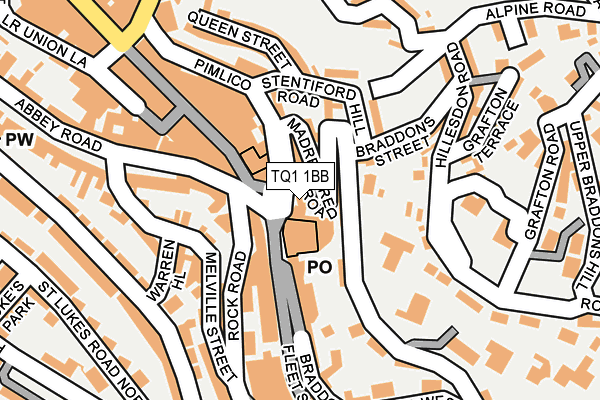
TQ1 1BB is located in the Tormohun electoral ward, within the unitary authority of Torbay and the English Parliamentary constituency of Torbay. The Sub Integrated Care Board (ICB) Location is NHS Devon ICB - 15N and the police force is Devon & Cornwall. This postcode has been in use since January 1980.


GetTheData
Source: OS OpenMap – Local (Ordnance Survey)
Source: OS VectorMap District (Ordnance Survey)
Licence: Open Government Licence (requires attribution)
| Easting | 291756 |
| Northing | 63909 |
| Latitude | 50.464987 |
| Longitude | -3.526478 |
GetTheData
Source: Open Postcode Geo
Licence: Open Government Licence
| Country | England |
| Postcode District | TQ1 |
➜ See where TQ1 is on a map ➜ Where is Torquay? | |
GetTheData
Source: Land Registry Price Paid Data
Licence: Open Government Licence
Elevation or altitude of TQ1 1BB as distance above sea level:
| Metres | Feet | |
|---|---|---|
| Elevation | 20m | 66ft |
Elevation is measured from the approximate centre of the postcode, to the nearest point on an OS contour line from OS Terrain 50, which has contour spacing of ten vertical metres.
➜ How high above sea level am I? Find the elevation of your current position using your device's GPS.
GetTheData
Source: Open Postcode Elevation
Licence: Open Government Licence
| Ward | Tormohun |
| Constituency | Torbay |
GetTheData
Source: ONS Postcode Database
Licence: Open Government Licence
| Post Office Roundabout (Fleet Street) | Torquay | 14m |
| Tesco (Fleet Street) | Torquay | 110m |
| Tesco (Fleet Street) | Torquay | 127m |
| Abbey Road | Torquay | 148m |
| Abbey Road | Torquay | 170m |
| Torquay Station | 1.3km |
| Torre Station | 1.7km |
| Paignton Station | 4.3km |
GetTheData
Source: NaPTAN
Licence: Open Government Licence
GetTheData
Source: ONS Postcode Database
Licence: Open Government Licence


➜ Get more ratings from the Food Standards Agency
GetTheData
Source: Food Standards Agency
Licence: FSA terms & conditions
| Last Collection | |||
|---|---|---|---|
| Location | Mon-Fri | Sat | Distance |
| Torquay Post Office | 17:30 | 13:00 | 60m |
| Torquay Delivery Office | 18:00 | 13:00 | 60m |
| Warren Road | 18:15 | 12:30 | 182m |
GetTheData
Source: Dracos
Licence: Creative Commons Attribution-ShareAlike
The below table lists the International Territorial Level (ITL) codes (formerly Nomenclature of Territorial Units for Statistics (NUTS) codes) and Local Administrative Units (LAU) codes for TQ1 1BB:
| ITL 1 Code | Name |
|---|---|
| TLK | South West (England) |
| ITL 2 Code | Name |
| TLK4 | Devon |
| ITL 3 Code | Name |
| TLK42 | Torbay |
| LAU 1 Code | Name |
| E06000027 | Torbay |
GetTheData
Source: ONS Postcode Directory
Licence: Open Government Licence
The below table lists the Census Output Area (OA), Lower Layer Super Output Area (LSOA), and Middle Layer Super Output Area (MSOA) for TQ1 1BB:
| Code | Name | |
|---|---|---|
| OA | E00076894 | |
| LSOA | E01015217 | Torbay 008A |
| MSOA | E02003161 | Torbay 008 |
GetTheData
Source: ONS Postcode Directory
Licence: Open Government Licence
| TQ1 1DR | Fleet Street | 31m |
| TQ1 1EY | Madrepore Road | 38m |
| TQ1 1EZ | Clifton Terrace | 47m |
| TQ1 1ES | Union Street | 91m |
| TQ2 5NB | Abbey Road | 104m |
| TQ2 5PL | Union Street | 108m |
| TQ1 1RF | Stentiford Hill Road | 109m |
| TQ1 1QH | Braddons Street | 113m |
| TQ2 5SP | Rock Road | 114m |
| TQ2 5NF | Abbey Road | 121m |
GetTheData
Source: Open Postcode Geo; Land Registry Price Paid Data
Licence: Open Government Licence