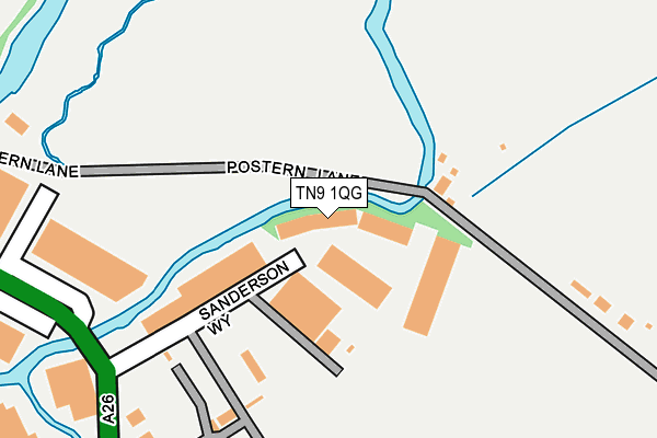
TN9 1QG is located in the Cage Green & Angel electoral ward, within the local authority district of Tonbridge and Malling and the English Parliamentary constituency of Tonbridge and Malling. The Sub Integrated Care Board (ICB) Location is NHS Kent and Medway ICB - 91Q and the police force is Kent. This postcode has been in use since February 1990.


GetTheData
Source: OS OpenMap – Local (Ordnance Survey)
Source: OS VectorMap District (Ordnance Survey)
Licence: Open Government Licence (requires attribution)
| Easting | 560160 |
| Northing | 146424 |
| Latitude | 51.194594 |
| Longitude | 0.290753 |
GetTheData
Source: Open Postcode Geo
Licence: Open Government Licence
| Country | England |
| Postcode District | TN9 |
➜ See where TN9 is on a map ➜ Where is Tonbridge? | |
GetTheData
Source: Land Registry Price Paid Data
Licence: Open Government Licence
Elevation or altitude of TN9 1QG as distance above sea level:
| Metres | Feet | |
|---|---|---|
| Elevation | 20m | 66ft |
Elevation is measured from the approximate centre of the postcode, to the nearest point on an OS contour line from OS Terrain 50, which has contour spacing of ten vertical metres.
➜ How high above sea level am I? Find the elevation of your current position using your device's GPS.
GetTheData
Source: Open Postcode Elevation
Licence: Open Government Licence
| Ward | Cage Green & Angel |
| Constituency | Tonbridge And Malling |
GetTheData
Source: ONS Postcode Database
Licence: Open Government Licence
| Somerhill Road (Lodge Oak Lane) | Tonbridge | 733m |
| Hectorage Road | Tonbridge | 738m |
| Somerhill Road (Lodge Oak Lane) | Tonbridge | 762m |
| Town Lock (Lockside) | Tonbridge | 789m |
| Cannon Lane (Hadlow Road) | Tonbridge | 851m |
| Tonbridge Station | 1.4km |
| Hildenborough Station | 4.9km |
GetTheData
Source: NaPTAN
Licence: Open Government Licence
Estimated total energy consumption in TN9 1QG by fuel type, 2015.
| Consumption (kWh) | 73,489 |
|---|---|
| Meter count | 6 |
| Mean (kWh/meter) | 12,248 |
| Median (kWh/meter) | 12,888 |
GetTheData
Source: Postcode level gas estimates: 2015 (experimental)
Source: Postcode level electricity estimates: 2015 (experimental)
Licence: Open Government Licence
GetTheData
Source: ONS Postcode Database
Licence: Open Government Licence


➜ Get more ratings from the Food Standards Agency
GetTheData
Source: Food Standards Agency
Licence: FSA terms & conditions
| Last Collection | |||
|---|---|---|---|
| Location | Mon-Fri | Sat | Distance |
| London Road | 16:45 | 12:00 | 1,031m |
| High Street | 18:45 | 12:30 | 1,141m |
| Tonbridge School | 18:45 | 12:45 | 1,175m |
GetTheData
Source: Dracos
Licence: Creative Commons Attribution-ShareAlike
| Risk of TN9 1QG flooding from rivers and sea | Medium |
| ➜ TN9 1QG flood map | |
GetTheData
Source: Open Flood Risk by Postcode
Licence: Open Government Licence
The below table lists the International Territorial Level (ITL) codes (formerly Nomenclature of Territorial Units for Statistics (NUTS) codes) and Local Administrative Units (LAU) codes for TN9 1QG:
| ITL 1 Code | Name |
|---|---|
| TLJ | South East (England) |
| ITL 2 Code | Name |
| TLJ4 | Kent |
| ITL 3 Code | Name |
| TLJ46 | West Kent |
| LAU 1 Code | Name |
| E07000115 | Tonbridge and Malling |
GetTheData
Source: ONS Postcode Directory
Licence: Open Government Licence
The below table lists the Census Output Area (OA), Lower Layer Super Output Area (LSOA), and Middle Layer Super Output Area (MSOA) for TN9 1QG:
| Code | Name | |
|---|---|---|
| OA | E00125709 | |
| LSOA | E01024768 | Tonbridge and Malling 012F |
| MSOA | E02005160 | Tonbridge and Malling 012 |
GetTheData
Source: ONS Postcode Directory
Licence: Open Government Licence
| TN11 0QY | Postern Lane | 402m |
| TN11 0QZ | Postern Lane | 420m |
| TN9 1TB | Vale Rise | 490m |
| TN9 1PP | Cannon Lane | 508m |
| TN11 0QU | Postern Lane | 516m |
| TN9 1ST | Vale Road | 556m |
| TN9 1FX | Redbud Road | 562m |
| TN9 1FW | Crabapple Road | 573m |
| TN9 1RA | Morley Road | 590m |
| TN9 1FT | Crabapple Road | 595m |
GetTheData
Source: Open Postcode Geo; Land Registry Price Paid Data
Licence: Open Government Licence