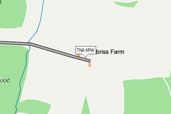
TN8 6PW is located in the Brasted, Chevening and Sundridge electoral ward, within the local authority district of Sevenoaks and the English Parliamentary constituency of Sevenoaks. The Sub Integrated Care Board (ICB) Location is NHS Kent and Medway ICB - 91Q and the police force is Kent. This postcode has been in use since January 1980.


GetTheData
Source: OS OpenMap – Local (Ordnance Survey)
Source: OS VectorMap District (Ordnance Survey)
Licence: Open Government Licence (requires attribution)
| Easting | 546604 |
| Northing | 150104 |
| Latitude | 51.231296 |
| Longitude | 0.098421 |
GetTheData
Source: Open Postcode Geo
Licence: Open Government Licence
| Country | England |
| Postcode District | TN8 |
➜ See where TN8 is on a map | |
GetTheData
Source: Land Registry Price Paid Data
Licence: Open Government Licence
Elevation or altitude of TN8 6PW as distance above sea level:
| Metres | Feet | |
|---|---|---|
| Elevation | 100m | 328ft |
Elevation is measured from the approximate centre of the postcode, to the nearest point on an OS contour line from OS Terrain 50, which has contour spacing of ten vertical metres.
➜ How high above sea level am I? Find the elevation of your current position using your device's GPS.
GetTheData
Source: Open Postcode Elevation
Licence: Open Government Licence
| Ward | Brasted, Chevening And Sundridge |
| Constituency | Sevenoaks |
GetTheData
Source: ONS Postcode Database
Licence: Open Government Licence
| Boons Park (Toys Hill) | Four Elms | 744m |
| Boons Park (Toys Hill) | Four Elms | 769m |
| Tally Ho Cottages (Toy's Hill) | Toys Hill | 1,243m |
| Tally Ho Cottages (Toy's Hill) | Toys Hill | 1,243m |
| Edenbridge Station | 3.7km |
| Edenbridge Town Station | 4.1km |
GetTheData
Source: NaPTAN
Licence: Open Government Licence
GetTheData
Source: ONS Postcode Database
Licence: Open Government Licence


➜ Get more ratings from the Food Standards Agency
GetTheData
Source: Food Standards Agency
Licence: FSA terms & conditions
| Last Collection | |||
|---|---|---|---|
| Location | Mon-Fri | Sat | Distance |
| Toys Hill | 16:00 | 09:00 | 1,267m |
| Piggots Cross | 16:30 | 09:00 | 1,314m |
| Pootings | 16:30 | 09:00 | 1,477m |
GetTheData
Source: Dracos
Licence: Creative Commons Attribution-ShareAlike
The below table lists the International Territorial Level (ITL) codes (formerly Nomenclature of Territorial Units for Statistics (NUTS) codes) and Local Administrative Units (LAU) codes for TN8 6PW:
| ITL 1 Code | Name |
|---|---|
| TLJ | South East (England) |
| ITL 2 Code | Name |
| TLJ4 | Kent |
| ITL 3 Code | Name |
| TLJ46 | West Kent |
| LAU 1 Code | Name |
| E07000111 | Sevenoaks |
GetTheData
Source: ONS Postcode Directory
Licence: Open Government Licence
The below table lists the Census Output Area (OA), Lower Layer Super Output Area (LSOA), and Middle Layer Super Output Area (MSOA) for TN8 6PW:
| Code | Name | |
|---|---|---|
| OA | E00123940 | |
| LSOA | E01024419 | Sevenoaks 013B |
| MSOA | E02005099 | Sevenoaks 013 |
GetTheData
Source: ONS Postcode Directory
Licence: Open Government Licence
| TN8 6PN | Mapleton Road | 567m |
| TN8 6NP | Toys Hill Road | 737m |
| TN8 6PL | Mapleton Road | 794m |
| TN16 1PX | Puddledock Lane | 940m |
| TN8 6NX | Toys Hill Road | 1045m |
| TN16 1QB | 1049m | |
| TN16 1PU | Puddledock Lane | 1106m |
| TN16 1PY | Puddledock Lane | 1172m |
| TN8 6PJ | White Post Cottages | 1283m |
| TN16 1QD | Tally Ho Cottages | 1298m |
GetTheData
Source: Open Postcode Geo; Land Registry Price Paid Data
Licence: Open Government Licence