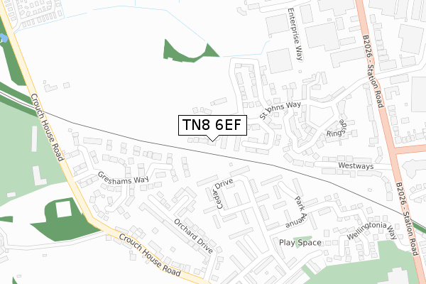
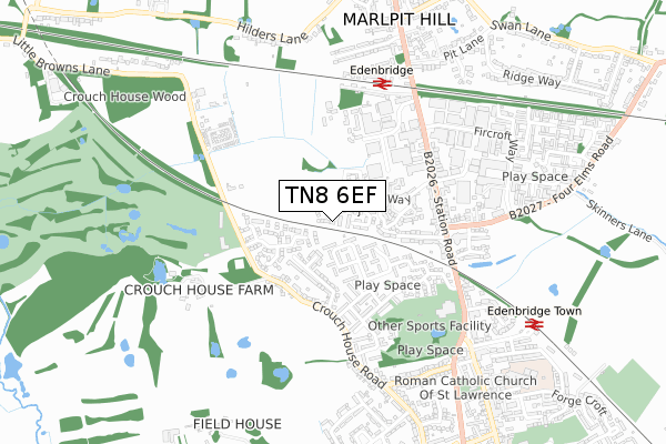
TN8 6EF is located in the Edenbridge North and East electoral ward, within the local authority district of Sevenoaks and the English Parliamentary constituency of Tonbridge and Malling. The Sub Integrated Care Board (ICB) Location is NHS Kent and Medway ICB - 91Q and the police force is Kent. This postcode has been in use since January 2020.


GetTheData
Source: OS Open Zoomstack (Ordnance Survey)
Licence: Open Government Licence (requires attribution)
Attribution: Contains OS data © Crown copyright and database right 2024
Source: Open Postcode Geo
Licence: Open Government Licence (requires attribution)
Attribution: Contains OS data © Crown copyright and database right 2024; Contains Royal Mail data © Royal Mail copyright and database right 2024; Source: Office for National Statistics licensed under the Open Government Licence v.3.0
| Easting | 543767 |
| Northing | 146963 |
| Latitude | 51.203791 |
| Longitude | 0.056557 |
GetTheData
Source: Open Postcode Geo
Licence: Open Government Licence
| Country | England |
| Postcode District | TN8 |
➜ See where TN8 is on a map ➜ Where is Edenbridge? | |
GetTheData
Source: Land Registry Price Paid Data
Licence: Open Government Licence
| Ward | Edenbridge North And East |
| Constituency | Tonbridge And Malling |
GetTheData
Source: ONS Postcode Database
Licence: Open Government Licence
16, HILL CLOSE, EDENBRIDGE, TN8 6EF 2024 8 AUG £750,000 |
16, HILL CLOSE, EDENBRIDGE, TN8 6EF 2021 4 JUN £684,995 |
18, HILL CLOSE, EDENBRIDGE, TN8 6EF 2020 17 SEP £525,000 |
19, HILL CLOSE, EDENBRIDGE, TN8 6EF 2020 9 JUL £544,995 |
17, HILL CLOSE, EDENBRIDGE, TN8 6EF 2020 27 MAR £547,895 |
GetTheData
Source: HM Land Registry Price Paid Data
Licence: Contains HM Land Registry data © Crown copyright and database right 2024. This data is licensed under the Open Government Licence v3.0.
| Crouch House Road | Edenbridge | 300m |
| Crouch House Road | Edenbridge | 314m |
| Greshams Way (Crouch House Road) | Edenbridge | 357m |
| Greshams Way (Crouch House Road) | Edenbridge | 374m |
| Pine Grove (Crouch House Road) | Edenbridge | 461m |
| Edenbridge Station | 0.6km |
| Edenbridge Town Station | 0.9km |
| Hever Station | 3.7km |
GetTheData
Source: NaPTAN
Licence: Open Government Licence
GetTheData
Source: ONS Postcode Database
Licence: Open Government Licence


➜ Get more ratings from the Food Standards Agency
GetTheData
Source: Food Standards Agency
Licence: FSA terms & conditions
| Last Collection | |||
|---|---|---|---|
| Location | Mon-Fri | Sat | Distance |
| Stangrove | 17:00 | 09:00 | 662m |
| Marlpit Old Post Office | 17:00 | 11:00 | 899m |
| Little Browns | 16:15 | 09:00 | 1,368m |
GetTheData
Source: Dracos
Licence: Creative Commons Attribution-ShareAlike
The below table lists the International Territorial Level (ITL) codes (formerly Nomenclature of Territorial Units for Statistics (NUTS) codes) and Local Administrative Units (LAU) codes for TN8 6EF:
| ITL 1 Code | Name |
|---|---|
| TLJ | South East (England) |
| ITL 2 Code | Name |
| TLJ4 | Kent |
| ITL 3 Code | Name |
| TLJ46 | West Kent |
| LAU 1 Code | Name |
| E07000111 | Sevenoaks |
GetTheData
Source: ONS Postcode Directory
Licence: Open Government Licence
The below table lists the Census Output Area (OA), Lower Layer Super Output Area (LSOA), and Middle Layer Super Output Area (MSOA) for TN8 6EF:
| Code | Name | |
|---|---|---|
| OA | E00172102 | |
| LSOA | E01024425 | Sevenoaks 014A |
| MSOA | E02005100 | Sevenoaks 014 |
GetTheData
Source: ONS Postcode Directory
Licence: Open Government Licence
| TN8 5JT | Cedar Drive | 135m |
| TN8 5JP | Cedar Drive | 138m |
| TN8 5JR | Cedar Drive | 142m |
| TN8 5EU | Orchard Close | 145m |
| TN8 5JS | Cedar Drive | 153m |
| TN8 5NY | Greshams Way | 171m |
| TN8 6GA | St Johns Way | 185m |
| TN8 5LB | Park Avenue | 185m |
| TN8 5JW | Cedar Drive | 192m |
| TN8 6GF | Champions Drive | 195m |
GetTheData
Source: Open Postcode Geo; Land Registry Price Paid Data
Licence: Open Government Licence