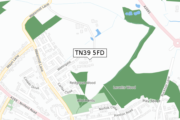
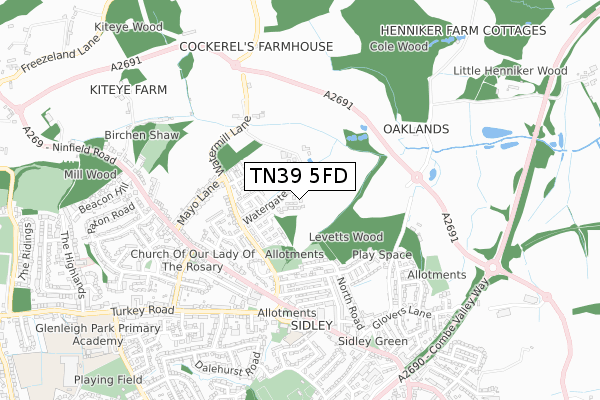
TN39 5FD is located in the Bexhill Sidley electoral ward, within the local authority district of Rother and the English Parliamentary constituency of Bexhill and Battle. The Sub Integrated Care Board (ICB) Location is NHS Sussex ICB - 97R and the police force is Sussex. This postcode has been in use since February 2020.


GetTheData
Source: OS Open Zoomstack (Ordnance Survey)
Licence: Open Government Licence (requires attribution)
Attribution: Contains OS data © Crown copyright and database right 2024
Source: Open Postcode Geo
Licence: Open Government Licence (requires attribution)
Attribution: Contains OS data © Crown copyright and database right 2024; Contains Royal Mail data © Royal Mail copyright and database right 2024; Source: Office for National Statistics licensed under the Open Government Licence v.3.0
| Easting | 573832 |
| Northing | 109743 |
| Latitude | 50.861064 |
| Longitude | 0.468686 |
GetTheData
Source: Open Postcode Geo
Licence: Open Government Licence
| Country | England |
| Postcode District | TN39 |
➜ See where TN39 is on a map ➜ Where is Bexhill? | |
GetTheData
Source: Land Registry Price Paid Data
Licence: Open Government Licence
| Ward | Bexhill Sidley |
| Constituency | Bexhill And Battle |
GetTheData
Source: ONS Postcode Database
Licence: Open Government Licence
| Morgan Close | Sidley | 289m |
| Watermill Close (Watermill Lane) | Sidley | 315m |
| Mayo Lane (Ninfield Road) | Sidley | 484m |
| Mayo Lane (Ninfield Road) | Sidley | 486m |
| Whitehouse Avenue (Turkey Road) | Sidley | 489m |
| Bexhill Station | 2.3km |
| Collington Station | 2.5km |
| Crowhurst Station | 3.8km |
GetTheData
Source: NaPTAN
Licence: Open Government Licence
GetTheData
Source: ONS Postcode Database
Licence: Open Government Licence


➜ Get more ratings from the Food Standards Agency
GetTheData
Source: Food Standards Agency
Licence: FSA terms & conditions
| Last Collection | |||
|---|---|---|---|
| Location | Mon-Fri | Sat | Distance |
| Preston Road | 17:00 | 12:15 | 332m |
| Mayo Lane | 17:15 | 12:15 | 483m |
| Sidley Post Office | 17:00 | 12:00 | 560m |
GetTheData
Source: Dracos
Licence: Creative Commons Attribution-ShareAlike
The below table lists the International Territorial Level (ITL) codes (formerly Nomenclature of Territorial Units for Statistics (NUTS) codes) and Local Administrative Units (LAU) codes for TN39 5FD:
| ITL 1 Code | Name |
|---|---|
| TLJ | South East (England) |
| ITL 2 Code | Name |
| TLJ2 | Surrey, East and West Sussex |
| ITL 3 Code | Name |
| TLJ22 | East Sussex CC |
| LAU 1 Code | Name |
| E07000064 | Rother |
GetTheData
Source: ONS Postcode Directory
Licence: Open Government Licence
The below table lists the Census Output Area (OA), Lower Layer Super Output Area (LSOA), and Middle Layer Super Output Area (MSOA) for TN39 5FD:
| Code | Name | |
|---|---|---|
| OA | E00107373 | |
| LSOA | E01021137 | Rother 007F |
| MSOA | E02004398 | Rother 007 |
GetTheData
Source: ONS Postcode Directory
Licence: Open Government Licence
| TN39 5ED | Watergate | 111m |
| TN39 5EH | Langley Close | 165m |
| TN39 5EG | Carfax Close | 177m |
| TN39 5EE | Faygate Close | 180m |
| TN39 5DQ | Redwell Avenue | 240m |
| TN39 5EW | Watermill Lane | 245m |
| TN39 5BT | Norfolk Close | 261m |
| TN39 5EB | Watermill Lane | 274m |
| TN39 5EQ | Morgan Close | 296m |
| TN39 5BZ | Preston Road | 301m |
GetTheData
Source: Open Postcode Geo; Land Registry Price Paid Data
Licence: Open Government Licence