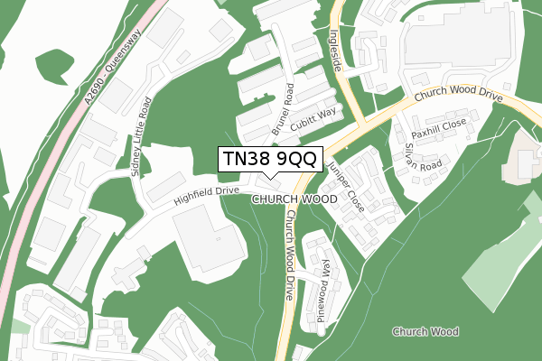
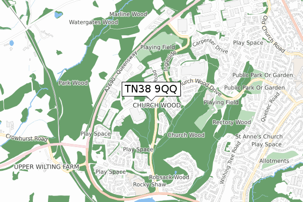
TN38 9QQ lies on Church Wood Drive in St Leonards-on-sea. TN38 9QQ is located in the Hollington electoral ward, within the local authority district of Hastings and the English Parliamentary constituency of Hastings and Rye. The Sub Integrated Care Board (ICB) Location is NHS Sussex ICB - 97R and the police force is Sussex. This postcode has been in use since October 2017.


GetTheData
Source: OS Open Zoomstack (Ordnance Survey)
Licence: Open Government Licence (requires attribution)
Attribution: Contains OS data © Crown copyright and database right 2025
Source: Open Postcode Geo
Licence: Open Government Licence (requires attribution)
Attribution: Contains OS data © Crown copyright and database right 2025; Contains Royal Mail data © Royal Mail copyright and database right 2025; Source: Office for National Statistics licensed under the Open Government Licence v.3.0
| Easting | 578158 |
| Northing | 111456 |
| Latitude | 50.875137 |
| Longitude | 0.530925 |
GetTheData
Source: Open Postcode Geo
Licence: Open Government Licence
| Street | Church Wood Drive |
| Town/City | St Leonards-on-sea |
| Country | England |
| Postcode District | TN38 |
➜ See where TN38 is on a map ➜ Where is Hastings? | |
GetTheData
Source: Land Registry Price Paid Data
Licence: Open Government Licence
| Ward | Hollington |
| Constituency | Hastings And Rye |
GetTheData
Source: ONS Postcode Database
Licence: Open Government Licence
FIAT ALFA ROMEO, CHURCH WOOD DRIVE, ST LEONARDS-ON-SEA, TN38 9QQ 2000 13 NOV £500,000 |
GetTheData
Source: HM Land Registry Price Paid Data
Licence: Contains HM Land Registry data © Crown copyright and database right 2025. This data is licensed under the Open Government Licence v3.0.
| Juniper Close (Church Wood Drive) | Hollington | 141m |
| Juniper Close (Church Wood Drive) | Hollington | 149m |
| Pinewood Way (Church Wood Drive) | Hollington | 153m |
| Pinewood Way (Church Wood Drive) | Hollington | 156m |
| Tesco (Store Forecourt) | Hollington | 405m |
| West St Leonards Station | 2.5km |
| Crowhurst Station | 2.6km |
| St Leonards Warrior Square Station | 3km |
GetTheData
Source: NaPTAN
Licence: Open Government Licence
GetTheData
Source: ONS Postcode Database
Licence: Open Government Licence


➜ Get more ratings from the Food Standards Agency
GetTheData
Source: Food Standards Agency
Licence: FSA terms & conditions
| Last Collection | |||
|---|---|---|---|
| Location | Mon-Fri | Sat | Distance |
| Churchwood Drive | 17:30 | 12:15 | 241m |
| Robsack | 17:30 | 12:15 | 651m |
| Whatlington Way | 17:30 | 12:15 | 699m |
GetTheData
Source: Dracos
Licence: Creative Commons Attribution-ShareAlike
The below table lists the International Territorial Level (ITL) codes (formerly Nomenclature of Territorial Units for Statistics (NUTS) codes) and Local Administrative Units (LAU) codes for TN38 9QQ:
| ITL 1 Code | Name |
|---|---|
| TLJ | South East (England) |
| ITL 2 Code | Name |
| TLJ2 | Surrey, East and West Sussex |
| ITL 3 Code | Name |
| TLJ22 | East Sussex CC |
| LAU 1 Code | Name |
| E07000062 | Hastings |
GetTheData
Source: ONS Postcode Directory
Licence: Open Government Licence
The below table lists the Census Output Area (OA), Lower Layer Super Output Area (LSOA), and Middle Layer Super Output Area (MSOA) for TN38 9QQ:
| Code | Name | |
|---|---|---|
| OA | E00106620 | |
| LSOA | E01020995 | Hastings 003C |
| MSOA | E02004370 | Hastings 003 |
GetTheData
Source: ONS Postcode Directory
Licence: Open Government Licence
| TN38 9RQ | Curlew Court | 119m |
| TN38 9RH | Laurel Walk | 145m |
| TN38 9RW | Teal Court | 154m |
| TN38 9ST | Armstrong Close | 178m |
| TN38 9RJ | Plover Court | 192m |
| TN38 9RN | Wren Court | 201m |
| TN38 9RR | Pinewood Way | 211m |
| TN38 9RL | Raven Court | 216m |
| TN38 9UB | Highfield Business Park | 221m |
| TN38 9RT | Brunel Road | 252m |
GetTheData
Source: Open Postcode Geo; Land Registry Price Paid Data
Licence: Open Government Licence