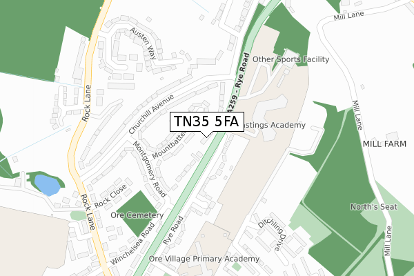
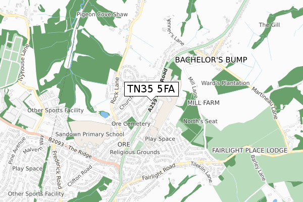
TN35 5FA is located in the Ore electoral ward, within the local authority district of Hastings and the English Parliamentary constituency of Hastings and Rye. The Sub Integrated Care Board (ICB) Location is NHS Sussex ICB - 97R and the police force is Sussex. This postcode has been in use since April 2020.


GetTheData
Source: OS Open Zoomstack (Ordnance Survey)
Licence: Open Government Licence (requires attribution)
Attribution: Contains OS data © Crown copyright and database right 2025
Source: Open Postcode Geo
Licence: Open Government Licence (requires attribution)
Attribution: Contains OS data © Crown copyright and database right 2025; Contains Royal Mail data © Royal Mail copyright and database right 2025; Source: Office for National Statistics licensed under the Open Government Licence v.3.0
| Easting | 583931 |
| Northing | 112083 |
| Latitude | 50.878963 |
| Longitude | 0.613205 |
GetTheData
Source: Open Postcode Geo
Licence: Open Government Licence
| Country | England |
| Postcode District | TN35 |
➜ See where TN35 is on a map ➜ Where is Hastings? | |
GetTheData
Source: Land Registry Price Paid Data
Licence: Open Government Licence
| Ward | Ore |
| Constituency | Hastings And Rye |
GetTheData
Source: ONS Postcode Database
Licence: Open Government Licence
| King's Head (Rye Road) | Ore | 28m |
| King's Head (Rye Road) | Ore | 36m |
| Montgomery Road (Churchill Avenue) | Ore | 147m |
| Winchelsea Lane (Churchill Avenue) | Ore | 157m |
| Ore Cemetery (Winchelsea Road) | Ore | 242m |
| Ore Station | 2km |
| Three Oaks Station | 2.5km |
| Hastings Station | 3.5km |
GetTheData
Source: NaPTAN
Licence: Open Government Licence
GetTheData
Source: ONS Postcode Database
Licence: Open Government Licence


➜ Get more ratings from the Food Standards Agency
GetTheData
Source: Food Standards Agency
Licence: FSA terms & conditions
| Last Collection | |||
|---|---|---|---|
| Location | Mon-Fri | Sat | Distance |
| Ore Post Office | 17:30 | 12:15 | 672m |
| Peter James Lane | 16:30 | 09:30 | 1,943m |
| Elphinstone Road (Upper) | 17:45 | 12:00 | 2,038m |
GetTheData
Source: Dracos
Licence: Creative Commons Attribution-ShareAlike
The below table lists the International Territorial Level (ITL) codes (formerly Nomenclature of Territorial Units for Statistics (NUTS) codes) and Local Administrative Units (LAU) codes for TN35 5FA:
| ITL 1 Code | Name |
|---|---|
| TLJ | South East (England) |
| ITL 2 Code | Name |
| TLJ2 | Surrey, East and West Sussex |
| ITL 3 Code | Name |
| TLJ22 | East Sussex CC |
| LAU 1 Code | Name |
| E07000062 | Hastings |
GetTheData
Source: ONS Postcode Directory
Licence: Open Government Licence
The below table lists the Census Output Area (OA), Lower Layer Super Output Area (LSOA), and Middle Layer Super Output Area (MSOA) for TN35 5FA:
| Code | Name | |
|---|---|---|
| OA | E00106672 | |
| LSOA | E01021005 | Hastings 004B |
| MSOA | E02004371 | Hastings 004 |
GetTheData
Source: ONS Postcode Directory
Licence: Open Government Licence
| TN35 5DH | Rye Road | 34m |
| TN35 4LE | Mountbatten Close | 70m |
| TN35 5DD | Rye Road | 130m |
| TN35 4LD | Churchill Avenue | 142m |
| TN35 4LA | Montgomery Road | 165m |
| TN35 4LB | Churchill Avenue | 168m |
| TN35 4JW | Rock Close | 248m |
| TN35 4JP | Tedder Terrace | 255m |
| TN35 4JH | Austen Way | 263m |
| TN35 5EX | Ditchling Drive | 297m |
GetTheData
Source: Open Postcode Geo; Land Registry Price Paid Data
Licence: Open Government Licence