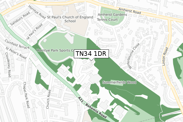
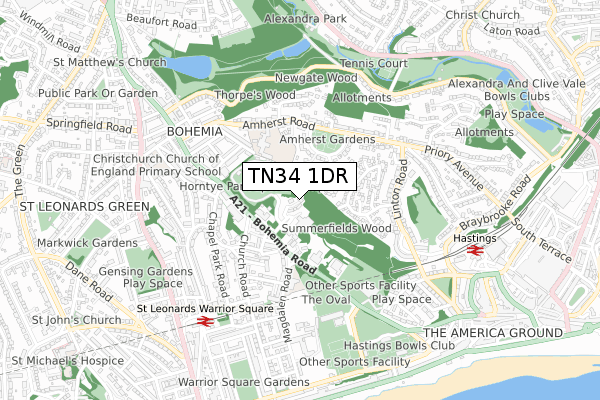
TN34 1DR is located in the Gensing electoral ward, within the local authority district of Hastings and the English Parliamentary constituency of Hastings and Rye. The Sub Integrated Care Board (ICB) Location is NHS Sussex ICB - 97R and the police force is Sussex. This postcode has been in use since December 2019.


GetTheData
Source: OS Open Zoomstack (Ordnance Survey)
Licence: Open Government Licence (requires attribution)
Attribution: Contains OS data © Crown copyright and database right 2024
Source: Open Postcode Geo
Licence: Open Government Licence (requires attribution)
Attribution: Contains OS data © Crown copyright and database right 2024; Contains Royal Mail data © Royal Mail copyright and database right 2024; Source: Office for National Statistics licensed under the Open Government Licence v.3.0
| Easting | 580720 |
| Northing | 109880 |
| Latitude | 50.860185 |
| Longitude | 0.566524 |
GetTheData
Source: Open Postcode Geo
Licence: Open Government Licence
| Country | England |
| Postcode District | TN34 |
➜ See where TN34 is on a map | |
GetTheData
Source: Land Registry Price Paid Data
Licence: Open Government Licence
| Ward | Gensing |
| Constituency | Hastings And Rye |
GetTheData
Source: ONS Postcode Database
Licence: Open Government Licence
| Fire Station (Bohemia Road) | Bohemia | 177m |
| Fire Station (Bohemia Road) | Bohemia | 212m |
| Magdalen Road (Bohemia Road) | Bohemia | 265m |
| De Cham Road (Church Road) | Bohemia | 322m |
| St Peter's Church (Bohemia Road) | Bohemia | 327m |
| St Leonards Warrior Square Station | 0.7km |
| Hastings Station | 0.8km |
| Ore Station | 1.9km |
GetTheData
Source: NaPTAN
Licence: Open Government Licence
GetTheData
Source: ONS Postcode Database
Licence: Open Government Licence


➜ Get more ratings from the Food Standards Agency
GetTheData
Source: Food Standards Agency
Licence: FSA terms & conditions
| Last Collection | |||
|---|---|---|---|
| Location | Mon-Fri | Sat | Distance |
| Summerfields | 18:00 | 12:00 | 178m |
| Amherst Road | 18:15 | 12:30 | 296m |
| Blomfield Road | 17:30 | 12:00 | 353m |
GetTheData
Source: Dracos
Licence: Creative Commons Attribution-ShareAlike
The below table lists the International Territorial Level (ITL) codes (formerly Nomenclature of Territorial Units for Statistics (NUTS) codes) and Local Administrative Units (LAU) codes for TN34 1DR:
| ITL 1 Code | Name |
|---|---|
| TLJ | South East (England) |
| ITL 2 Code | Name |
| TLJ2 | Surrey, East and West Sussex |
| ITL 3 Code | Name |
| TLJ22 | East Sussex CC |
| LAU 1 Code | Name |
| E07000062 | Hastings |
GetTheData
Source: ONS Postcode Directory
Licence: Open Government Licence
The below table lists the Census Output Area (OA), Lower Layer Super Output Area (LSOA), and Middle Layer Super Output Area (MSOA) for TN34 1DR:
| Code | Name | |
|---|---|---|
| OA | E00106602 | |
| LSOA | E01020992 | Hastings 008E |
| MSOA | E02004375 | Hastings 008 |
GetTheData
Source: ONS Postcode Directory
Licence: Open Government Licence
| TN34 1TS | Barnfield Close | 148m |
| TN34 1BX | Tennis Close | 150m |
| TN34 1XX | Verdant Close | 163m |
| TN34 1TU | Amherst Gardens | 195m |
| TN37 6EZ | Bohemia Cottages | 209m |
| TN37 6RZ | Bohemia Road | 218m |
| TN37 6HE | De Cham Avenue | 228m |
| TN34 1XG | Winterbourne Close | 247m |
| TN37 6HF | De Cham Road | 267m |
| TN37 6SR | St Catherines Close | 280m |
GetTheData
Source: Open Postcode Geo; Land Registry Price Paid Data
Licence: Open Government Licence