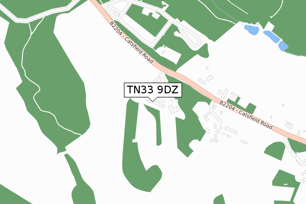
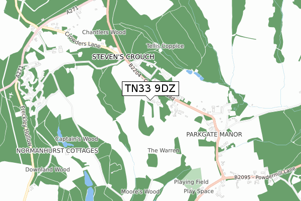
TN33 9DZ is located in the Catsfield & Crowhurst electoral ward, within the local authority district of Rother and the English Parliamentary constituency of Bexhill and Battle. The Sub Integrated Care Board (ICB) Location is NHS Sussex ICB - 97R and the police force is Sussex. This postcode has been in use since January 2020.


GetTheData
Source: OS Open Zoomstack (Ordnance Survey)
Licence: Open Government Licence (requires attribution)
Attribution: Contains OS data © Crown copyright and database right 2025
Source: Open Postcode Geo
Licence: Open Government Licence (requires attribution)
Attribution: Contains OS data © Crown copyright and database right 2025; Contains Royal Mail data © Royal Mail copyright and database right 2025; Source: Office for National Statistics licensed under the Open Government Licence v.3.0
| Easting | 572080 |
| Northing | 114801 |
| Latitude | 50.907030 |
| Longitude | 0.446195 |
GetTheData
Source: Open Postcode Geo
Licence: Open Government Licence
| Country | England |
| Postcode District | TN33 |
➜ See where TN33 is on a map | |
GetTheData
Source: Land Registry Price Paid Data
Licence: Open Government Licence
| Ward | Catsfield & Crowhurst |
| Constituency | Bexhill And Battle |
GetTheData
Source: ONS Postcode Database
Licence: Open Government Licence
| North Trade Road (Catsfield Road) | Steven's Crouch | 959m |
| Catsfield Road (A271) | Steven's Crouch | 960m |
| Catsfield Road (A271) | Steven's Crouch | 995m |
| Penhurst Lane (A271) | Steven's Crouch | 1,099m |
| Penhurst Lane (A271) | Steven's Crouch | 1,122m |
| Battle Station | 3.5km |
| Crowhurst Station | 4.4km |
GetTheData
Source: NaPTAN
Licence: Open Government Licence
GetTheData
Source: ONS Postcode Database
Licence: Open Government Licence


➜ Get more ratings from the Food Standards Agency
GetTheData
Source: Food Standards Agency
Licence: FSA terms & conditions
| Last Collection | |||
|---|---|---|---|
| Location | Mon-Fri | Sat | Distance |
| Ashburnham Vicarage | 16:30 | 11:15 | 1,084m |
| Catsfield Post Office | 17:15 | 11:30 | 1,167m |
| Battle Post Office | 18:00 | 12:30 | 2,922m |
GetTheData
Source: Dracos
Licence: Creative Commons Attribution-ShareAlike
The below table lists the International Territorial Level (ITL) codes (formerly Nomenclature of Territorial Units for Statistics (NUTS) codes) and Local Administrative Units (LAU) codes for TN33 9DZ:
| ITL 1 Code | Name |
|---|---|
| TLJ | South East (England) |
| ITL 2 Code | Name |
| TLJ2 | Surrey, East and West Sussex |
| ITL 3 Code | Name |
| TLJ22 | East Sussex CC |
| LAU 1 Code | Name |
| E07000064 | Rother |
GetTheData
Source: ONS Postcode Directory
Licence: Open Government Licence
The below table lists the Census Output Area (OA), Lower Layer Super Output Area (LSOA), and Middle Layer Super Output Area (MSOA) for TN33 9DZ:
| Code | Name | |
|---|---|---|
| OA | E00107158 | |
| LSOA | E01021096 | Rother 006D |
| MSOA | E02004397 | Rother 006 |
GetTheData
Source: ONS Postcode Directory
Licence: Open Government Licence
| TN33 9DU | Stone Cottages | 271m |
| TN33 9LN | Catsfield Road | 430m |
| TN33 9DT | 606m | |
| TN33 9LP | Crowders Lane | 696m |
| TN33 9LL | The Gardens | 987m |
| TN33 9DL | 1017m | |
| TN33 9LJ | North Trade Road | 1040m |
| TN33 0SZ | Powdermill Lane | 1042m |
| TN33 9DJ | The Green | 1054m |
| TN33 9DS | Blacksmiths Lane | 1073m |
GetTheData
Source: Open Postcode Geo; Land Registry Price Paid Data
Licence: Open Government Licence