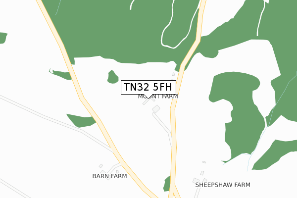
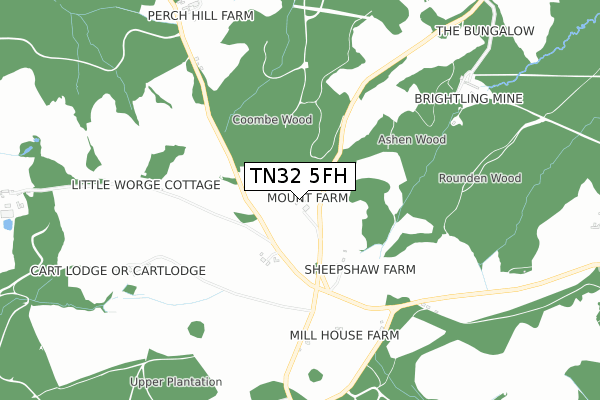
TN32 5FH is located in the Burwash & the Weald electoral ward, within the local authority district of Rother and the English Parliamentary constituency of Bexhill and Battle. The Sub Integrated Care Board (ICB) Location is NHS Sussex ICB - 97R and the police force is Sussex. This postcode has been in use since April 2020.


GetTheData
Source: OS Open Zoomstack (Ordnance Survey)
Licence: Open Government Licence (requires attribution)
Attribution: Contains OS data © Crown copyright and database right 2024
Source: Open Postcode Geo
Licence: Open Government Licence (requires attribution)
Attribution: Contains OS data © Crown copyright and database right 2024; Contains Royal Mail data © Royal Mail copyright and database right 2024; Source: Office for National Statistics licensed under the Open Government Licence v.3.0
| Easting | 567028 |
| Northing | 121336 |
| Latitude | 50.967227 |
| Longitude | 0.377398 |
GetTheData
Source: Open Postcode Geo
Licence: Open Government Licence
| Country | England |
| Postcode District | TN32 |
➜ See where TN32 is on a map | |
GetTheData
Source: Land Registry Price Paid Data
Licence: Open Government Licence
| Ward | Burwash & The Weald |
| Constituency | Bexhill And Battle |
GetTheData
Source: ONS Postcode Database
Licence: Open Government Licence
| Village Hall (Woods Corner Road) | Brightling | 1,376m |
| Village Hall (Woods Corner Road) | Brightling | 1,392m |
| Etchingham Station | 6.6km |
GetTheData
Source: NaPTAN
Licence: Open Government Licence
GetTheData
Source: ONS Postcode Database
Licence: Open Government Licence

➜ Get more ratings from the Food Standards Agency
GetTheData
Source: Food Standards Agency
Licence: FSA terms & conditions
| Last Collection | |||
|---|---|---|---|
| Location | Mon-Fri | Sat | Distance |
| Netherfield Post Office | 17:00 | 11:15 | 502m |
| The Old Post Office | 16:45 | 10:00 | 1,427m |
| Dallington Post Office | 17:00 | 09:00 | 2,035m |
GetTheData
Source: Dracos
Licence: Creative Commons Attribution-ShareAlike
The below table lists the International Territorial Level (ITL) codes (formerly Nomenclature of Territorial Units for Statistics (NUTS) codes) and Local Administrative Units (LAU) codes for TN32 5FH:
| ITL 1 Code | Name |
|---|---|
| TLJ | South East (England) |
| ITL 2 Code | Name |
| TLJ2 | Surrey, East and West Sussex |
| ITL 3 Code | Name |
| TLJ22 | East Sussex CC |
| LAU 1 Code | Name |
| E07000064 | Rother |
GetTheData
Source: ONS Postcode Directory
Licence: Open Government Licence
The below table lists the Census Output Area (OA), Lower Layer Super Output Area (LSOA), and Middle Layer Super Output Area (MSOA) for TN32 5FH:
| Code | Name | |
|---|---|---|
| OA | E00107167 | |
| LSOA | E01021099 | Rother 003B |
| MSOA | E02004394 | Rother 003 |
GetTheData
Source: ONS Postcode Directory
Licence: Open Government Licence
| TN32 5HL | 592m | |
| TN32 5HN | 644m | |
| TN32 5HP | 729m | |
| TN19 7DW | 1045m | |
| TN32 5HJ | 1229m | |
| TN21 9LL | Brightling Road | 1328m |
| TN32 5HH | 1429m | |
| TN32 5HG | 1504m | |
| TN32 5HE | 1592m | |
| TN21 9JU | Bakers Lane | 1622m |
GetTheData
Source: Open Postcode Geo; Land Registry Price Paid Data
Licence: Open Government Licence